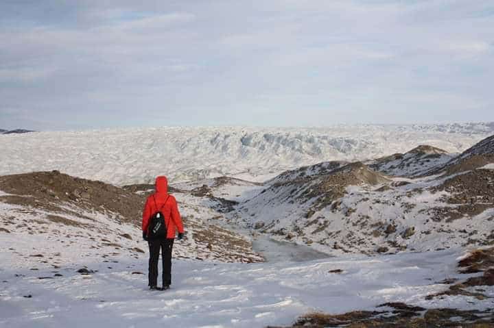
Highest Point in Each State: 50 State High Point Hikes in the US
“High pointers” are a unique breed of hiker, whose goal it is to eventually make it to the highest peak or highest point in each state in the United States, or perhaps another country or continent. This checklist mentality of hiking and traveling is a fun way to travel to states you ordinarily may have never gone to, or to experience some of the most grand and humble high point hikes across the country! It also could be considered as one of the 19 different types of hiking! I personally am several years into my own pursuit of state high points, and closing in on all 50, and each one has left me with something new to appreciate, and new travelers to have met. From the lowest state high point in Florida, to the king of state high points in Alaska, here is the complete breakdown of all 50 state high points in the United States, in order from highest to lowest!

Disclosure: Below are some affiliate links-these are all products I highly recommend. I won’t make any recommendations on this page that I haven’t tested or personally used! Enjoy this guide to the 50 state high points in the US!
Table of Contents
The 50 Highest Points in Each State of the US
These are the highest points in each state, in descending order from highest elevation to lowest elevation. Included in this guide you will find:
- Location of the 50 state high points in the US.
- Quick facts on each of the highest peaks, including elevation, length of high point hike, elevation gain, difficulty rating, and a synopsis of “how to hike” each of these 50 state high points.
- Helpful Links for Highpointers
- Gear Recommendations for Highpointing
- Interesting Facts and FAQs about State High Points and Highpointing

Location of Each Highest Point in the United States
Before you dive into state high point explorations, get a feeling for where each is located across the United States. Many highpointers clump state high point hikes together in a single road trip, based on location, and are able to knock out multiple ones per trip. I myself have hiked up to a dozen state high points in a single road trip.
Map of all 50 U.S. state high points
As you can see, each of the highest points in the country are unique in their location. Some are very remote and isolated. Others are clustered together, maybe even sharing the same mountain range. You may even notice some trends regarding where the lowest high points are located, as well as some of the highest points in each state.
Now let the list begin, starting with the reigning king of state high points, Alaska’s Denali!
Alaska: Denali (Mt. McKinley)
Denali reigns supreme, with a total elevation and elevation gain that no other US state comes close to. You’re gonna need a few weeks to get to the top of this state high point!
- Elevation: 20,320 feet
- Length: 13 miles out and back
- Elevation Gain: 13,500 feet
- Rating: Difficult – this is a technical climb! Considered a Class 3/4, and requiring possibly multiple weeks to summit safely and successfully.
- Other Useful Tips: If you need a comparison to just how impressive Denali is, go ahead and compare it to the #2 state high point in the United States. Denali dwarfs Mt. Whitney by about 6,000 feet!

California: Mt. Whitney
Get ready for the infamous 97 switchbacks! Mt. Whitney can be done in one day, but there is the option to camp overnight beneath the summit and make this a 2 day hike. Plan in advance, because hiking Mt. Whitney requires a permit that must be secured through the lottery process beginning each year in February. Once you have your permit, you are ready to hit the ground on this iconic trail to the highest point in California and the lower 48 states! Just be sure to grab all your hiking essentials for Mt. Whitney first! Don’t miss out on one of the toughest climbs in America with this guide!
- Elevation: 14,505
- Length: 22.5 miles out and back
- Elevation Gain: 6,656 feet
- Rating: Difficult
- Other Useful Tips: You have to conquer 97 switchbacks to summit Mt. Whitney. Those who wish to make this a 2 day summit attempt can camp beneath the summit at Outpost Camp or Trail Camp. Whether you complete this as a day hike or overnight, be sure that you apply for the Mt. Whitney lottery that takes place annually in February!

Colorado: Mt. Elbert
The highest point in the Rockies, and the highest point in Colorado! Mt. Elbert is a true 14’er, but rumor among the locals is that it is not the most difficult 14’er in the state, even though it is the tallest one! It beats out nearby neighbor Mt. Massive by only a matter of feet! Even though it is the highest peak in the Rockies, Elbert is still classified as a day hike, and is doable as such as long as you get a very early start! If you are looking for a good beginner 14’er to break in on, this is an excellent choice, because it is non-technical and a day hike. This guide will cover all the basics of hiking Mt. Elbert!
- Elevation: 14,440 feet
- Length: 9.8 miles out and back
- Elevation Gain: 4,458 feet
- Rating: Difficult
- Other Useful Tips: Get an early start and be off the summit before noon, to avoid afternoon storms. Parking fills up extremely early, so be parking by 6am on a weekday or 5am on a weekend!

Washington: Mt. Rainier
Mt. Rainier requires technical training and preparation, and involves different facets of hiking than some of its other state high point companions, such as glacial mountaineering. That being said, you can (and the majority of people probably should) hire a guided tour for this one.
- Elevation: 14,411 feet
- Length: 14.7 miles out and back
- Elevation Gain: 8,986 feet
- Rating: Difficult – this is considered a technical climb that demands glaciated hiking experience, as well as other technical skills such as crevasse rescue and high alpine traversing.
- Other Useful Tips: This is a multi-day summit hike, and can be done with or without securing a guide.

Wyoming: Gannett Peak
Gannett Peak is very remote and very isolated. It takes a commitment of several backpacking days to accomplish. It sums up perfectly the raw nature and ruggedness of Wyoming. A lot of preparation and care go into a summit attempt of Gannett Peak. Due to the miniscule amount of foot traffic and its secluded location, you want to be extra cautious! This is another state high point hike worth considering a guide for unless you are a very experienced hiker in the backcountry.
- Elevation: 13,809 feet
- Length: 48.8 miles out and back
- Elevation Gain: 11,023 feet
- Rating: Difficult – long, remote, and a ton of elevation gain!
- Other Useful Tips: This is the longest state high point hike in the United States by length, at just short of 49 miles!

Hawaii: Mauna Kea
Hiking this state high point gives you a valid excuse to go to Hawaii, and that never hurt anyone! Technically, Mauna Kea is considered the tallest mountain in the world! If you are counting what’s below the surface.
- Elevation: 13,796 feet
- Length: 1 mile loop (possible to increase the length) OR 13.4 miles out and back
- Elevation Gain: 259 feet OR 4,986 feet
- Rating: Moderate – some incline, some rocky sections involving scree and lava rock OR Difficult
- Other Useful Tips: Why do I use “OR” in the description of Mauna Kea so much? Because you can drive to the top and walk around the 1 mile visitor’s loop, if you have the right off road vehicle. OR you can hike to the top, which is slightly more than 13 miles in length. The longer version is a difficult hike comprised of scree and uneven terrain, but epic views. A lot of hikers hike up, and then walk down the paved road from the Visitor’s Center back down to the bottom. There are multiple options to visiting Mauna Kea! Help narrow down which options are best for you with this in depth guide to summiting Mauna Kea from my first hand experience.


Utah: Kings Peak
Another very rugged and remote high point, one that can be done in a day by expert and well experienced hikers, but is recommended as a multi-day backpacking hike. I had a very personal experience on Kings Peak, and that is why it is my favorite state high point hike to date.
- Elevation: 13,527 feet
- Length: 26.8 miles out and back
- Elevation Gain: 5,118 feet
- Rating: Moderate – it’s a long hike obviously, but limited amounts of steep sections. Elevation gain is consistently spread out and has a more manageable feel.
- Other Useful Tips: this hike is most commonly approached as a multi-day backpacking trip. Get the complete breakdown for this multi-day summiting itinerary here.

New Mexico: Wheeler Peak
Located just outside of Taos, this state high point mirrors all the natural beauty found in this state. But don’t be fooled, because the last section of climb is over rock scree fields and switchbacks! Get your Wheeler Peak day hiking guide here!
- Elevation: 13,159 feet
- Length: 7.9 miles out and back
- Elevation Gain: 2,979 feet
- Rating: Difficult – there’s a sizable amount of scree laden switchbacks to deal with below the summit.
- Other Useful Tips: William’s Lake is only a short detour off the main trail to the summit. It’s worth a stop on the descent to cool off, rest, and enjoy the serenity! Look for the trail sign notating the split between the main trail to Wheeler Peak and the branch off to William’s Lake.

Nevada: Boundary Peak
This state high point lies closely adjacent with the border of California, and is a challenging, yet doable, day hike of a high point. Get ready for a rocky, barren, yet beautiful, state high point hike! The scree fields here are no joke, and neither is the drive in! It’ll be easy to see from Boundary’s summit why its home is called the White Mountains! Fair warning, while I respect and appreciate the beauty and challenge of Boundary Peak, this was one of my least favorite state high point hikes in the entire US! Get the complete trail report here!
- Elevation: 13,147 feet
- Length: 5.9 miles out and back
- Elevation Gain: 3,953 feet
- Rating: Difficult
- Other Useful Tips: 4WD and high clearance vehicles are HIGHLY recommended to get to the trailhead. If not, plan on pulling off the road early and adding a couple extra miles to your hike! Boundary Peak is EXTREMELY remote, so be sure to have all your day hiking essentials with you, a reliable navigation system, and plenty of water.

Montana: Granite Peak
A solid option for those looking for remote, isolated, multi-day backpacking pursuits of state high points! This one is untouched by civilization! It is also one of the hardest of the 50 state high points of the US – get your technical skills ready for this one!
- Elevation: 12,807 feet
- Length: 19.4 miles out and back
- Elevation Gain: 7,240 feet
- Rating: Difficult
- Other Useful Tips: The last couple hundred feet of this summit hike are considered technical due to a snow bridge that must be crossed and then a scramble on the actual summit. Some highpointers have found rope helpful for the last push on the summit.
Idaho: Borah Peak
Borah Peak is famous for Chicken Out Ridge, a narrow saddle that must be crossed to reach the high point! Caution must be carefully exercised with this one, and it is best to plan on a late summer hike in order to avoid a snowy crossing of Chicken Out Ridge! For many, Borah Peak is easily one of the top hardest state high point hikes, as well as one of the steepest.
- Elevation: 12,667 feet
- Length: 7.3 miles out and back
- Elevation Gain: 5,242 feet
- Rating: Difficult
- Other Useful Tips: The ascent of over 5,000 feet in under 4 miles each way means that there are some consistently steep grades on this hike, that basically don’t let up until the end!

Arizona: Humphreys Peak
Humphreys Peak is a beautiful standout among Flagstaff, Arizona, a region that really doesn’t go wrong with any of its high elevation, forest hikes. Get all the details for summiting this Arizona stunner here!
Fun fact – you can see Humphreys Peak from several of the best Grand Canyon National Park hikes, like the Widforss Trail on the North Rim of the Grand Canyon!
- Elevation: 12,633 feet
- Length: 10.5 miles out and back
- Elevation Gain: 3,353 feet
- Rating: Difficult – there are plenty of rocky sections over scree fields on the way to the summit.
- Other Useful Tips: This is a day hike. From the summit, on a clear day, you may even be able to see the Grand Canyon! I would also recommend exploring the immediate area surrounding the trailhead when you finish, as there are some beautiful Aspen groves here. Make a several day trip out of this state high point hike, there are so many good trails in Flagstaff!

Oregon: Mt. Hood
Mt. Hood is not the tallest peak in its respective Northwestern region, but it boasts an impressive amount of prominence, and it is easy to see why it is so iconic and beloved. Hood is a mountain and a name unto itself in this region! It also touts an impressive amount of technicality to be prepared for, which is why I recommend using a guide service for summiting Mount Hood, like I personally did. High pointers should have some experience and awareness with mountaineering, technical gear, and ice climbing for this one. A guide service can help train you in all of these areas.
- Elevation: 11,250 feet
- Length: 7 miles out and back
- Elevation Gain: 5,236 feet
- Rating: Difficult
- Other Useful Tips: This is a technical climb and needs to be treated as such. Experience with glaciated climbing, mountaineering gear, and snow and ice traversing is necessary.

Texas: Guadalupe Peak
Guadalupe Peak resides in the other National Park in Texas, Guadalupe Mountains National Park. It starts off in high desert terrain, rounds the face of the mountain into shady ponderosa forests, and finally emerges at a barren, rocky summit overlooking all of West Texas. A true treat for those who appreciate hiking through multiple topographies and eco-systems. This was my first state high point hike, and it is one I love so much I have returned to hike it multiple times!
This was the high point hike that started it all for me. Standing at the top took my breath away, and I was hooked! Walk step by step with me on this Guadalupe Peak day hiking guide!
- Elevation: 8,750 feet
- Length: 8.1 miles out and back
- Elevation Gain: 2,867 feet
- Rating: Difficult
- Other Useful Tips: this may not be the best hike to complete in the summer, due to the extreme west Texas desert heat! Also, for those looking to make this an overnight backpacking event, there is a primitive backcountry campsite a mile below the summit. Camping here makes for some epic sunsets and sunrises! Just be sure to secure the proper backcountry permit from the park website.

South Dakota: Black Elk Peak
Spires, spires, spires! That is the characteristic trait of Black Elk Peak and the surrounding Black Elk Wilderness. Some of the most fascinating topography in the country can be witnessed on this state high point hike. And it doesn’t hurt that it is within the borders of Custer State Park, one of the most beloved and cherished state parks. Get ready to hike this South Dakota standout here!
- Elevation: 7,244 feet
- Length: 7.6 mile loop
- Elevation Gain: 1,551 feet
- Rating: Moderate
- Other Useful Tips: The spires here are really other worldly! If you have time, branch off of the main trail and add on the Cathedral Spires Trail. Also, be sure to explore all the gems that are close by to this state high point, including Sylvan Lake in Custer State Park, Wind Cave and Badlands National Parks, and Mount Rushmore! This itinerary here can show you how to visit both of the National Parks in South Dakota!

North Carolina: Mt. Mitchell
For an east coast hike, which are not characteristically as high in elevation as their west coast counterparts, Mt. Mitchell still manages to hold its own with an impressive day hike to its state high point. In fact, it is the highest point not only in North Carolina, but it is the highest peak east of the Mississippi River. You can drive up this state high point, but why would you want to when you can hike to the highest summit east of the Mississippi at Mt. Mitchell! Get ready for a long, formidable day hike with this one.
- Elevation: 6,683 feet
- Length: 11.3 miles out and back
- Elevation Gain: 3,733 feet
- Rating: Difficult
- Other Useful Tips: From the summit, you can add on another couple miles and knock out two eastern peaks, Mt. Mitchell and Mt. Craig!

Tennessee: Clingmans Dome
Beautifully suspenseful views, but get there before winter as the road to this hike is seasonally closed due to winter road conditions. This may be a short trek, but don’t be fooled as it is surprisingly steep! And at the summit of Clingman’s Dome, get ready to be greeted by one of the most impressive viewing platforms of the 50 state high points! Check out more details on Clingman’s Dome here, and bonus – when you hike this state high point, you also are automatically checking off a visit to one of the best National Parks in the U.S., the Great Smoky Mountains. And the highest point on the iconic Appalachian Trail!
- Elevation: 6,644 feet
- Length: 1.2 miles out and back
- Elevation Gain: 331 feet
- Rating: Easy
- Other Useful Tips: The road to Clingmans Dome closes during the winter. Also, this is a surprisingly steep climb, so don’t be fooled by the short distance! And wear sturdy shoes for the incline. Also, dogs are not allowed on this trail.

New Hampshire: Mt. Washington
Though not the highest peak in the country by any means, Mt. Washington has a notorious reputation. Weather conditions here are wildly unpredictable, causing a high rate of unsuccessful summit attempts. Some of the coldest recorded temperatures in the country and strongest winds have been charted on top of Mt. Washington! It is among one of the feistier state high points! On Mt. Washington, you have the choice to drive to the summit or hike it, but know that if you choose to hike, you need to be extremely cautious and extremely well prepared due to this mountain’s reputation!
- Elevation: 6,288 feet
- Length: ~ 8 miles, depending on which trail you take. There are several trail options to the summit.
- Elevation Gain: ~4,300 feet, depending on the trail
- Rating: Difficult
- Other Useful Tips: Winds have been recorded in excess of over 200 miles per hour at the summit, and temperatures as low as negative 36 degrees Fahrenheit, making it one of the most inhospitable places in the world. Check the forecast carefully before attempting.

Virginia: Mt. Rogers
Found in the region of the picturesque Grayson Highlands, this area of Virginia is so scenic, that it is even home to a population of feral ponies. It’ll be easy to see why this state high point hike resides in a region referred to as “highlands”. Mount Rogers is easily one of my all time favorite hikes, and if you trek this trail, you will immediately see why! Did I mention the best part – the Mt. Rogers hike is on the iconic Appalachian Trail! And of course, there are wild ponies!
- Elevation: 5,728 feet
- Length: 12.4 miles out and back
- Elevation Gain: 2,427 feet
- Rating: Moderate to Hard
- Other Useful Tips: A long day hike, but a day hike nonetheless. This elevation gain is spread out over 12.4 miles, making it more manageable. You can’t go wrong with a hike that traverses the famed Appalachian Trail, which Mount Rogers does for 10 miles!

Nebraska: Panorama Point
This humble state high point is located in rural Nebraska, on private property populated by bison herds! It is not a hike, but a drive up high point, though the views are still serene and peaceful.
- Elevation: 5,429 feet
- Length: 2.5 miles out and back (some apps like AllTrails will say that this is 2.5 miles, but you can drive up just short of the high point marker.
- Elevation Gain: 82 feet
- Rating: Easy
- Other Useful Tips: There is a donation box located where you turn in to for the high point marker. Consider leaving a donation so that this high point on private property can continue to be shared with the public. And don’t forget to search for bison while you’re there! Just don’t get close, and be mindful getting out of your vehicle if they are around. Also, because this high point is on private property, the owners reserve the right to close access at certain times, and that needs to be respected and heeded.

New York: Mount Marcy
This is a longer high point day hike, but the payoff is worth it. There are some pretty rocky sections climbing up through a ravine, so bring reliable and sturdy hiking boots, and this is a trail that is perfectly primed for trekking poles! I can’t say enough about these Black Diamond trekking poles of mine! Be in the know with this guide to hiking Mount Marcy in the stunning Adirondacks of New York!
- Elevation: 5,344 feet
- Length: 15 miles out and back
- Elevation Gain: 3,559 feet
- Rating: Difficult
- Other Useful Tips: Bear spray is recommended for this trail. This trail is comprised of a lot of rocky surfaces, so be extra careful following a rain, or if rain is in the forecast, as this can make conditions very slippery.

Maine: Mt. Katahdin
The highest point in Maine, as well as the northernmost terminating peak of the Appalachian Trail. Check off two potential hiking achievements with this one! There are multiple trail options for ascending Katahdin, so be sure to do your proper research ahead of time. Also, Baxter State Park has some rules and particular reservation systems to follow for visiting, so be sure to be aware of these before attempting your climb.
- Elevation: 5,267 feet
- Length: 13.5 miles out and back
- Elevation Gain: 4,967 feet
- Rating: Difficult
- Other Useful Tips: There are multiple routes up to the summit of Mt. Katahdin, so make sure to do your research ahead of time when choosing your route. Also, be sure to follow Baxter State Park’s specific system for accessing Mt. Katahdin.

Oklahoma: Black Mesa
Oklahoma impressed me, because in a region of the state’s panhandle not known for hiking, this long distance state high point day hike is cradled in grassland prairies, surrounded by a ring of mesas, buttes, and plateaus. It is located at the exact point where the Rockies meet the Plains. In fact, you’re only a few short minutes from the Colorado border!
Almost all the elevation gain on this hike is in one short section. The last mile or so in to the state high point marker is almost entirely flat along the top of the mesa.
- Elevation: 5,705 feet
- Length: 8.5 miles out and back
- Elevation Gain: 734 feet
- Rating: Moderate
- Other Useful Tips: You may get lucky and see some mountain goats on this hike!

West Virginia: Spruce Knob
This is a drive up state high point, with only a half a mile walk to the actual high point! Regardless, this is one of my favorite “short” hikes I’ve ever done, in one of the most beautiful National Forests in the U.S., Monongahela National Forest!
- Elevation: 4,863 feet
- Length: 0.6 mile loop
- Elevation Gain: 26 feet
- Rating: Easy
- Other Useful Tips: You can make this hike longer by taking the Huckleberry Trail, which makes this an approximately 11 mile hike.

Georgia: Brasstown Bald
The best thing about this short high point hike is the views of blue mountains blanketed in cottony clouds at the end! And don’t miss out on the unique and expansive viewing platform and high point museum. Soak it all up with this guide to the highest point in Georgia!
- Elevation: 4,783 feet
- Length: 1.2 miles out and back
- Elevation Gain: 423 feet
- Rating: Easy
- Other Useful Tips: The trailhead for Brasstown Bald is located behind the facilities. It is a short, but all uphill, walk. The other unique thing about this high point is that the enormous viewing platform wraps around the highest point, and even has bathroom facilities and informational exhibits inside. If you don’t want to hike, you can take the free shuttle up.

Vermont: Mt. Mansfield
Found in the Green Mountains region of Underhill State Park, this is a high point day hike. There are two technical characteristics of this hike, a rock wall that has to be “scaled”, and a 6 foot chasm that one has to leap over. You can also just drive the toll road up and take the short hike to the high point summit as well. Get to know more about Mt. Mansfield here!
- Elevation: 4,395 feet
- Length: 7.3 mile loop
- Elevation Gain: 2880 feet
- Rating: Difficult
- Other Useful Tips: The fee for parking at the trailhead in Underhill State Park is $4 a person.

Kentucky: Black Mountain
This “trail” is really more of a walk on an old unpaved gravel road. Unfortunately, there are no panoramic views from the top, and the summit is populated by cell towers.
- Elevation: 4,145 feet
- Length: 4.6 mile loop
- Elevation Gain: 734 feet
- Rating: Easy
- Other Useful Tips: There is a scenic overlook located on the Virginia side of this hike, with great views over the valley!
Kansas: Mount Sunflower
Another drive up high point hike, this one still manages to charm with its quirky nods to sunflowers and other eclectic touches, like the welded signs at the high point, and the tiny library housed there.
- Elevation: 4,039 feet
- Length: 0.1 mile out and back
- Elevation Gain: 13 feet
- Rating: Easy
- Other Useful Tips: Located down several miles or rural, one lane country roads, where visitors will pass acres and acres of livestock and grasslands! These rural farm roads can get quite muddy and impassable after a heavy rain though!

South Carolina: Sassafras Mountain
Visiting South Carolina’s high point just got a major upgrade, with a new visitor’s center and viewing platform to take in the views. Also, this easily has to be the most fun state high point name to say out of all 50.
- Elevation: 3,533 feet
- Length: Drive Up
- Elevation Gain: NA – Drive Up
- Rating: Easy
- Other Useful Tips: On the drive up to Sassafras Mountain, you will actually cross into North Carolina for a brief second, before crossing back into South Carolina! So you really get to visit both Carolinas on this high point trek.

North Dakota: White Butte
Located on private property in rural North Dakota, White Butte is a short, quick high point day hike that overlooks herds of livestock and some lush plateaus and buttes. It sums up the feel of all things Midwest! It is short, but sweet, with plenty of peaceful seclusion.
- Elevation: 3,506 feet
- Length: 1.3 miles out and back
- Elevation Gain: 334 feet
- Rating: Moderate
- Other Useful Tips: There is an overgrown path leading from the parking lot to the actual entrance gate of the trailhead, but the owners prefer for people to walk in from the parking lot to the gate, and not drive. There is also a box for donations at the parking area.

Massachusetts: Mt. Greylock
A scenic mid-length day hike on old ski slopes to the summit. Or a scenic drive up straight to the top, your choice! And a bonus, you can witness a part of the Appalachian Trail on this state high point hike!
- Elevation: 3,491 feet
- Length: 5.1 mile loop
- Elevation Gain: 2,244 feet
- Rating: Difficult
- Other Useful Tips: Parts of this trail were previously old skiing trails. At the top, there are beautiful views and a stunning monument.

Maryland: Backbone Mountain
This day hike, often referred to as both Backbone Mountain and Hoye Crest, is in very close proximity to the West Virginia border.
- Elevation: 3,360 feet
- Length: 2 miles out and back
- Elevation Gain: 672 feet
- Rating: Hard
- Other Useful Tips: This day hike packs a lot of elevation gain in just one short mile uphill, and there are some rocky sections. Can be a little tricky after a rain.

Pennsylvania: Mt. Davis
Part of this lovely day hike loop follows parallel to a river. There is a tower located at the top of the summit, which can be climbed and offers impressive panoramic views!
- Elevation: 3,212 feet
- Length: 5.4 mile loop
- Elevation Gain: 826 feet
- Rating: Easy
- Other Useful Tips: You can technically cheat and drive to the top of this state high point.

Arkansas: Mt. Magazine
Mt. Magazine is actually part of Mt. Magazine State Park. A visit to this state high point can include not only making it to the highest point in Arkansas, but exploring some of the other fun trails in the park, or staying for an overnight of camping. Plan for all these Arkansas state high point opportunities with this Mt. Magazine guide!
- Elevation: 2,753 feet
- Length: 1.8 mile loop
- Elevation Gain: 259 feet
- Rating: Easy
- Other Useful Tips: This high point trail is also known as the Signal Hill Trail. There are several other longer, and arguably more scenic trails in this state park, and it is definitely worth adding them on to any visit to Mt. Magazine.

Alabama: Cheaha Mountain
Cheaha Mountain rests on top of Cheaha Mountain State Park. At the highest point, you will find an old stone observatory that is open to visitors. The most impressive views of Cheaha Mountain do not actually come from the official high point, but from some of the other trails in the park, like the Pulpit Rock Trail, so make sure to add on some additional hikes to your Alabama high point visit!
- Elevation: 2,411 feet
- Length: Drive Up
- Elevation Gain: NA – Drive Up
- Rating: Easy
- Other Useful Tips: Definitely add on the other trails in this state park! Pulpit Rock has an absolutely breathtaking view! You can also extend the hike to the top of Cheaha Mountain by starting at Cheaha Lake and taking the Lake Trail up the mountain!

Connecticut: Mt. Frissell
This slopey, hilly, high point hike is short and sweet, and the summit is close to the tri-state marker for Connecticut, Massachusetts, and New York!
- Elevation: 2,379 feet
- Length: 2.3 mile out and back
- Elevation Gain: 800 feet
- Rating: Moderate
- Other Useful Tips: The road may be closed during the winter due to snow.

Minnesota: Eagle Mountain
A long day hike in northern Minnesota’s Superior National Forest region, just shy of the Canadian border. The elevation gain here is gentle over several miles, making it a moderate state high point hike. Enjoy the humble and peaceful path and lake views at Eagle Mountain, Minnesota.
- Elevation: 2,301 feet
- Length: 6.3 miles out and back
- Elevation Gain: 646 feet
- Rating: Moderate
- Other Useful Tips: Located close by to several other gems, such as Isle Royale National Park, Voyageurs National Park, Lake Superior, and the Canadian border.

Michigan: Mt. Arvon
Like its neighboring sibling high point hike Eagle Mountain in Minnesota, Mt. Arvon is also a resident of the Lake Superior region, this time located in its beautifully forested southern border. This is a bumpy drive up hike, though there are plenty of options for nearby hiking to add on to this state high point visit. Check out the whole post on Mt. Arvon, Michigan!
- Elevation: 1,979 feet
- Length: Drive Up
- Elevation Gain: NA Drive Up
- Rating: Easy
- Other Useful Tips: Check nearby Craig Lake State Park or nearby National Forests for additional hiking. Also, directions to Mt. Arvon can be spotty if using Google Maps, so be sure to follow the actual blue markers posted on the roadway up to the summit.

Wisconsin: Timms Hill
Just south of Mt. Arvon is another forested northern high point at Timms Hill, Wisconsin. This high point is basically a drive up, with a short 0.4 mile walk to the summit. Learn more about Timms Hill, Wisconsin here.
- Elevation: 1,951
- Length: 0.4 miles out and back
- Elevation Gain: 98 feet
- Rating: Easy
- Other Useful Tips: There are not one, but two observation towers at the top! Only one is recommended to climb though.

New Jersey: High Point
Aptly named! This is a short, easy, state high point hike! You can also drive directly to the top of the high point where the monument marker is. Parking and bathroom facilities are available there.
- Elevation: 1,804 feet
- Length: 3 miles out and back (or drive up)
- Elevation Gain: 511 feet
- Rating: Easy
- Other Useful Tips: Some rocky sections, take care after a rain! High Point State Park is also immediately adjacent to the high point.

Missouri: Taum Sauk Mountain
Taum Sauk Mountain is home to both the highest point in Missouri, as well as Taum Sauk Mountain State Park. The high point unfortunately is limited on views, but if you continue past the official high point marker to Mina Sauk Falls, you won’t be disappointed! Get the complete picture on Taum Sauk Mountain with this itinerary!
- Elevation: 1,772 feet
- Length: 1.9 miles out and back
- Elevation Gain: 62 feet
- Rating: Easy
- Other Useful Tips: Explore the rest of Taum Sauk Mountain while you’re there! Mina Sauk Falls is your best bet, and has better views than the Taum Sauk high point.

Iowa: Hawkeye Point
This is a flat, drive up, state high point, but they excelled at keeping it quirky and educational! You will find a walk through mini-museum housed in an old red barn, as well as displays of farming equipment surrounding the high point.
- Elevation: 1,670 feet
- Length: Drive Up
- Elevation Gain: NA – Drive Up
- Rating: Easy
- Other Useful Tips: Look for the colorful circular mosaic at the summit!

Ohio: Campbell Hill
The highest point in Ohio is literally located just off a college parking lot. But there are some pretty quintessential small Ohio towns in the nearby vicinity that are enjoyable to drive through on the way to Campbell Hill.
- Elevation: 1,550 feet
- Length: Drive Up
- Elevation Gain: NA – Drive Up
- Rating: Easy
- Other Useful Tips: There are some older, quaint Ohio small towns on the drive to Campbell Hill. The scenic road trip is possibly delivers more on views and charm than the high point itself.

Indiana: Hoosier Hill
A simple dirt road off the side of a farm road will lead you to a small forested enclave at the highest point in Indiana.
- Elevation: 1,257 feet
- Length: Drive Up
- Elevation Gain: NA – Drive Up
- Rating: Easy
- Other Useful Tips: Only a short drive away from Campbell Hill, the state high point of Ohio, these two state high points can be knocked out together in just a couple of hours!

Illinois: Charles Mound
You have limited chances to see this high point in person, ironically making this easy state high point hike somewhat elusive. It is located on private property, and the owners typically allow visitors on the first weekends of June, July, August, and September only.
- Elevation: 1,235 feet
- Length: 2.4 miles out and back
- Elevation Gain: 255 feet
- Rating: Easy
- Other Useful Tips: There is no fee to visit this high point located on private property. Just make sure to respect the fact that it is on private property, and there are only certain weekends in the year it is open to the public.

Rhode Island: Jerimoth Hill
A short, well marked, easy state high point, under 1,000 feet in elevation!
- Elevation: 810 feet
- Length: 0.3 miles out and back
- Elevation Gain: 6 feet
- Rating: Easy
- Other Useful Tips: Located very close to the Connecticut border.
Mississippi: Woodall Mountain
Mississippi is a drive up high point, marked by a singular large boulder in the middle of a cleared out section of forest.
- Elevation: 806 feet
- Length: 0.1 mile loop
- Elevation Gain: 9 feet
- Rating: Easy
- Other Useful Tips: You can walk up part of the dirt road if you just want to stretch your legs a little longer on this state high point visit. This hill is privately owned, but it is open to visitors.

Louisiana: Driskill Mountain
The trailhead for the highest point in Louisiana is located adjacent to a small country church and cemetery. This trail is almost all forested, with some minor hills to climb. In a state known for bayous, swamps, and Bourbon Street, this secluded Louisiana state high point day hike is pleasantly surprising.
- Elevation: 535 feet
- Length: 1.8 miles out and back
- Elevation Gain: 167 feet
- Rating: Easy
- Other Useful Tips: The False Mountain alternate trail to the top is worth checking out!

Delaware: Ebright Azimuth
Located residentially in the small town of Azimuth, Delaware, just south of the Pennsylvania border, this is an easy drive up and walk up high point.
- Elevation: 448 feet
- Length: 0.2 miles out and back
- Elevation Gain: 0 feet
- Rating: Easy
- Other Useful Tips: Just down the road from the scenic Delaware River.

District of Columbia: Point Reno
Not technically a state high point, but…
- Elevation: 409 feet
- Length: Drive Up
- Elevation Gain: NA – Drive Up
- Rating: Easy
- Other Useful Tips: Located in a small park by a high school.


Florida: Britton Hill
The title of lowest of all the state high points in the United States goes to Britton Hill, Florida! This simple marker is found on a boulder, placed in a small, unassuming park off the side of a country road in the panhandle of Florida. But, if you are up for a short side trip, you can easily stop and pay a visit to some of Florida’s nicest beaches just south of Britton Hill.
- Elevation: 345 feet
- Length: Drive Up
- Elevation Gain: NA – Drive Up
- Rating: Easy
- Other Useful Tips: This state high point is literally located right off the road, so slow down when you get close or you might miss it! The high point marker is located right when you walk up, but there are some other short trails in the park to explore if you choose.

Helpful Links for Highpointers
If you are considering a hobby of highpointing, these links will help point you in the right direction:
- Mountain Forecasts – always check the forecast for those higher of state high points! Mountain weather may be different at the top than it is at the base!
- Highpointers Club – yes, there is a club for highpointers, and a newsletter!
- Hotels.com, VRBO, and Airbnb – because highpointing involves a lot of road trips!
- Google Maps – you’re gonna need maps, not only for the road tripping part, but to help find trailheads
- AllTrails – useful for locating trails and route finding. You can even download maps for offline route finding
- Highpointing books – here’s a few helpful highpointing books and maps for purchase:
Facts and FAQs on the 50 State High Points in the US.
Maybe you weren’t keeping track, but most of these high point hikes can be done in a day!
***Which ones require (or highly recommend) a backpacking trip of several days to reach the highest point in the state?
- Denali, Alaska
- Granite Peak, Montana
- King’s Peak, Utah
- Gannett Peak, Wyoming
- Mount Rainier, Washington
***Which high point hikes are the most remote and isolated?
- Denali, Alaska
- Granite Peak, Montana
- King’s Peak, Utah
- Gannett Peak, Wyoming
- Boundary Peak, Nevada
***Which ones are the most closely surrounded by civilization?
- Charles Mound, Illinois
- High Point, New Jersey
- Campbell Hill, Ohio
- Point Reno, District of Columbia
- Ebright Azimuth, Delaware
***Which ones were the most surprising for me personally?
- Texas’s Guadalupe Peak hike really surprised me, because a common misconception of this state is that it is flat and boring. There are mountains here, rugged, multi-dimensional mountains, and Guadalupe Peak is proof of that!
- Brasstown Bald in Georgia was another huge shocker! The backdrop of blue mountains blanketed in billowy white clouds was stunning, and still one of the most breathtaking views I have seen anywhere.
- Mt. Hood! This iconic peak challenged me, forcing me to learn a new set of skills for mountaineering, including how to use an ice pick and a belay system! But it surprised me in its do-ability, though I did opt to use a guide for this Oregon high point!
- Spruce Knob, West Virginia! Stunningly beautiful, in a gorgeous National Forest. This is probably my favorite short hike. It looks like something out of a fairy tale, with a surprisingly alpine vibe!
***Which ones have been my personal favorites?
- I have to say I loved Guadalupe Peak in Texas, enough to go back multiple times, not only because it is my home state, but because it proves there are mountains here in Texas!
- Kings Peak, Utah, was my most memorable state high point hike, as well as my most respected hike, but for surprising reasons you might not suspect!
- Black Elk Peak in South Dakota was so exhilarating to explore and summit, with all the amazing spires of the Black Hills wilderness, and such close proximity to other South Dakota stars, like Badlands National Park, Custer State Park, and Mt. Rushmore!
- New Mexico’s Wheeler Peak is probably still one of my most beloved high points to conquer thus far!
- Mt. Sunflower in Kansas, and Hawkeye Point in Iowa are both quirky and fun! They know they do not reign supreme in elevation, so they play up the eclectic charm of the midwest at their state high point.
- Mt. Rogers, Virginia has it all! The fame of the Appalachian Trail, the excitement of meeting thru hikers and section hikers, the mystique of the resident wild ponies, and the breathtaking beauty of the Virginian “highlands”.
- One of the toughest in the country, but also one of my favorites and one I would go back and do again in a heartbeat, was Mt. Whitney, California! The highest point in the state and the lower 48 states!
Which State High Point Hikes Were My Least Favorites?
- It’s easy to say some of the less impressive high point hikes are the lowest elevation ones. Delaware, Florida, and Mississippi probably round out the least impressive ones for me. Views are minimal at Ohio and Indiana. And as beautiful and stoic as it is, Boundary Peak in Nevada was another of my least favorite hikes. The road in is so sketchy that I was on pins and needles the whole time, panicking about what I would do if I got stuck on this remote forest road in the middle of the Nevada desert with no cell service. The trail itself is also so remote, that it gives you a slight uneasy feeling if something were to go wrong. And don’t get me started on how rocky that trail is. So much scree. I only plan on doing Boundary Peak, Nevada, once in my lifetime.
If you are interested in learning more about the history, culture, and hikes behind the 50 state high points, check out the Highpointers Club website and social media accounts! There is even a newsletter and annual convention, at a state high point of course, for high point pursuers. High point achievers are recognized for the total tally of the highest peak and highest point in each state they have conquered!
What Gear Do You Need To Explore the Highest Point in Each State?
The 50 state high points encompass a lot of territory, literally and figuratively! There are a few basics though, that will help you prepare to summit them.
Recommended Gear Quick Links
- Platypus Water Hydration Bladder
- Camelbak Helena 20 Daypack
- Sports Pre-Wraps for Long Hair
- Hilly Twin Skin socks
- Merino Wool Tank Top
- Vasque Breeze GTX III Waterproof Hiking Boots
- HOKA One One Speedgoat Trail Runners
- Nalgene Water Bottle
- Water is always essential, no matter where you hike! Some of these high point hikes require a more substantial form of water transportation system, and some require enough for just a few hundred yards of walking. Whether you are preparing for the long haul or a short “sprint”, these are your three best options on the market!
>Get the best “long haul” water transportation system HERE
>This handy water bottle perfect for short hikes and day hikes!
>Hiking in the backcountry and need a water bottle with a filter as a backup?
- Good footwear is a must! Trail runners are great for shorter, lower grade, or less challenging terrain. A good, sturdy, waterproof, hiking boot is better for high altitude climbs and steep ascents.
>My every time go to for trail runners
>A lot of time and testing went into my selection of hiking boot – these are THE best, comfiest, most supportive, most element proof hiking boots I’ve ever worn!
- Being at your most comfortable when exploring the outdoors includes the clothing you choose to wear. Avoid cotton at all costs, and opt for moisture wicking, breathable, and quick drying fabrics. My indisputable favorite fabric that checks all these boxes is wool! And bonus – wool is naturally odor resistant as well!
>Get my favorite lightweight, breathable, wool hiking tank here!
- Your feet naturally do a lot of work when exploring high points! Treat them right with a good pair of blister resistant and moisture wicking socks.
>Every hiker should own a pair of these trusted and renowned “twin skin” performance socks!
- One of my biggest pet peeves when hiking, running, or generally being active in the outdoors, is my hair not staying put and getting in my face. I took a hint from the U.S. Women’s soccer team and started using these ingenious little hair hacks to create my own stay-proof, slip-proof headbands!
- Looking for a good day pack for your high point exploits? I love my Camelback Helena Day Pack – it carries the Camelback name and reputation that this brand has established in the outdoors! It has successfully sustained me on more day hikes than I can count, and it comes with a built in reservoir for water bladders. Be sure that you put all of your day hiking gear essentials in your daypack!
***You can grab your own downloadable day hiking essentials checklist HERE!
Insider Tip: wanna take on one of the multi-day high point hikes? You’ll need more than a daypack! In fact, you’ll need to stock up on all 10 backpacking essentials! Now there’s no reason to leave home without all of these backpacking vitals!
***Download your own backpacking essentials checklist HERE!
Want Your Own 50 State High Points Checklist?
PIN for LATER!