Hiking Cheaha Mountain: The Highest Point in Alabama
You may not think wooded forests and fog laden peaks when you think of Alabama, but an introduction to Cheaha State Park, home to the highest point in Alabama, is guaranteed to change your perspective on these Alabama mountains! If you are going to hike anywhere in the state, head north to the realms of Talladega National Forest, where you will find this quaint state park and its secluded highpoint trails that will lead you straight to the rooftop of Alabama while hiking Cheaha Mountain!

Disclosure: Below are some affiliate links-these are all products I highly recommend. I won’t make any recommendations on this page that I haven’t tested or personally used! Enjoy this guide to hiking Cheaha Mountain, the highest point in Alabama!
Table of Contents
Guide to Hiking Cheaha Mountain
For a region and state not immediately known for its elevation gains and insta-recognizable hiking opportunities, I was incredibly surprised by the diversity and beauty surrounding the trails of Cheaha State Park, home of the highest point in Alabama. Much like I was surprised by the humbly scenic neighboring state high point hikes of Brasstown Bald in Georgia and Mount Magazine in Arkansas. My visit to Cheaha State Park was just one stop in a road trip that was comprised of hikes to 6 total southeastern state highpoints, including Louisiana, Mississippi, Alabama, Florida, Georgia, and South Carolina.
>>Check out my trail reports on all 50 U.S. state high points!
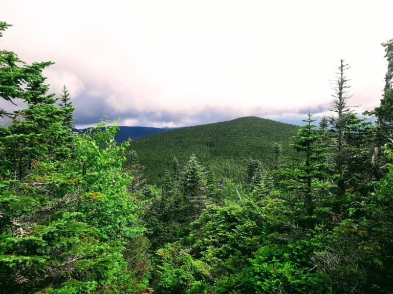
It probably did not hurt that I visited this summit on a brisk winter day in January, when the trails were empty, silent, and peaceful. Encompassed in a thin layer of crispy mist, I was able to hike along the ridge lines and paths of these Alabama mountains, submerged in a wispy fog that loitered in and out of the valleys and peaks of this area.
This state park and its respective high point pack a lot of humble mystery and bold serenity into a very compact package, making this a definite worthwhile place to stop and spend a day, while simultaneously knocking out a state high point hike.
Whether you are visiting just to knock off a highpointing experience, or to enjoy the entire state park as a whole, Cheaha State Park is a destination in itself. With multiple hiking trails, biking trails, and camping opportunities, this park is worth exploring in its entirety. When it comes to impressive views that will transport you to an unfamiliar realm, none beat the views surrounding Cheaha Mountain.
The great thing about this high point is that anyone can access and enjoy it, choosing the length and amount of difficulty of hiking they prefer. At the end of the day, however, the views reflect hikes that should be much harder when you consider the payoff! Though there is not a lot of elevation gain on the trails winding along the top of this Alabama mountain, the vistas along these trails and the views from the summit will leave you feeling that you hiked much further and higher!
Quick Facts About Cheaha Mountain
Length: Varies (drive up / hike up – 3.3 miles roundtrip)
There are several ways to get to the top of Cheaha Mountain and the highest point in Alabama. The longest version is 3.3 miles out and back along the Lake Trail. The shortest version is a drive up on park roads to the stone observation tower marking the highpoint.
Cheaha Mountain Via the Lake Trail:
- Length: 3.3 miles out and back roundtrip
- Rating: Hard – most of the incline occurs within the first mile, and has some steep sections.
- Estimated Time to Complete: 1.5 – 2 hours
- Elevation: 2,413 feet
- Elevation Gain: 1,128 feet

Cheaha Mountain Via the Lake Trail Elevation Chart
- Cost: $5 entry fee to Cheaha State Park
- Dog Friendly: Yes, this is a great state park to bring your pup along! The Lake Trail may prove challenging for some due to the steepness and ruggedness, but other hikes, such as Bald Rock and Pulpit Rock, are perfect options! As you can tell from some of my following pics, my girl Middy had a blast hiking Cheaha Mountain!
- Best Time of Year to Visit: Year Round! Cheaha Mountain State Park is beautiful year round. Spring and fall will be the best times of year to visit and hike, but summer temps are bearable, especially if you get an early morning start. Winter may come with a chance of cold temps, and a possibility of ice or snow, but these can be mitigated with proper layering, gear, and forecast monitoring.
- The trailhead for the Lake Trail to Cheaha Mountain can be found on the north end of Cheaha Lake, adjacent to the group campsites.
Almost all fitness levels can access this the highest point in Alabama, depending on which option you choose. For those preferring an easy jaunt, there is a drive up/walk up version for this state highpoint. For those looking for more of a challenge to hiking Cheaha Mountain, pick up the trailhead for the Lake Trail at Cheaha Lake. Follow the moderately challenging, steeper Lake Trail 1.65 miles northeast until you reach the park roads of Cheaha State Park on the western edge of the park’s boundaries, near the trailheads of Rock Garden and Pulpit Rock. From here, you can follow the paved park roads to the stone observation tower at the high point.
All of the trail options at Cheaha State Park, besides the Lake Trail, are well shaded for those hikers in the summer months. Take caution at the end of some of the park’s trails, such as Pulpit Rock and Bald Rock, as there are dropoffs at the rocky ledge overlooks.
Location of the Highest Point in Alabama
Cheaha State Park and Cheaha Mountain itself are located in northeastern Alabama, within Talladega National Forest.
Map of the highest point in Alabama and the surrounding area
Cheaha Mountain Trail Report
For those wishing to truly hike to this highpoint, my recommendation is to pick up the trailhead of the Lake Trail at Cheaha Lake, which is southwest of the state park. The Lake Trail trailhead is located on the northern end of Cheaha Lake, and the trail is marked with blue blazes. The Lake Trail is a 3.3 mile long roundtrip, out and back trail, that joins up with the park road to the stone observation tower just past Rock Garden, within the Cheaha State Park boundaries.
The Lake Trail ends just past Rock Garden, which is not actually the high point of Alabama. To reach the official high point, hikers will need to continue on from Rock Garden on the paved park roads.
To be specific, hikers will take the Lake Trail from Cheaha Lake and proceed northeast on the trail. After hiking up from Cheaha Lake, the trail will come out between several cabins within Cheaha State Park. Continue straight from here for several minutes, until reaching a paved park road. Go right on the park road, and then continue to follow this road until the split. Take a left at the split, and continue up to the stone observation tower on the left hand side of the road, at the state high point. If you go with this route, plan on 1.5 to 2 hours total.
The Lake Trail is arguably the most challenging hike of the park, and has some areas of significant steepness and rugged terrain with rocky underfooting. There are no switchbacks, but instead, the sections of ascent are basically straight up. Proper trail hiking footwear, such as my own pair of HOKA One One Speedgoats, is highly recommended if you are hiking this particular trail, in addition to a complete day hiking gear checklist.
*Add On to the Lake Trail: the Fisherman’s Trail is a 0.6 mile loop that wraps around the circumference of Cheaha Lake. It is ideal for an easy walk, or for finding a prime fishing spot.
Driving to the Top of Cheaha Mountain
If you are planning to do a drive up and walk up to this summit, you can take the Bunker Loop Road after entering the state park and continue north until reaching the stone observation tower and state high point. There is a wooden sign in front of the tower noting the state high point. The observation tower is open to the public, and you can climb the series of stairs inside to even more picturesque views from within. There is parking available onsite, as well as the trailhead for the 0.5 mile long Leave No Trace Bigfoot Trail adjacent to the parking area.
*Insider Tip: If you add this quick, easy Leave No Trace Bigfoot Trail on to your highpoint exploits, be sure to count how many Bigfoot cutouts you can find along the path!

Additional Trails in Cheaha State Park
The stone observation tower at the state high point may be the official top of Alabama, but it is not necessarily home to the best views in Cheaha State Park. Those who skip seeing the rest of this park are missing some of its best parts! The most impressive views would arguably go to two other stunning trails in this park, the Bald Rock Trail and Overlook, and the Pulpit Rock Trail and Overlook.
Hiking the Bald Rock Trail
- Length: 0.5 miles out and back roundtrip (0.3 miles of this trail can be walked on a wooden boardwalk, with a dirt trail running parallel on either side of the boardwalk).
- Elevation Gain: 52 feet
- Rating: Easy
The boardwalk is very solidly constructed, well maintained, and easy to walk on. Although it is not true hiking in the traditional sense, the boardwalk still adds an element of fun and uniqueness due to its elevation and height off of the ground. It lends to the sense that, even though you are walking on a boardwalk, you are still walking high amongst the ridge lines and forest. If you take the dirt paths on either side, there is some minor boulder scrambling at the very end that is optional.
- Location: The trailhead for Bald Rock is located at the northern end of Cheaha State Park. There are bathroom facilities located immediately next to the entrance to the trail on the left side.
- Pet Friendly: Yep! My pup accompanied me on this trail with ease, and thoroughly enjoyed the boulder scrambling!

I was not sure what to expect when I saw “boardwalk” included in the description of this trail, but it actually lends to the charm of this easy trail. This walk carves through heavy foliaged forest, with plenty of shade and dappled sunlight. The views at the end of the elevated boardwalk are breathtaking, and completely unexpected after emerging from such thick forest. It is quite an amazing surprise to the end of a boardwalk hike.
If you want just a touch more natural feeling, take the dirt path that runs parallel on either side. You will then have the chance to scramble over several large boulders that extend past the end of the boardwalk, which will place you further on the rock ledge overlooking the panoramic views of these Alabama mountains.

Hiking the Pulpit Rock Trail
- Length: 0.6 miles out and back roundtrip
- Elevation Gain: 95 feet
- Rating: Easy
- Trailhead Location: The trailhead is located on the western side of Cheaha Mountain State Park. It is marked with red blazes.
- Dog Friendly: Absolutely, as you can tell from my pictures!
If I was going to label one trail as the best viewpoint in the park, this would be the one! In addition to seeing the observation tower and officially standing on the top of Alabama, this would be the one other spot not to miss in this state park! Not only that, but I would dare to say that Pulpit Rock is hiding one of the best views in all of Talladega National Forest and the state of Alabama.

From the trailhead, there is no indicator that such a stunning view is at the end. But the payoff is definitely there! This is the one spot in Cheaha Mountain State Park that I could have sat and silently enjoyed the views for hours and not been bored for a second.

This is an easy hike, with only short, slight ascents, in thick forest and heavy shade. After hiking through this otherwise forest trail, the trees suddenly open up at the end to several rocky ledges, with unrivaled vista views of these cloud blanketed northern Alabama mountains!
*Insider Tip: Rappelling and rock climbing opportunities exist at Pulpit Rock. Permits are required and can be obtained upon entry at the state park office.
As you can see, there are some surprisingly diverse hiking opportunities here in these Alabama mountains! It’s a spot you can easily spend a day or a weekend while hiking Cheaha Mountain. Alabama may not be a big name in the world of noteworthy hikes, but it is humbly hiding some spectacular sights from its highpoint mountain and state park! From lakes, to steep uphill hiking, to secret overlooks, to historic stone towers, there is a lot to see in this endearing state park!
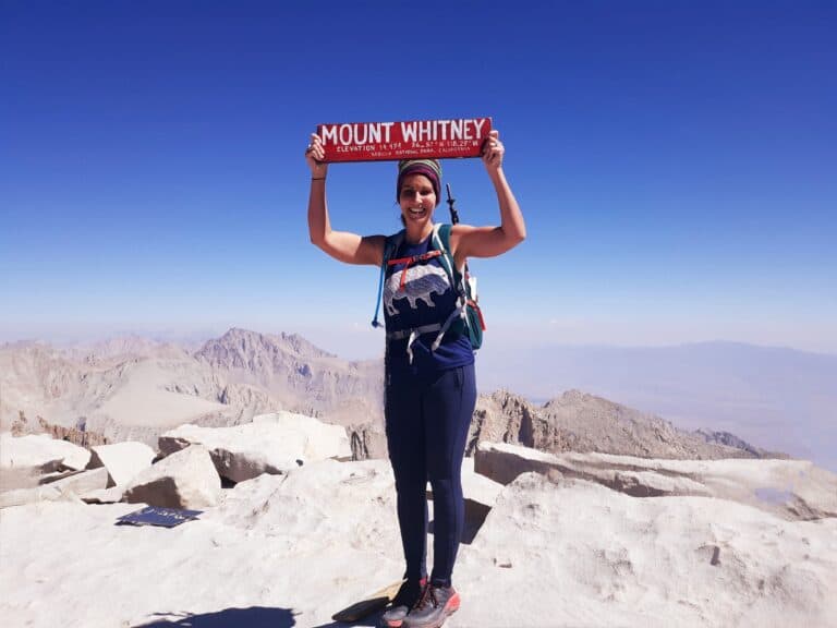
Read More: Did you know that hiking Cheaha Mountain was one of 45 state high point hikes I have completed so far? My goal is to make it to all 50! If you are interested in taking on your own highpointing hikes, visit the blog for itineraries, insights, and tips for your own highpoint hikes like a few of my other favorites at Wheeler Peak in New Mexico, Guadalupe Peak in Texas, Mt. Whitney in California, and King’s Peak in Utah!
>>Check out trail reports for all of my completed state high point hikes to date!
What About the Rest of the State High Points in the U.S.?
Learn about each one of them with this FREE 50 State High Points Graphic!
RELATED ARTICLES:
- 6 Hiking Exercises You Can Do From Anywhere!
- The Highest Point in Georgia at Brasstown Bald
- The Highest Point in North Carolina at Mt. Mitchell
- The Highest Point in Tennessee at Clingman’s Dome
- The Highest Point in South Carolina at Mount Sassafras
- The Highest Point in Arkansas at Mount Magazine
- Guide to the 50 State High Points in the U.S.
- Beginner Hiking Gear Checklist
- Beginner Hiking Tips: Top Mistakes NOT to Make on the Trail!
PIN for LATER!