The 13 Best Hikes Near Fort Worth
You may not automatically think “hiking mecca” when you think of hiking near Fort Worth, but don’t give up just yet! There are some outstanding trails near Fort Worth, perfect for escaping the hustle and bustle of the city, and immersing yourself in the surprising pockets of nature on the edges of the city! These hikes near Fort Worth include scenic lakefronts, challenging ups and downs, plateau overlooks, dense forests, cliffs and rock walls, and more! Discover these underrated gems of the 13 best hikes near Fort Worth!
The 13 best hikes near Fort Worth include:
- The Fort Worth Nature Center
- Chisenhall Park
- Marion Sansom Park
- Fossil Creek Park
- Parks of Aledo
- Tandy Hills Natural Area
- Cedar Hill State Park
- Lake Mineral Wells State Park
- Gateway Park
- Cleburne State Park
- River Legacy Parks
- Eagle Mountain Park
- Quanah Hill

Disclosure: Below are some affiliate links-these are all products I highly recommend. I won’t make any recommendations on this page that I haven’t tested or personally used! Enjoy this guide to the 13 best hikes near Fort Worth!
Table of Contents
The 13 Best Hikes Near Fort Worth
First off, I am a local, so my hope is to give readers the a true, authentic glimpse of the best places to hike near Fort Worth. This is a topic that is near to me, as I not only enjoy the escape to the trails as a part of my regular weekly routine, but I am also constantly in search of the best places to truly “hike” (not pavement), as I am always training for my next big hike, and some of those big destination hikes require suitable local trails to train on. Over the years, I have built up a sizable inventory of all the best hikes near Fort Worth, of which I have frequented each (I do have my favorites though!). This personal inventory of mine has led to this list, which contains a perfect blend of the things I find important in good hikes: scenery, diversity, and the option for varying degrees of difficulty. And of course, it is important that these trails are accessible, which is why this list contains only trails that are less than an hour from Fort Worth. Less time driving, more time hiking.
North Texas may get a somewhat bad rap for hiking options, but there are some gems hiding just outside the reaches of Fort Worth’s city center, making these hikes near Fort Worth perfect for the suburban hiker. These hikes contain the best traits and characteristics of north Texas hiking, and there are a surprising many to be discovered when you visit all 13 of these best hikes near Fort Worth!

What Defines Hiking “Near” Fort Worth?
It’s a fair question, and there’s nothing I hate more than reading an article with a list that claims “near”, only to discover that “near” is 3 hours away. These 13 hikes near Fort Worth are ALL less than 1 hour from the center of Fort Worth. Many are less than 30 minutes. You can see the location of all of them on the map below.
What Defines a “Hike”?
I am a traditionalist – hiking to me means a natural trail, with natural obstacles, natural canopies, and natural elevation gains and losses. Paved paths are great, but you won’t find any on this list, because I really wanted to narrow down the best true hikes near Fort Worth. Rest assured, this list contains true hiking. These are not paved pathways, as you can find plenty of those in the city. These are hiking trails on trails made of dirt, rocks, tree roots, sand, and more. Surrounded by nature.
Map of the 13 Best Hikes Near Fort Worth
Use this map below to plan out your hiking itineraries for each of the 13 best hikes near Fort Worth!
Tips for the Best Hikes Near Fort Worth
- Many of these trails are multi use trails, used by hikers and bikers. Always hike the correct direction (opposite bikers), and always yield to oncoming bikers
- Follow Leave No Trace!
- Assess your current fitness level before undertaking any of these hikes
- Use the recommended gear and accessories (see below), plus plenty of water
- Familiarize yourself with the trail beforehand (know the rating, the trail map, the facilities, the distance, etc).
- Always check for trail closures
#1: The Fort Worth Nature Center
- Google Location: Fort Worth Nature Center, Fort Worth
- Hours: fall – spring 8 AM – 5 PM / summer 7 AM – 5 PM
- Fees: $6 Adults / $2 Children 2 – 13 / Free Children Under 2
- Trail Map
- Additional Facilities: there are multiple parking lots and bathrooms across the nature center
- Best Time of Year to Visit: early fall – late spring
- You can find out more about the Fort Worth Nature Center HERE.
The Fort Worth Nature Center is one of the best places to hike near Fort Worth, but it is so much more than that! It has places to picnic, a small nature center with aquatic animals and exhibits, outdoor birds of prey displays, a full calendar of events, boating opportunities, and bison viewing spots. Yes, there is a herd of bison that live at the Fort Worth Nature Center, only minutes from downtown Fort Worth!
The Fort Worth Nature Center has a network of 12 different trails, ranging in distances from 0.16 miles to almost 3.5 miles in length, though you can connect trails to make longer hikes. Trails traverse ridgetop vistas, canyons, marshes, lakefronts, forests, prairies, grasslands, wetlands, and even a prairie dog town. The geography is incredibly diverse and varied here, and that makes for a great collection of characteristically unique hikes.


#2: Chisenhall Park
- Google Location: Chisenhall Park, Burleson
- Hours: open daily dusk til dawn (except when closed due to heavy rain/storms)
- Fees: FREE
- Trail Map
- Best Time of Year to Visit: early spring – late fall
- You can find out more about Chisenhall Park HERE.
Chisenhall Park is located in Burleson, Texas, south of Fort Worth center. This is a multi use path used by bikers and hikers, maintained by the Fort Worth Mountain Biker’s Association. There are over 10 miles of trails here, ranging in difficulty, but with plenty of shade, several creek crossings, and a bunch of fun trail names, like Keep on Truckin’, Wrecked, and Goatman’s Island.
As there are both bikers and hikers on these trails, it is important to always hike in the correct direction, which will be noted on trail maps. Hikers always hike the opposite direction of bikers, and it is crucial for everyone’s safety to always follow that rule!
Chisenhall Park may be closed following heavy rains or storms, in order to preserve the integrity of the trails. You can check the Fort Worth Mountain Biker’s Association Facebook page for any closures. Green means go! If you find yourself loving the Chisenhall Park trails (or any other of the Fort Worth Mountain Biker’s Association multi use trails), consider becoming a member to help further the good work!
#3: Marion Sansom Park
- Google Location: Marion Samson Park, Fort Worth
- Hours: 5 AM – 11:30 PM daily
- Fees: FREE
- Trail Map
- Additional Facilities: there is parking and bathrooms at the trailhead
- Best Time of Year to Visit: early fall – late spring
- You can find out more about Marion Samson Park HERE.
Marion Sansom Park is another fantastic multi use park perfect for hikers and bikers, with moderate to more challenging trails. The network of trails total 11 miles, and traverse portions of forest, open grassland, and plateau-ed views over Lake Worth and the West Fork of the Trinity River! In fact, Marion Samson Park is situated on a hillside overlooking these water features, so there are plenty of great views, when you are not enjoying the ample shaded trails.
Like some of the other multi use trails in the area near Fort Worth, Marion Sansom Park is maintained by the Fort Worth Mountain Biker’s Association, and may be closed following heavy rains or storms, to allow the trails to dry and not be damaged by hiking and mountain biking. You can check their Facebook page for closures ahead of a visit.
As also previously noted, any time you hike on a multi use trail, make sure that you hike in the opposite direction of bikers. Trail maps will indicate the direction hikers should hike.


#4: Fossil Creek Park
- Google Location: Fossil Creek Park, North Richland Hills
- Hours: open daily dawn til dusk
- Fees: FREE
- Trail Map
- Best Time of Year to Visit: early fall – late spring
- You can find out more about Fossil Creek Park HERE.
Fossil Creek Park is located northeast of Fort Worth, in the suburb of North Richland Hills. Tucked in among residences, this humble park offers just over 4 miles of easy trails, perfect for a beginner hiker or a hiker looking for easier trails. There are 3 separate hike and bike trails here, ranging from approximately 1 mile in length to just over 1.5 miles in length. The main centerpiece of this park is Fossil Creek, which runs right down the center of the park.
This trail system is operated by the Fort Worth Mountain Biker’s Association. As a multi use park, there are a few important things to keep in mind:
As a hiker, always hike the opposite direction of bikers. Directions will be noted on trail maps. Always yield to bikers and allow them to pass. Second, the trails may be closed following heavy rains or storms, to protect the integrity of the trails. You can check for closures on the Fort Worth Mountain Biker’s Association Facebook page.
#5: Parks of Aledo
- Google Location: Parks of Aledo, Aledo
- Hours: open daily dawn til dusk (except when closed after heavy rains/storms)
- Fees: FREE
- Trail Map
- Additional Facilities: there are benches near the trailheads. There are no bathrooms currently at the Parks of Aledo trails.
- Best Time of Year to Visit: early fall – late spring
- You can find out more about the Parks of Aledo trails HERE.
The Parks of Aledo trails are operated by the Weatherford Mountain Bike Club, and it contains a whopping 12 total miles of trails, right outside of Fort Worth in the suburb of Aledo, Texas.
The Parks of Aledo trails are categorized into 3 sections: the Prairies, Bluffs, and Lakes, which gives a good clue as to the type of terrain and geography to expect when hiking the trails grouped together in each section. In these 3 sections is a network of 8 separate trails, though many connect to each other. This means you can customize the distance you want to spend hiking here.
It is also important to note that there are two separate parking areas, a north and south area. The trails congregated on the north end tend to be easier, while the trails congregated on the south end tend to be more challenging. This helps in planning where to park, in order to more easily access the type of trail you’re wanting.
While some of the trails pass by neighborhood backyards, it is still a huge surprise to find this amount of hiking tucked away inconspicuously. The varied geography of forest, grasslands, streams, bluffs, and lakes is a huge bonus, along with the different difficulty ratings of the trails, perfect for different hiking abilities.
The Parks of Aledo trails are occasionally closed following heavy rains or storms, in order to protect the environment and trails themselves from hiking and mountain biking. You can check their Facebook page for closures. Green means go, red means no!
A couple other things to note about the Parks of Aledo trails:
- This is a multi use trail network. That means that hikers and bikers use these trails. Each go a different direction on the trails. At each trailhead, you can find signage indicating which direction to go as a hiker. It is important for both hikers and bikers safety to follow these signs, and always hike the opposite direction of bikers.
- Because this is a multi-use trail system, always yield to oncoming bikers by pulling off to the side and allowing them to pass. Also, if you happen to be hiking with pets or children, be ready to have them move quickly to the side as well.
- These trails are free to hike, but if you want to help with their maintenance, you can consider becoming a Club Member, especially if you find yourself a regular visitor to the Parks of Aledo.


#6: Tandy Hills Natural Area
- Google Location: Tandy Hills Natural Area, Fort Worth
- Hours: open daily
- Fees: FREE
- Trail Map
- Additional Facilities: picnic tables and a playground. No bathrooms.
- Best Time of Year to Visit: early fall – late spring
- You can find out more about the Tandy Hills Natural Area HERE.
Tandy Hills Natural Area is a exquisite example of a Texas prairie habitat, and it is reminiscent of Texas Hill Country to the south, right here only minutes from downtown Fort Worth. There are 2 trails here, one at 2 miles roundtrip length, and the other just short of 1 mile roundtrip length. Both are rated moderate, so it is the perfect hiking spot for those looking for a shorter day of less aggressive hiking, easily accessible from the heart of Fort Worth. Bonus – this park is stunning in the spring with its plethora of wildflower prairies!

#7: Cedar Hill State Park
- Location: Cedar Hill State Park, Cedar Hill
- Hours: open daily 6 AM – 10 PM
- Fees: Adults $7 / Under 12 Free
- Trail Map
- Additional Facilities: there are bathrooms, parking lots, picnic areas, and campgrounds in Cedar Hill State Park
- Best Time of Year to Visit: early fall – late spring
- You can find out more about Cedar Hill State Park HERE.
South of Fort Worth you will find Cedar Hill State Park, the closest state park to the DFW metroplex. This state park is large, with a whopping amount of trails to hike, as well as a large amount of campsites. There’s a good reason it makes the list for best state parks near DFW! Cedar Hill’s trails are largely known for their idyllic prairie environment, a welcoming and relaxing sight to hike amongst.
There’s something for every type of hiker here, with 8 trails to choose from, ranging in difficulty from easy to difficult. There are also multiple distances, from under 1 mile, to a hefty 12 miles as the longest trail.

#8: Lake Mineral Wells State Park
- Google Location: Lake Mineral Wells State Park, Mineral Wells
- Hours: open daily 6 AM – 10 PM
- Fees: Adults $7 / Under 12 Free
- Trail Map
- Additional Facilities: there are bathrooms, parking lots, picnic areas, and campgrounds at Lake Mineral Wells State Park.
- Best Time of Year to Visit: early fall – late spring
- You can find out more about Lake Mineral Wells State Park HERE.
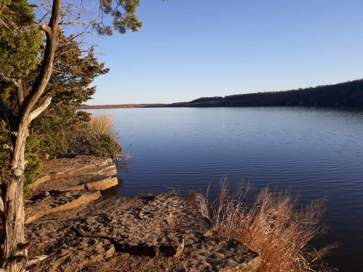
Lake Mineral Wells State Park is a favorite place to hike near Fort Worth, at less than an hour west. There is a scenic lake at its heart, Lake Mineral Wells, which is the highlight of many of the 9 trails in the park. It is also one of the many reasons this park is a candidate on the best of DFW state parks list!
Then there is also the local trail favorite, the Penitentiary Hollow Trail, which winds through slots in rock walls and cliffs. It is the one trail you shouldn’t miss when visiting Lake Mineral Wells State Park.

#9: Gateway Park
- Google Location: Gateway Park, Fort Worth
- Hours: open daily dawn til dusk
- Fees: FREE
- Trail Map
- Best Time of Year to Visit: early fall – late spring
- You can find out more about Gateway Park HERE.
Gateway Park is a multi use system of 7 trails, ranging in levels from easy to moderate. There are both mostly flat trails, and mostly hilly trails, and luckily, they happen to be grouped together. The West Fork of the Trinity River cuts this park in half, with the west side being mostly flat, and the east side being more hilly. There are also two separate trailheads to access each half of this park and its respective trail groupings.
Gateway Park is a very urban setting, only steps away from downtown Fort Worth. And while that does mean you will consistently hear the nearby freeway and city traffic, you can choose to look at it with a different perspective, one that is excited to have such a great network of trails in this little pocket of the city, so easily accessible to many, providing a true hiking escape!
Gateway Park is a multi use system of trails, and part of the Fort Worth Mountain Biker’s Association. As always, this means that the trails may be closed to preserve the trails after a heavy rain or storm (you can check for closures on the Facebook page), and you must hike the opposite direction of bikers. Directions for hikers and bikers will be posted on trail signs, and always make sure to yield to oncoming bikers on the trail.
#10: Cleburne State Park
- Google Location: Cleburne State Park, Cleburne
- Hours: open daily 7 AM – 10 PM
- Fees: Adults $6 / Under 12 Free
- Trail Map
- Additional Facilities: there are bathrooms, parking lots, picnic areas, and campgrounds at Cleburne State Park
- Best Time of Year to Visit: early fall – late spring
- You can find out more about Cleburne State Park HERE.
Cleburne State Park is also less than an hour south of Fort Worth, but contains a world of different sights! Cleburne State Park’s trails are a healthy mix of shady forest trails, with a lot of consistent ups and downs. It should be no surprise that some of the best trail running groups in Texas hold some of their annual trail races here, to really take advantage of the great views and exhilarating trails! Whether you hike or run the trails here, they are simply put, fun!
There are 11 separate trails here, and though they are all relatively short, you can combine many of them to create a longer day hike. There is also a good mix of easy, moderate, and more challenging trails to suit differing abilities.

#11: River Legacy Park
- Google Location: River Legacy Parks, Arlington
- Hours: open daily 5 AM – 10 PM
- Fees: FREE
- Trail Map
- Additional Facilities: there are bathrooms, picnic areas, parking lots, playground, canoe launch, and a nature center at River Legacy Parks
- Best Time of Year to Visit: early fall – late spring
- You can find out more about River Legacy Park HERE.
River Legacy Parks is an expansive urban oasis located south of Fort Worth, in the city of Arlington. Surrounded by neighborhoods and highways, this lush park contains 13 miles of multi use hike and bike trails that are a favorite among locals. This trail is maintained by DORBA (Dallas Off Road Bicycle Association).
River Legacy Parks is also renowned for being a local wildlife watching spot as well, frequented by local residents like coyotes, bobcats, and snakes!

#12: Eagle Mountain Park
- Google Location: Eagle Mountain Park, Fort Worth
- Hours: open daily dawn til dusk
- Fees: FREE
- Trail Map
- Additional Facilities: there are bathrooms and picnic tables
- Best Time of Year to Visit: early fall – late spring
- You can find out more about Eagle Mountain Park HERE.
Eagle Mountain Park is located northwest of Fort Worth, and is centered around the namesake Eagle Mountain Lake. Here the prairies and forests of north Texas meet, creating a beautiful surrounding to hike in, centered around Eagle Mountain Lake. The hiking trails here are a combination of some flat portions, some exposed, some shady, plenty of waterfront, and some cliffside.
There are 6 separate, and color coded, trails here, though because they connect they are most often just hiked as one continuous trail. Together, all the trail systems form a somewhat “figure 8” continuous trail, with one lopsided loop on the west side, and one lopsided loop on the east side. There are well marked maps at every trail intersection, and color coded metal poles along the trails. It is easy to customize how many trails and how long you want to hike here. There are some modest climbs and gains, but that is because there are stunning overlooks of Eagle Mountain Lake, so the effort is definitely worth it!


#13: Quanah Hill
- Google Location: Quanah Hill Trail, Weatherford
- Hours: 24 hours a day, daily (except when closed after heavy rains/storms)
- Fees: FREE
- Trail Map
- Additional Facilities: parking and bathroom at trailhead
- Best Time of Year to Visit: early fall – late spring
- You can find out more about Quanah Hill HERE.
Quanah Hill is a true under-rated gem, located about 30 minutes west of Fort Worth. Hidden in the small community of Lake Weatherford, this multi use system of trails totals 7 miles of varying loops, and is my personal favorite on this entire list of the best hikes near Fort Worth! In fact, you can find me on this trail just about every weekend.
Why is Quanah Hill such a great trail system and one of the best hikes in Fort Worth? There are several reasons:
- You Can Customize Your Preferred Distance: Quanah Hill is unique, in that there is one point to point trail that is 3 miles roundtrip in length. But then there are an additional 4 loop trails attached to the main point to point trail, and all of these trails together total 7 miles. The 4 loop trails vary in roundtrip length from 0.33 miles, to 1.7 miles. That means there are dozens of combinations you can do to achieve various lengths. Hike straight through on the main point to point trail for 3 miles roundtrip. Attach one of the loop trails, and you can do any number of distances, from 3.3 miles to 4.7 miles. Do all the trails together, and achieve 7 miles total.
- Unique Terrain: Quanah Hill has different “regions” on its trails. There are open grasslands on the Lost Boys Loop. There are dense, forested patches on the 1886 main point to point trail. There are challenging uphills, overlooks, and plateaus on the El Bandito Loop. There are signs of suburban life here from time to time, like stretches of trail that pass nearby farms and small neighborhoods roads, but Quanah Hill really hits the mark as far as making the most of its surroundings by providing varying scenery, and a hefty amount of ups and downs and decent climbs. As an added bonus, from several spots along the trail, you can overlook Lake Weatherford. My favorite spot is on El Bandito, at sunrise!
- Easy, Moderate, and Hard Trails: in addition to varied terrain, there are also varying degrees of difficulty in the trails at Quanah Hill. El Bandito is the hardest trail, while Lost Boys is the easiest. If you’re like me and find yourself training for hardcore hikes (mostly out west), you may find yourself doing multiple loops of El Bandito for a truly difficult workout hike.
- Easy Access: Quanah Hill is not hard to find, or reach in any vehicle. There are also bathroom facilities at the trailhead, and plenty of parking.
- Plenty of Shade: this is an important one for me personally, as I generally do not stop hiking even during the summer. Quanah Hill has a surprising amount of shade along its trails, which is a super plus for hiking in Texas!
What else do you need to know for hiking Quanah Hill?
- First, Quanah Hill is operated by the Weatherford Mountain Bike Club. They do close the trails after rains to allow the paths to dry and avoid damage from hiking and mountain biking. You can check the Facebook page for closures.
- Second, this is a multi use trail system! That means there are hikers and bikers. Bikes go one way, hikers go the other. It is important to follow this rule for the safety of both hikers and bikers. You can find signs located at each trail/loop indicating the direction for both hikers and bikers to proceed. As a hiker, always be vigilant in watching for bikers, and if hiking with pets or children, be ready to move them to the side to allow bikers to pass. Hikers always move to the side and give right of way to oncoming bikers.
- Lastly, it is free to park and hike at Quanah Hill! If you find yourself a regular and want to support the trail, consider becoming a Club Member!


What Gear Do You Need for the 13 Best Hikes Near Fort Worth?
Whether you are planning a quick jaunt or an all day trek, here are a few key gear items to have before tackling the 13 best hikes near Fort Worth.
Footwear – it should be no surprise that you won’t be hiking aggressively up any mountains on these trails, but you still need supportive footwear. I personally feel a traditional hiking boot is overkill for these Fort Worth hiking trails. Instead, opt for a lightweight, cushioned, trusty trail runner, like my go to’s – HOKA One One Speedgoats. These lightweight shoes leave my feet feeling “fresher” and lighter after hiking all day, without compromising on grip, supportiveness, and cushioning.
Performance Socks – your shoes are only as good as the socks you pair them with. This is especially true of longer, full day hiking. Nothing can derail an awesome day of hiking quicker than a blister. These Hilly Twin Skin socks with their “twin layers” help prevent the friction that can cause blisters. I used to be extremely blister prone, but haven’t had a single one since discovering Hilly Twin Skin socks, not even on my longest and most grueling day hikes, like the Grand Canyon’s Rim to Rim hike, or California’s Mt. Whitney, the tallest mountain in the lower 48 states!
Daypack – a good daypack is essential for any day hike, no matter how long. Invest in a day hike that has enough room for necessary day hiking gear, personal belongings, plenty of water, and snacks. My favorites are this Camelbak Helena daypack, and this Osprey Daylite daypack.
Water System – no matter how long you plan to hike, make sure you have a water system capable of providing plenty of water along the trail. For short hikes, I prefer this hydration belt that can carry a large insulated water bottle. For longer hikes, I prefer a hydration vest like this Camelbak hydration vest, that can carry a Platypus hydration bladder and provide consistent, on the go hydration. A couple sturdy water bottles, like these trusty Nalgene water bottles, are also suitable being carried in a day pack for day hikes.
Hiking Snacks – if you plan to hike more than an hour or so, make sure to bring along some hiking snacks. The best hiking snacks include snacks that are lightweight, compact and easy to carry, have minimal trash, and of course, provide good, solid energy!
RELATED ARTICLES:
- Best Trail Races in Texas
- Best Half Marathons in Texas
- Best Hikes in Texas
- Best Hikes in West Texas
- Best Hikes in El Paso
- Best Hikes in Big Bend National Park
- Best State Parks Near DFW
- Things to Do in Guadalupe Mountains National Park
PIN for LATER!