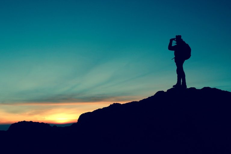
Mountains in Texas: Are They Fact or Fiction?
As a native Texan, I am naturally biased to thinking that my home state of Texas is a multi-dimensional state. I have also taken the time to explore the ins and outs of the multiple regions, ecosystems, National Parks (yes there is more than one), and state parks represented in this state. One of my favorite revelations to break to “outsiders”, is that Texas is not all flat and boring. A huge state, yes! But it is anything from flat and boring. The best misconception – shattering example of this is Texas mountain ranges! Yes there are mountains in Texas, and I don’t mean just a couple hills here and there, but there are numerous mountain ranges, some that even contain some high elevation hikes topping out at over 8,000 feet! Where can you find said mountains in Texas? The best place to find superb peaks in the Lone Star State is in west Texas mountains, which includes the Guadalupe Mountains, the Chisos Mountains, the Franklin Mountains, and the Davis Mountains!

Disclosure: Below are some affiliate links-these are all products I highly recommend. I won’t make any recommendations on this page that I haven’t tested or personally used in these Texas mountain ranges!
Table of Contents
The Top 4 Texas Mountain Ranges
West Texas mountains are a myriad of ranges melding together to cover this unique region of the state. Four of my favorite ranges of mountains in Texas are the high elevation Guadalupe Mountains, the rugged Chisos Mountains, the multi-faceted Franklin Mountains, and the humble Davis Mountains.
The 4 West Texas Mountain Ranges
- Guadalupe Mountains
- Chisos Mountains
- Franklin Mountains
- Davis Mountains

Location of the 4 Mountains in Texas
The Guadalupe Mountains, Chisos Mountains, Franklin Mountains, and Davis Mountains make up the quad – fecta of perfect mountains in Texas. These west Texas mountains can all be found in relatively close proximity to each other, all in west Texas. Road trip anyone?
Proposed itinerary for a Mountains in Texas Road Trip!
- The Guadalupe Mountains are located in the far corner of west Texas, just south of the border with New Mexico. In fact, the Guadalupe Mountains are only an hour south of Carlsbad, New Mexico, and the home of Carlsbad Caverns National Park. If you are up for it, you can visit both these parks during the same trip – a great way to check more National Parks off of your list! A perfect home base that is close to both parks is Whites City, New Mexico.
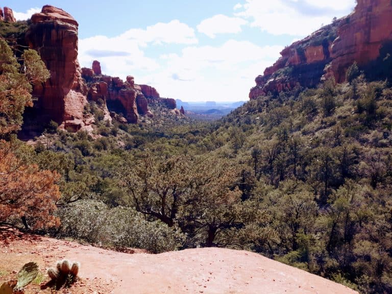
- The Chisos Mountains are located in the heart of Big Bend National Park in southwest Texas. They are centrally located in the park, and house some of the best hikes and camping spots in the Chisos Basin. My favorite things to do in the Chisos Mountains? Hike the Lost Mine Trail, the Window Trail, and explore Santa Elena Canyon!
- The Franklin Mountains are located just outside the west Texas city of El Paso – a seriously under-rated destination with a wealth of awesome hikes. They are unique in that they provide such a wealth of outdoor opportunity to such a metropolitan area, when compared to the other three mountains in Texas, that are relatively isolated. That is part of the appeal of the Franklin Mountains, and why they are so popular as an outdoor destination for hikers, bikers, and rock climbers alike.
- The Davis Mountains are humble but such an exciting area to explore, located in the central panhandle area of west Texas. These mountains hide a lot of surprises, from their high elevation surrounding the quaint town of Fort Davis, to their historical roots based in the history of Fort Davis National Historic Site, to challenging uphill climbs with stunning views in Fort Davis State Park and the Davis Mountains Preserve. In the entire gigantic state of Texas, Fort Davis just might be my favorite small town because of all the fun and unique outdoor opportunities there are here!
Map of West Texas Mountains
#1: The Guadalupe Mountains
If the Guadalupe Mountains sound vaguely familiar, that is because they have a namesake National Park, Guadalupe Mountains National Park. They also lend their name to the state high point of Texas, the Guadalupe Peak hike.
Guadalupe Mountains National Park, though it boasts the tallest mountains in Texas, is relatively unknown when compared to its sister National Park, Big Bend. But if you play your cards right, this characteristic could benefit you, as a visit to the Guadalupe Mountains most likely will mean having the place largely to yourself!

The other fascinating aspect of these mountains in Texas is the eclectic diversity and multiple ecosystems that are housed here in singular harmony. There are desert panoramas that stretch for miles, overshadowed by forest clad mountains upholding high elevation environments, mixed in with a little canyon topography here and there, like on the McKittrick Canyon Trail, one of the most stunning fall foliage hikes in the entire state! In Guadalupe Mountains, you can simultaneously explore both slot canyon hikes, like the Devil’s Hall Trail, foliaged trails that in the fall easily rival the Northeastern states, like McKittrick Canyon, and beautifully barren Chihuahuan desert hikes like the Tejas Trail to “the Bowl”, all in one day! Though it is not hard to spend more time here!

Perhaps the most impressive hike in the Guadalupe Mountains is the hike to the highest point in Texas, Guadalupe Peak! This experience will undoubtedly grant you a new appreciation for how mountainous Texas can truly be. This hike also mimics the overall multi-dimensionality of this mountain range, in that it leads you through multiple environments in a single hike.
This hike begins in a shrubby, open, high desert environment, then after climbing in elevation on switchbacks and rounding the face of Guadalupe Peak, leads you through a shady, forest environment, before forging above the treeline to arrive at the barren cliff faces of the Guadalupe Peak summit. To find all this here on a single hike is a testament to the uniqueness of these mountains in Texas. There is a reason I have hiked Guadalupe Peak multiple times, and keep wanting to come back!


Quick Facts on the Guadalupe Peak Hike
The Guadalupe Peak Trail
• Length: 8.5 miles point to point
• Rating: Hard
• Elevation Gain: 2,952 feet
• Elevation: 8,750 feet

For other top hiking recommendations, check out McKittrick Canyon, whose vibrant colors shine the best in fall. This hike shares similar characteristics of the Guadalupe Peak hike, minus the summit and high elevation ascent. But it does take hikers on a journey through multiple facets of the Guadalupe Mountains topography. Start on the floor of the Chihuahuan desert, ascend into the namesake canyon, and along the way pass through some of Guadalupe’s lusher vegetated areas, and even encounter a unique grotto feature and old historical cabins.
Quick Facts on the McKittrick Canyon Trail
- Length: 20.2 miles point to point
- Rating: Moderate to Difficult

- Elevation Gain: 4,366 feet

The Devil’s Hall hike traverses a large slot canyon in the heart of Guadalupe, a literal nature’s own “hallway”. This hike is also a great option for those not looking for a climb, but something a little flatter in nature, without compromising views and intrigue.
Quick Facts on the Devil’s Hall Trail
- Length: 3.6 miles loop
- Rating: Moderate

- Elevation Gain: 577 feet
For other forest setting hikes, look to the Smith Springs Trail, which has a water feature, and the Tejas Trail, a challenging long distance hike to “the Bowl”.
Quick Facts on the Smith Spring Trail
- Length: 2.4 mile loop
- Rating: Easy

- Elevation Gain: 387 feet
Quick Facts on the Tejas Trail to the Bowl
- Length: 12.5 mile loop
- Rating: Difficult

- Elevation Gain: 3,293 feet

Camping is equally impressive in the Guadalupe Mountains and Guadalupe Mountains National Park, a common characteristic shared by all four of these west Texas mountains. Since seclusion and privacy are one of the best traits of these mountains in Texas, your camping experience goes hand in hand. That and the night skies are simply unbeatable out here, with the Guadalupe Mountains peaks silhouetted against an inky backdrop. There are both developed campgrounds and campsites here, as well as backcountry camping opportunities. There is even a backcountry campsite on Guadalupe Peak, just shy of the summit, for those that truly want to embrace the experience atop the highest point in Texas! Check out the park website for more information on camping in the Guadalupe Mountains.

Their other impressive claim to fame is that the Guadalupe Mountains technically spawned another National Park, Carlsbad Caverns National Park. These renowned subterranean caves are hewn from the very same mountain range that tops 8,000 feet in height, and looms over West Texas, the Guadalupe Mountains.
Guadalupe Mountains Entrance Fees: $10 per person, payable at the Visitor’s Center or at self pay stations located at any trailhead.
The Chisos Mountains
The Chisos Mountains call Big Bend National Park their home, and they are, in my opinion, the most beautiful, and unexpected, mountains in Texas. They rise from the earth so surprisingly, creating a fascinating ecosystem in the midst of the Chihuahuan desert. Boasting purples, reds, and golds, and often covered in green tinted lichen, this range’s peaks are beautiful to behold in person.
There are some fantastic hiking opportunities in these rugged and jagged hewn monoliths, but just as impressive is the diverse environment that is cradled in the basin created by these mountains, the Chisos Basin. It is the premier spot to explore in Big Bend National Park, home to the secluded Chisos Basin Campground, and remote hiking like the challenging Lost Mine Trail climb and Emory Peak Trail, the long distance South Rim Trail, and the fun and whimsical Window Trail.

Quick Facts on the Lost Mine Trail
- Length: 4.2 miles out and back
- Rating: Moderate

- Elevation Gain: 1,099 feet
Quick Facts on the Emory Peak Trail:
- Length: 10.4 miles out and back
- Rating: Difficult

Emory Peak Elevation Chart
- Elevation Gain: 2,529 feet
Quick Facts on the South Rim Trail
- Length: 11.5 mile loop
- Rating: Difficult

- Elevation Gain: 2,368 feet
Quick Facts on the Window Trail
- Length: 5.2 miles out and back
- Rating: Moderate

- Elevation Gain: 948 feet

Each of these hikes provide visitors with a unique perspective on life in these mountains, whether you choose a hike to the precipice of mountain summits, like the challenging Lost Mine Trail, or a hike that winds through canyons formed by divergent forces at the base of these mountains, like the intriguing Window Trail.
In terms of camping, the undeniably best spot to overnight it in the Chisos Mountains is in their heart, the Chisos Basin Campground. Nestled snuggly in a cradle of summits, a camping experience here is completely encompassed in stunning views of the Chisos Mountains. Watching the sun rise and set over these peaks is breathtaking. You can find out more information about camping at the Chisos Basin Campground, or other campgrounds in the park, by visiting the park website.
Big Bend National Park Entrance Fees: $30 per vehicle

The Franklin Mountains
The Franklin Mountains are so much fun to explore on foot, that a major trail running event is held there every year (looking for more trail running events near you? Find them quickly and easily HERE!). Hiking here is both remote and challenging. Camping here is even more impressive. Again, this is a quality that is shared among all four of the west Texas mountain ranges.
Campgrounds and sites in Franklin Mountains State Park are nestled into the base of the Franklin Mountains, and are generously spread out so as to have a true feeling of privacy. Night skies are unfiltered and unrivaled here. You can find out more info on camping at Franklin Mountains State Park on the park website.

The fantastic thing about the trails here in the Franklin Mountains and the surrounding are are that there are a large amount of multi-purpose trails that can be used for both mountain biking and hiking. In fact, the Franklin Mountains region is renowned as a superb mountain biking destination in the state.
Other surprises to be found when taking on the trails here are hikes to old abandoned tin mines, hikes to decades old plane crash sights, hikes to caves, and hikes that literally take on 1,000 steps! The Franklin Mountains and the surrounding region of El Paso have all the hikes!

One of the best features of mountains in Texas is that anytime you have converging and diverging topography, you’re likely to get an interesting combination of not only mountains, but the canyons, slots, and caves that are left in their wake. One of the Franklin Mountains’ most interesting hike is the Aztec Caves hike, a trail that can be found within Franklin Mountains State Park. This is a short, one mile hike, but it is impressive in the payoff. A somewhat steep grade results in a hike that terminates in not just one cave, but a grouping of caves, ones that can even be explored on foot, so be sure to bring along a flashlight for this trail!
Quick Facts on the Aztec Caves Trail:
- Length: 1.2 miles out and back
- Rating: Easy

- Elevation Gain: 419 feet
My personally biased and favorite hike in the Franklin Mountains has to be the Tin Mines Trail. This hike mainly features the Chihuahuan desert landscape, but the views are so expansive here, with a backdrop of purple hued Franklin Mountains in the background. The finale of this hike just graces the base of the mountain range, as the quick and final ascent up from the desert floor ends in a abandoned tin mine chiseled from the side of the mountain range.
These tin mines were the only ones to ever exist in the United States, so the uniqueness of this trail is literally one of a kind. Obviously tin mining did not take off as expected, but that means that now hikers can explore this abandoned mine underneath the Franklin Mountains. Another hike to bring along a flashlight for! The tunneling in the mine is short, and only takes a few minutes to see, but it is still a fun and quirky way to end a day of hiking!

Quick Facts on the El Paso Tin Mines Trail:
- Length: 6.6 miles out and back
- Rating: Easy to Moderate

- Elevation Gain: 1,023 feet
Another unique find in the Franklin Mountains. This hike is actually a part of the 1000 Steps Trail, whose trailhead you will want to use for this hike. The 1,000 Steps Trail will actually take hikers to an official overlook of the wreckage, but to actually hike to the wreckage in person will require a little detouring.
The trail to the remnants of this plane wreck is rather informal and not officially marked, and is more of a boulder hopping experience than actual hiking. The wreckage can be found in between the converging slopes of two adjacent mountain sides, so rock scrambling here involves navigating this narrower slot. For more specifics on this hike, visit my post on the best of the Franklin Mountains hikes.
Quick Facts on the B-36 Plane Wreck Trail
- Length: 2.3 mile loop
- Rating: Moderate

- Elevation Gain: 1,069 feet
Thousand Steps Trail
The entirety of this challenging mountain hike not only passes the B-36 plane wreck, but continues on to Ranger Peak, making this a great option for those looking for a good uphill ascent on a characteristic peak of the Franklin Mountains. Views over the city of El Paso are among some of the best from this trail’s vantage point!
Quick Facts on the Thousand Steps Trail
- Length: 3.7 mile loop
- Rating: Difficult

- Elevation Gain: 1,423 feet
The Mundy’s Gap Overlook Trail is a hike that highlights the literal gap between two Franklin Mountain peaks. Its trailhead is found within the Franklin Mountains State Park, making it very accessible to campers and day visitors to this park.
Quick Facts on the Mundy’s Gap Overlook Trail
- Length: 3.9 miles out and back
- Rating: Difficult

- Elevation Gain: 1,003 feet

The Schaeffer Shuffle Trail
This hike traverses the ups and down of the Franklin Mountains, as well as winds around the bases and through the valleys created by these mountains in Texas. It is a great hike, and an even better trail running path! There are both steep uphills and steep downhills here, and fantastic panoramic views!
Quick Facts on the Shaeffer Shuffle Trail
- Length: 2.6 mile loop
- Rating: Moderate

- Elevation Gain: 698 feet
The North Mount Franklin Trail is the highest hikeable trail in the Franklin Mountains, so it is the premier example of the best of the Franklin Mountains! This long distance hike packs almost 3,000 feet in elevation gain, for the truly adventurous!
Quick Facts on the North Mount Franklin Trail
- Length: 7.2 miles out and back
- Rating: Difficult

- Elevation Gain: 2,408 feet
As mentioned before, not only do the Franklin Mountains harbor some of the best mountain hiking in Texas, but many of those trails double as great mountain biking opportunities! A favorite mountain biking trail among locals and visitors alike is the Tin Mines Trail, as well as the impressive 25 mile long Franklin Mountain Loop! All in all, there are over 80 plus trails weaving through the Franklin Mountains, creating a plethora of ways to actively enjoy these mountains in Texas!
Franklin Mountains State Park Entrance Fees: $5 per person 13 years and older
The Davis Mountains
One of the reasons I simply LOVE the Davis Mountains is not only for the unique hiking and outdoor opportunities here, but also for the way the mountains have created and cradled one of my favorite quaint West Texas towns, the town of Fort Davis. Fort Davis is one of my all time favorite destinations in the entire state of Texas, and it is the reason I have visited multiple times!
The Davis Mountains are not the most dramatic mountain ranges in Texas. But they are just so much fun, and have created this unique mountain town environment in the middle of the Texas panhandle, which is such a pleasant surprise! So what can you do in the Davis Mountains?
Davis Mountains State Park
Davis Mountains State Park seamlessly and beautifully blends together the unique topography and terrain of this region. Its mountains are comprised of part igneous rock stacks and slabs, and part gentle grasslands. Some of its peaks jut erratically into the sky, while some high plateaus and summits are blanketed by soft expanses of prairie.
All of Davis Mountains State Park is ruggedly remote, and its trails equally engaging! It is also the prime destination for those looking to partake in some west Texas mountain camping. Find out more about camping at Davis Mountains State Park here.
One other thing that makes a visit to Davis Mountains State Park unique is the quaint and historic Indian Lodge, a stunning white washed hotel set within the state park boundaries. There is also a restaurant and a pool on site.

Rough rock meets grasslands in Davis Mountains State Park, with a view overlooking historic Indian Lodge
Davis Mountains State Park Hikes
There are 7 hiking trails in Davis Mountains State Park, ranging in lengths from 0.6 miles to almost 6 miles in length. Trails that climb hills and ridges, trace along canyons, wind through juniper forests and grasslands, and trails that are dotted with historical remnants!
If you are looking for shorter, gentler hiking trails in Davis Mountains State Park, there is the 0.6 mile long roundtrip Headquarters Trail, which intermingles views of Keesey Canyon and old lava flows. This trail is located in the heart of Davis Mountains State Park.
Or consider the just short of 2 mile roundtrip Montezuma Quail Trail, located adjacent to the Headquarters Trail. This loop contains just a bit more elevation gain than the Headquarters Trail, with a brief ascent that offers some stunning views of the wild expanses, as well as the historic Indian Lodge. This trail also incorporates an enclosed wildlife viewing blind, the Emory Oak Wildlife Viewing Area, found at the trailhead.
***Both the Headquarters Trail and the Montezuma Quail Trails connect to the Indian Lodge Trail, a longer and more robust hiking trail found in the park, and perfect for those looking to extend their hiking. In fact, the only way to complete the Indian Lodge Trail is to connect to either the Montezuma Quail Trail or Headquarters Trail at the eastern terminus of the Indian Lodge Trail, in order to complete the Indian Lodge Trail.
There are several intermediate day hikes available in Davis Mountains State Park. These include the 3 mile roundtrip Indian Lodge Trail, a personal favorite, whose trailhead can be found immediately next to the historic Indian Lodge. If hiking the Indian Lodge Trail from its western trailhead in a clockwise direction, you would start at the trailhead at the Indian Lodge parking lot, and then immediately begin climbing up prairie covered peaks, jutted with rough rock.
The Indian Lodge Trail has its highlight at the top of the ridge, whose overlooks boast the best views of the Davis Mountains, as well as the switchbacks up the scenic Skyline Drive park road. To descend down the Indian Lodge Trail takes careful footwork through narrow and uneven terrain, before reaching the terminus at the connecting branch with the Montezuma Quail Trail and the Headquarters Trail. Either of these trails will complete the loop for you and drop you back onto the main park road, but the Montezuma Quail Trail is a slightly shorter version than the Headquarters Trail.


There is also the 3.2 mile roundtrip Old CCC Trail, which connects to the Skyline Drive Trail to complete the loop trail, or, if hiked even further, connects to neighboring Fort Davis National Historic Site. This old CCC road has been around since the 1930’s, and is used for mountain biking in addition to hiking.
The Skyline Drive Trail parallels the park’s scenic Skyline Drive, and climbs some impressive elevation along its 5.2 mile roundtrip length. It includes the Keesey Canyon Overlook, as well as several historical park buildings. The Skyline Drive Trail connects with the Old CCC Trail for completion.

The final two hiking options will require more of your day, but are the most immersive trails in Davis Mountains State Park. Both are located in the northern portion of the park, and both require a gate code to access the trails, so be sure to inquire with the park rangers when entering the park if you plan to do either, or both, hikes.
The Limpia Creek Trail is a 5 mile roundtrip trek, which does connect with its other backcountry hiking trail, the Sheep Pen Canyon Loop Trail, for completion. The Limpia Creek Trail starts off easily and flatly, then climbs at its junction with the Sheep Pen Canyon Loop Trail.
The Sheep Pen Canyon Loop Trail is the longest hike in Davis Mountains State Park, at 5.6 miles roundtrip. This plateau-ed hike emphasizes the high desert surroundings, including waving grasslands and juniper forests, and peaceful vistas. There is also primitive camping along the Sheep Pen Canyon Loop Trail.
***Both the Limpia Creek Trail and Sheep Pen Canyon Loop Trails are considered multi-use, for hiking, mountains biking, and equestrian use. There are equestrian campsites located at the trailhead of the Limpia Creek Trail, and primitive campsites located along the Sheep Pen Canyon Loop Trail.
***You can find a PDF version of all the hiking trails in Davis Mountains State Park here.
And after you’re done hiking, don’t forget about the scenic 4.5 mile Skyline Drive, the park’s high elevation, point to point, scenic drive. It’s not just a scenic drive, but also a chance to enjoy many of the designated lookouts and old structures located along the way!
And good way to end a day of hiking and exploring in Davis Mountains State Park is to visit the white-washed historic Indian Lodge, which also houses a down to earth restaurant inside, the Black Bear Restaurant.
***Day use entrance fees for Davis Mountains State Park are $6 a person 13 years and older.


The best spot in Fort Davis for camping is Davis Mountains State Park. This state park, nestled below the stacked mountains and rolling hills, offers unrivaled night skies and remote camping!
There are 3 designated campgrounds at Davis Mountains State Park. There is also primitive camping, with a 4 mile walk in and an elevation gain of 800 feet, so be prepared! Campsites at Davis Mountains State Park can be reserved in advance online here.

Fort Davis National Historic Site
Fort Davis National Historic Site also packs in some exciting mountain trails in addition to its history, which you can read more about here.
***Entrance fees to the park are $10 per person or $20 per vehicle, and the park is open daily (with the exception of a few holidays) from 8 AM – 5 PM.

As far as Fort Davis National Historic Site’s hiking goes, there are a couple great trail options! And all of them contain spectacular views of the historic fort and its remaining remnants as well!
Several of Fort Davis National Historic Site’s trails connect together to form a lopsided loop that winds through the onlooking Davis Mountains. These connected trails together are the Hospital Canyon Trail (0.7 miles), the North Ridge Trail (0.3 miles), and the Tall Grass Loop (0.8 miles).
These connected trails are considered moderate to challenging, with the Hospital Canyon Trail climbing up the overlooking ridge in the fort’s background, and the North Ridge Trail proceeding over the spine of the ridge, before beginning the descent amid the Tall Grass Loop.
These three trails are considerably more challenging than the shorter trails in “the valley” of Fort Davis National Historic Site, but the views from atop the ridge overlooking Fort Davis are mesmerizing, and definitely worth the work! To access these 3 trails in a clockwise direction, look to start with the Hospital Canyon Trail to the left of Fort Davis National Historic Site.


There are flatter and shorter trail options below, on the same “ground level” as the fort. These trails are more pathlike and gentle at heart, but provide up close views of Fort Davis National Historic Site, as well as the surrounding towers of stacked mountain peaks. Some of these “flat land” trails include the Cemetery Trail (0.2 miles), and the brief Photographer’s Trail, immediately adjacent to the Visitor’s Center.
***For a PDF view of all the hiking trails at Fort Davis National Historic Site, visit this link!
***Insider Tip: Another cool way to experience Fort Davis National Historic Site is to run its trails during the annual Fort Davis trail race!
Davis Mountains Preserve
The Davis Mountains Preserve is yet another hiking destination in Fort Davis, Texas, in addition to the Fort Davis National Historic Site and Davis Mountains State Park. Set just a little further outside of the actual town of Fort Davis, this spot really highlights what it means to hike remotely.
Hewn by the elements out of the area’s characteristic rock, this region surprisingly houses a host of delicate canyon water sources and springs. If you are looking to hone in on arguably the best attraction at the Davis Mountains Preserve, that would be Madera Canyon.
The Madera Canyon Trail exposes this unique balance between arid, seemingly inhospitable land, encompassing a surprisingly vibrant and rich ecosystem. It’s also a trail to take advantage of higher altitude hiking, at 6,000 feet elevation.
The Madera Canyon Trail is 2.4 miles roundtrip, and contains several engaging features. Some patches of rough and uneven rock trails, stream crossings, cliff drop offs, moderate grades, and views of neighboring Mount Livermore, an 8,000 foot peak.
Local wildlife is also abundant in this area, including javelina, bobcat, mountain lion, black bears, elk, and golden eagles. Texas madrone trees, a unique beauty also found along Guadalupe Mountains National Park’s McKittrick Canyon Trail, another west Texas highlight, adds extra appeal to this hike.
***The Madera Canyon Trail is open daily from sunrise to sunset.

Chihuahuan Desert Research Institute And Botanical Gardens
While the Chihuahuan Desert Research Institute is primarily the home of a succulent rich botanical garden, it also offers several short hikes in addition. So it is not only a great place for some shorter trails, but it is also a chance to get educated on the local flora and fauna simultaneously! And don’t forget to check out the small outdoor mining exhibit at the entrance, with a large collection of old mining tools on display, as well as local minerals mined from the region!
***The Institute is open Mon., Tues., Thurs., Fri., and Sat., from 9 AM – 5 PM. Entrance fees are $6.50, and can be booked online on the Institute’s website here.

In addition to the short nature trail that leads from the Visitor’s Center to the succulent greenhouse, there are a couple other hiking trails located at the Chihuahuan Desert Research Center.
The Upper Loop Trail is a short loop found immediately adjacent to the Visitor’s Center. It is considered an easier hike, and is 0.5 miles in length. Another shorter hiking trail is the 0.33 mile loop Hummingbird and Butterfly Trail, which encompasses the Pollinator Garden. The surroundings are rockier with rugged outcroppings, larger boulders, and impressive views.
Modesta Canyon Trail and Clayton’s Overlook are 1.75 mile and 1.5 mile long trails respectively, are are more challenging in their terrain. The Modesta Canyon Trail incorporates grasslands, natural springs, and canyon hiking among igneous rock formations. Clayton’s Overlook climbs a moderately challenging hilltop. If you want to take on both the Modesta Canyon Trail and Clayton’s Overlook Trail, the Outer Loop Trail has it all! This 2.5 mile roundtrip loop includes both these other trails. For a trail map, visit the park’s website here.
Checking out the impressive succulent collection at the Institute’s Botanical Garden is a relaxing and well-rounded way to close out any outdoor explorations of this area. Several hundred unique succulents that showcase the local flora and fauna of the surrounding Chihuahuan Desert can be found in the greenhouse, a short walk from the Visitor’s Center. As you follow the path to the greenhouse, enjoy the labeled local residents found along the trail.


What Do You Need to Explore These Mountains in Texas?
Recommended Gear Quick Links:
- Hoka One One Speedgoat Trail Runners
- Vasque Breeze GTX Waterproof Hiking Boots
- Hilly Twin Skin Socks
- Water Hydration Bladder
- Daypack
- ALL other necessary Day Hiking Essentials (use this Day Hiking Gear Checklist)
- Hiking Itinerary Planner and Hiking Safety Contact Form
- Hiking Snacks (use this Hiking Snacks Checklist to help pack the right stuff!)
- reliable footwear! For hiking on lower grade elevation trails, or trail running through these mountains in Texas, look into a good trail hiking/running shoe, like these ultra cushioned and dependable Hoka One One Speedgoats that I use! For higher elevation and steeper hikes, like the uphill, long distance, Guadalupe Peak hike, North Mount Franklin hike, or the Lost Mine Trail, you may want to opt for a sturdier shoe with stable ankle support and a reliable sole good for grip, like my sound Vasque Breeze GTX hiking boots!
- socks! Your footwear is only as good as the socks you pair it with! Nothing can derail a hike quicker than blisters. I used to be extremely blister prone until I discovered Hilly Twin Skin socks. The “twin skin” is what helps to prevent the friction that can cause blisters. Haven’t had any blisters since switching to Hillys, not even on all day long treks like the Grand Canyon’s Rim to Rim hike!
- a water transportation system! All of the trails in these mountains in Texas require plenty of water, and a safe bet for any day hike is a minimum of 3 liters of water, carried in a water transportation system like this Platypus 3 liter water hydration bladder!
- a daypack! For most of the trails in these four west Texas mountain ranges, you will want a daypack that can carry your water, food, and all of the gear you need. There are plenty of backpacking trails in Guadalupe Mountains National Park and Big Bend National Park, and for those, you will want a different set of backpacking gear essentials. But for most of the trails, and especially those found in the state parks, you will want a reliable day pack, like this Camelbak Helena 20 daypack I use for all my day hikes.
***Download your own Backpacking Gear Essentials Checklist HERE!
- and finally, don’t forget plenty of water and hiking snacks! Take into account the elements that might be present in these west Texas mountain ranges, (such as heat), and length of planned hike, when considering how many snacks to bring. Here’s what the inside of my daypack looks like when it comes to snacks:
- Sandwich
- Beef Jerky
- Trail Mix / Nuts
- Tuna Packets
- Applesauce Pouches
- Squeezable Peanut Butter
- Honey Stinger Waffles
- GU Energy Gels
- Banana
- Carrots
- RX Bars
- NUUN Tablets / Electrolytes
- for all the rest of you hiking requirements, for trails in these west Texas mountain ranges, or anywhere else, invest in a comprehensive inventory like my hiking checklist including all ten hiking essentials categories!
***Download your own Hiking Essentials Checklist for day hikes HERE!

Download Your Own Hiking Essentials Checklist HERE!
PIN for LATER!