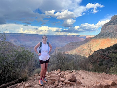
Best El Paso Hiking Trails
El Paso is home to some truly underrated and rugged pockets of the Southwest, a pocket that is home to a surprising number of unique and challenging hikes! Don’t be fooled into thinking that Texas is just all flat and boring – checking out this collection of the best El Paso hiking trails will change your mind! Come discover abandoned tin mines, gloomy caves, mountain summits, rock art adorned paths, old plane crash sites, pipeline roads turned trails, boggy wetlands, and “a thousand steps”, all within El Paso!

Disclosure: Below are some affiliate links-these are all products I highly recommend. I won’t make any recommendations on this page that I haven’t tested or personally used!
Table of Contents
The Best El Paso Hiking Trails
This list of the best El Paso hiking trails is broken down by trails inside state parks, and those outside state park boundaries. The two state parks are Franklin Mountains State Park and Hueco Tanks State Park.
Location of the Best El Paso Hiking Trails
Located below are the locations of both state parks in El Paso, as well as the trails that can be found outside the state parks boundaries, but within the area of El Paso.
Locations of the best El Paso hiking trails
Best El Paso Hiking Trails in State Parks: Franklin Mountains and Hueco Tanks State Parks
Franklin Mountains State Park and Hueco Tanks State Park are the premier state parks in El Paso in which to find the best El Paso hiking trails. Not only do these two state parks encompass the heart of El Paso outdoors, they house some pretty awesome treks, as well as additional perks like rock climbing, mountain biking, camping, and rock art!
Helpful Tips for Visiting State Parks in Texas:
- All Texas state park lodging and day passes can be reserved online HERE
- Plan in Advance! For more popular parks, day passes need to be reserved weeks in advance, and campsites need to be reserved months in advance
- Consider getting a Texas State Parks pass and visit as many parks as you can!
- Consider using a trail app like AllTrails for route finding and navigation (and is offline capable), or Google Maps for locating trailheads for hikes
Franklin Mountains State Park
For those of you that may be tempted to think you can’t find challenging hiking in west Texas, Franklin Mountains State Park will prove you wrong. Here you will find a unique mixture of trails that explore caves, mountain gaps, peaks, and the rugged beauty of the Franklin Mountains, El Paso’s most cherished mountain range!
#1: Aztec Caves Trail
This hike, though short, is somewhat steep, and terminates in a grouping of caves that can be explored with flashlights. It is a very convenient, easily accessible hike that is located within the Franklin Mountains State Park, specifically in the parking lot for the Aztec Caves campsites.
Length: 1.2 mile out and back roundtrip
Elevation Gain: 419 feet

Aztec Caves Trail Elevation Chart
Rating: Easy
Time to Hike: ~ 30 – 60 minutes

#2: Mundy’s Gap Trail
The Mundy’s Gap Trail is true to its name. It traverses a “gap” between the Franklin Mountains range. Hikers on the El Paso Tin Mines Trail (another of El Paso’s best hiking trails later in this post) will pass one of the branches of Mundy’s Gap, but its trailhead starts just inside the Franklin Mountains State Park borders, along the main Tom Mays Park Access Road.
Length: 3.9 mile out and back roundtrip
Elevation Gain: 1,003 feet

Rating: Hard ( ~ 1,000 feet elevation gain )
Time to Hike: ~ 1.5 – 2.5 hours

#3: Ron Coleman Trail / Mammoth Rock
The Ron Coleman Trail is a favorite of El Paso locals and visitors alike, and as an added bonus, you can also see the incredible Mammoth Rock formation when hiking the Ron Coleman Trail. Some of the best viewpoints in El Paso can be found on the Ron Coleman Trail’s 7 miles, as well as two small caves for exploring!
At over 3 thousand feet of elevation gain in 7 miles, the Ron Coleman Trail is one of El Paso’s hardest trails and a true test of endurance, but the payoff is worth it! Just be sure that you are adequately prepared with the right day hiking gear, a daypack complete with all the day hiking essentials you need, and of course, plenty of WATER!
***Download your own Day Hiking Essentials Checklist HERE!
Length: 7 miles out and back roundtrip
Elevation Gain: 3,166

Rating: Difficult
***NOTE – The Ron Coleman Trail is currently closed, as of Spring 2023, for restoration work. You can check the state park homepage for park alerts regarding when the Ron Coleman Trail is open again.
Time to Hike: ~ 2.5 – 4 hours
#4: Schaeffer Shuffle Trail
This trailhead is within the Franklin Mountains State Park borders at the very end of the main park road, just right of the Sunset Pavilion. There are several sections of steep uphill and loose, rocky terrain, followed by steep downhills that require extra precaution. But overall, the panoramic views of the surrounding rugged desert, weaving through the mountainsides, is a fun and varied way to hike.
When I completed the Franklin Mountains Trail Run that is held here annually every fall, this is the trail that us runners started out on, and it is a superb trail for trail running, because of all the varied terrain and ups and downs.
Length: 2.6 mile loop roundtrip
Elevation Gain: 698 feet

Rating: Moderate
Time to Hike: ~ 1 – 1.5 hours

#5: North Mount Franklin Trail
If you want to take on the highest trail in this region, then you will want to check out North Mount Franklin, the highest peak in the Franklin range. The trailhead is in the same nearby vicinity as the trailhead for Mundy’s Gap, just within the Franklin Mountain State Park borders.
Length: 7.2 mile out and back roundtrip
Elevation Gain: 2,408 feet

Rating: Hard ( ~ 2,500 feet elevation gain )
Time to Hike: ~ 2.5 – 4 hours
#6: Sugarloaf Summit
This mountain summit in Franklin Mountains State Park is short yet sweet. At just over a mile in length, but 1,000 feet in elevation gain, it will get your heart pumping as you tackle Sugarloaf Summit and take in the epic panoramic views from the top. The sections of steeper grade may be easier tackled with trekking poles, like my favorite Black Diamonds here!
This trail has a reputation for dicey route finding and trail markings, so be sure to have a downloadable map handy, like an AllTrails map. And don’t miss the old hut stationed atop Sugarloaf!
Length: 1.1 mile out and back roundtrip
Elevation Gain: 961 feet

Rating: Moderate to Difficult
Time to Hike: ~ 30 minutes – 1.5 hours
***Learn more about all the trails at Franklin Mountains State Park HERE!
Hueco Tanks State Park
Hueco Tanks State Park is another underrated gem in this nook of the Lone Star State. It derives its name from the “hueco” formations, or natural rock pools, that can be found in this state park. There is also camping opportunities, as well as stellar rock climbing, some of the best in the country! Plus many of the hiking trails display primitive rock art, another bonus to exploring Hueco Tanks State Park!
Below are some of the best trails to check out during a visit to Hueco Tanks State Park:
#7: The North Mountain Trail
Come check out the monumental cliffs of the North Mountain! This is also the longest trail in Hueco Tanks State Park.
Length: 1.9 miles out and back roundtrip
Elevation Gain: 59 feet

Rating: Easy
Time to Hike: ~ 45 – 60 minutes
***Note – dogs are not allowed on this trail!
The following trails are all short in length (less than a mile roundtrip), and all have one thing in common – rock art on display! So check out any of these, or all of them, for a unique glimpse into the past, surrounded by natural beauty!
#8: Nature Trail
Pictographs on display, along with many examples of the native flora and fauna of this region.
Length: .16 miles roundtrip
Elevation Gain: 59 feet
Rating: Easy
Time to Hike: > 30 minutes
#9: Pond Trail
Rock art plus plenty of fascinating geological formations!
Length: .86 miles out and back roundtrip
Rating: Easy
Time to Hike: > 30 minutes
#10: Site 17 Trail
Another short trail with rock art to check out.
Length: .26 miles roundtrip
Rating: Easy
Time to Hike: > 30 minutes
#11: Site 19 Trail
This is the shortest hike in Hueco Tanks State Park, but another chance to witness resident pictographs!
Length: .12 miles roundtrip
Rating: Easy
Time to Hike: > 30 minutes
#12: The Chain Trail
Short but challenging, this trail ascends North Mountain, which earns it the moderate rating, but also some great views!
Length: 0.6 miles out and back roundtrip
Elevation Gain: 91 feet
Rating: Moderate
Time to Hike: > 30 minutes
***Learn more about all of the trails at Hueco Tanks State Park HERE!
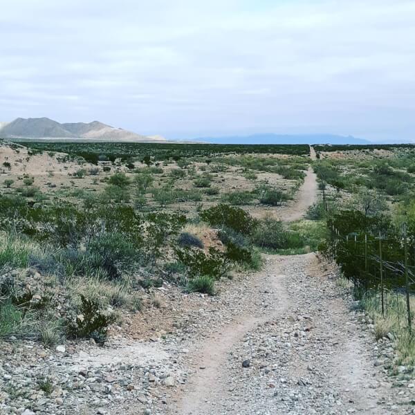
Best El Paso Hiking Trails Outside the State Parks
These hikes can be found outside of state park boundaries, but within the El Paso area.
#13: El Paso Tin Mines Trail
This is my favorite hiking trail in El Paso, not only for the desert views that I find beautiful, but also because of what waits for hikers at the end of the trail. As you might guess from the name, this trail ends at an abandoned tin mine. The fascinating part though, is that these tin mines were the only ones to ever exist in the United States, which means this is literally a “one of a kind” hike, and one of the reasons it is among the best hikes in El Paso.
The added bonus is that you can actually explore inside these tin mines. If you are a Lord of the Rings fan like me, you will understand the giddiness of walking underground through “the mines”. Visitors can still observe the rough-hewn, chisel marked walls inside the cave, shimmering with specks of subterranean minerals.
Depending on who you ask, some would describe this hike as either easy or moderate. I lean more towards moderate, due to the 1,000 feet increase in elevation experienced primarily during the second half of this hike.
Also, the trail is marked well right up until the end. The final hill that has to be climbed off to the left of the main trail is not very well marked, but you should be able to visibly see the old brick and metal grating of the mine to the left of the main trail to lead you these last few steps.
Length: 6.6 miles out and back roundtrip
Elevation Gain: 1,023 feet

Rating: Moderate
Time to Hike: ~ 2 – 3.5 hours
Insider Tip: While this trail is part of the Franklin Mountains, the trail head is actually located outside the state park boundaries, in a residential area of El Paso. You will locate the trail head in the Chuck Heinrich Park, by walking up the white dam and heading left.

#14: Thousand Steps Trail
This trail is the same trailhead for accessing the B-36 wreckage (another trail further in this post), but continues on to Ranger Peak and the Wyler Aerial Tramway, if hiked through to completion. Initially there is a quick, steep climb from the parking lot to the trail under the water tower, but the first mile or so after is relatively easy with a gentle uphill grade. The last several miles do become progressively steeper the closer to the peak one gets, but the views are the payoff to the effort here!
Length: 3.7 mile loop roundtrip
Elevation Gain: 1,423 feet

Rating: Hard ( ~ 1,500 feet in elevation gain )
Time to Hike: ~ 1.5 – 3 hours
#15: B-36 Plane Wreck Trail
The initial mile or so of this hike is on the marked path of the “Thousand Steps Trail”. The trailhead for the B-36 Wreck Trail is the same as the Thousand Steps Trail/Ranger Peak Trail, and there will be an information sign at the trailhead denoting this. There is an overlook of the plane wreckage on the Thousand Steps Trail, but to actually reach the plane wreckage up close requires going somewhat off trail, hopping boulders up a mountainside.
As you can see below, the first part of the B-36 Plane Wreck Trail follows the established trail, from the trailhead of at the parking area, of the Thousand Steps Trail. You can see where the B-36 Plane Wreck Trail departs the established trail and veers off towards the left, towards the B-36 Crash Memorial. This is the portion that is “off trail”, and more difficult in degree.

After the first mile, start looking for the unmarked informal trail on the left that branches off from the main trail. The best way I can describe how to find this trail to the wreckage is to watch for the giant triangle boulder around mile one of the Thousand Steps trail. Once you see this boulder, the trail to the B-36 wreckage will be several feet ahead on the left.

Someone also helpfully left a string of cairns marking the way up the mountainside, so you can also rely on these to guide you. This ascent can be rough going at times, and involves hoisting and jumping from boulder to boulder. It takes approximately thirty minutes to reach the wreckage, so be sure that you are up for this type of climb before starting.
The climb itself may be more memorable than the actual destination. It is a fun way to add some varied terrain into your west Texas hiking. The actual B-36 wreckage consists of several large, rusted axles, and a green tinted axle and box device. Several other smaller plates are also scattered among the mountainside, but that is really all there is to see. It is interesting and another “one of a kind” type of hiking in El Paso, plus the views over the city and the surrounding Chihuahuan Desert are breathtaking! If you are looking for more from this hike, you can rejoin the main Thousand Steps Trail, and continue on to Ranger Peak.

Length: 2.3 miles out and back roundtrip
Elevation Gain: 1,069 feet

Rating: Difficult
Time to Hike: ~ 1- 1.5 hours
Insider Tip: This is another trail that, while located in the Franklin Mountains, the trailhead is actually located outside the state park boundaries in a residential neighborhood in El Paso. You can locate the small parking lot and trailhead at the very end of N. Stanton Street in El Paso.
#16: Lost Dog Trail
This trail is a local favorite and very popular with the El Paso outdoors and visitors alike! Great terrain for hiking as well as mountain biking, and very well maintained!
Length: 7.7 mile loop roundtrip
Elevation Gain: 987 feet

Rating: Moderate
Time to Hike: ~ 2.5 -3.5 hours
#17: Palisades Canyon Trail
As the name implies, this trail takes you hiking through a canyon, with great views of the neighboring city of Juarez in Mexico. It is an excellent option for a sunset hike to witness the city lights in the distance.
Length: 5 mile loop roundtrip
Elevation Gain: 1,079 feet

Rating: Moderate
Time to Hike: ~ 2 – 3 hours
#18: Rio Bosque Wetlands
Enjoy the Rio Bosque Loop Trail in the Rio Bosque Wetlands for an unexpected view of wetlands in the middle of the desert! There is plenty of local flora and fauna to observe, and the peacefulness and stillness of this trail are hard to match! Great for bird watching as well! With so many desert hikes in El Paso, the real draw of the Rio Bosque Wetlands is the chance to see a completely different ecosystem!
Rio Bosque Loop Trail
Length: 2.1 mile loop roundtrip
Elevation Gain: 6 feet

Rating: Easy
Time to Hike: ~ 45 – 60 minutes
What Do You Need to Bring With You?
Here’s the essential gear you will need to take on these El Paso hiking trails:
Footwear: Hiking boots or trail runners
- My favorite hiking boots: Vasque GTX III
- My favorite trail runners: HOKA One One Speedgoats
Why do I love these two shoes? I use my Vasques when the terrain is going to be a little sketchier or less predictable, such as steep uphills, or traversing scree fields, where I need a little extra ankle support. These Vasques are also waterproof which is great for stream crossings or wetter conditions.
I use trail runners when efficiency is key, and when I know that I am going to be on my feet all day and need a little extra cushioning. There is no better trail runner in the trail running world than HOKA One One Speedgoats! The cushioning is unmatched, and the grip and traction will have you feeling secure on the trail. It is the trail runner I trust on all my long day hikes, like the Grand Canyon’s Rim to Rim hike, or the 21 mile long hike to the top of California’s Mt. Whitney, the highest point in the lower 48 states! Also, for those active travelers out there doing double duty as hikers AND trail runners, the HOKA One One Speedgoat crosses both genres!
Socks: Anti blister performance socks like these Hilly Twin Skin socks
I used to get TERRIBLE blisters on long day hikes, until I discovered the Hilly Twin Skins! The “twin skin” is the secret to combating the friction that can cause blisters. These socks prevent blisters, even on all day hikes like the Grand Canyon’s Rim to Rim, or California’s Mt. Whitney!
Daypack: I like this Camelbak Helena daypack because it is the perfect size to fit all my day hiking essentials, as well as being water bladder compatible.
Navigation: make sure to have a hard copy or downloadable map, such as an app like AllTrails, for these El Paso hiking trails. AllTrails maps are also offline capable.
Water Transportation System: make sure that you have a system in place that allows you to have plenty of water on your person for these hikes. The west Texas sun can be brutal, even in winter, and the ruggedness of this area tends to lend towards less water being available on these hikes. So make sure that you have plenty at the start of your hike! You can choose to utilize a traditional water bottle, like these Nalgene bottles, or a filtered water bottle like this Lifestraw water bottle with internal filter. Or, my personal favorite, a water hydration bladder, like this wide mouthed 3 liter Platypus bladder. I like this 3 liter option because it provides plenty of water for day hikes, and I can hydrate on the go easily. Plus, the wide mouth makes filling, emptying, cleaning, and drying simple!
In El Paso, it is also not a bad idea to have a backup plan, which is why I often hike with a full Platypus bladder, as well as my Lifestraw water bottle with filter as a backup. If there ever is an emergency and I need to utilize a water source on the trail, the Lifestraw water bottle is the perfect solution!
When Is the Best Time to Go Hiking in El Paso?
The better question in regards to hiking in El Paso, may be when is the worst time to go hiking! Summer in El Paso can be brutal, and if you choose to hike in summer, start early and bring plenty of water and sun protection!
Fall and spring are the ideal times to hike in El Paso, and you may luck out and even catch some wildflowers on the trail! Winter is still reasonable in regards to hiking, as you are unlikely to be caught in a torrential blizzard in El Paso. Just make sure to layer properly in the winter to combat the cold desert temps and the ever present strong winds, and that occasional winter ice/sleet/snow storm! When it comes to proper layering, be sure to utilize materials that are breathable yet insulating, quick drying, and moisture wicking – like wool! Use layers including a base layer, mid layer, and outer shell layer if necessary, depending on weather conditions. Make sure that your outer shell layer has waterproof and windproof capacities – like my favorite lightweight outer shell – the Outdoor Research Helium II.
Here’s a few of my other favorite winter layers:
Check out any, or all, of these El Paso hiking trails, and this will soon become one of your favorite, most underrated, hiking destinations! And be sure to discover more about some of Texas’s other amazing hikes in this best of Texas hiking checklist!
Looking to extend your visit to West Texas and explore a NATIONAL PARK? Check out the best of Guadalupe Mountains National Park, within driving distance of El Paso!
Related Articles:
- Mountains in Texas: Fact or Fiction?
- The Best Hiking Trails in West Texas
- The Best of Caprock Canyons State Park
- The Top 5 Canyons in Texas
- The Best Outdoor Things to Do in West Texas
- The Best of Palo Duro Canyon State Park
PIN for LATER!