Hiking the North Kaibab Trail in Grand Canyon National Park
The North Kaibab Trail in Grand Canyon National Park is one of a kind, and it claims a lot of accolades. It is one of the longest trails in the park, it is the only corridor trail on the North Rim, and it contains a drastically distinct and starkly unique environment very different from the desert canyon of the South Rim. It dazzles with brilliant red walls, glowing aspen trees, gentle streams, and even a waterfall! While hiking the North Kaibab Trail in Grand Canyon is not for the faint of heart, whether it is hiked individually or used to connect to South Rim corridor trails for an epic Rim to Rim hike, the reward is worth the work! Get to know just what makes the North Kaibab Trail so unforgettable!

Disclosure: Below are some affiliate links-these are all products I highly recommend. I won’t make any recommendations on this page that I haven’t tested or personally used. Enjoy this guide to hiking the North Kaibab Trail in Grand Canyon National Park!
Table of Contents
Guide to Hiking the North Kaibab Trail in Grand Canyon National Park
This guide will walk you step by step through everything you need to know to hike the North Kaibab Trail safely and responsibly. This includes the location, tips for hiking the North Kaibab Trail, and a full trail report INCLUDING PICTURES!

Quick Facts on Hiking the North Kaibab Trail in Grand Canyon
LENGTH: 28.2 miles roundtrip out and back / 23.5 miles roundtrip point to point on a Rim to Rim hike connecting to the Bright Angel Trail
RATING: Very Difficult
ELEVATION: 8,240 feet
ELEVATION GAIN: 6,620 feet (or 5,574 on a Rim to Rim hike connecting to the Bright Angel Trail
BEST TIME OF YEAR TO HIKE: late spring – early fall (the North Rim closes in winter mid October – mid May)

Maps of the North Kaibab Trail Routes
Hiking the North Kaibab Trail out and back roundtrip only
Hiking the North Kaibab Trail point to point on a Rim to Rim hike connecting to the Bright Angel Trail
Location of the North Kaibab Trail in Grand Canyon National Park
Not everyone knows that there are 2 rims in Grand Canyon National Park, the North Rim and the South Rim. The driving distance between the two rims is approximately 5 hours. The North Kaibab Trail is located on the North Rim. It does connect to the South Rim at the bottom of the canyon via the Bright Angel and South Kaibab Trails.
The closest town(s) to the North Rim and the North Kaibab Trail are:
- Jacob Lake, AZ to the North Kaibab Trailhead: 1 hour
- Fredonia, AZ to the North Kaibab Trailhead: 1 hour and 30 minutes
- Kanab, UT to the North Kaibab Trailhead: 2 hours
If you need lodging near the trailhead, your best bets are accommodations in either of the towns listed above, paired with a very early morning drive in to start your hike on the North Kaibab Trail – or lodging within the National Park. My recommendation is the small outpost of Jacob Lake, which contains a small inn and cabins for rent.
Check availability for your dates HERE!
There is also the North Rim Campground of the National Park, boondocking in Kaibab National Forest, or the Grand Canyon North Rim Lodge, the only National Park lodge on the North Rim. It is the closest lodging structure to the North Kaibab Trailhead.
*Keep in mind that if you are planning to hike the North Kaibab Trail and connect to a South Rim Trail at the bottom of the canyon, you will need to make transportation arrangements. Use my complete Rim to Rim guide to help plan these logistics.
If you are flying in to hike the North Kaibab Trail, the closest airports are Flagstaff Pulliam Airport, St. George Regional Airport, Grand Canyon National Park Airport, and Phoenix Sky Harbor International Airport.
BEFORE You Hike the North Kaibab Trail
*Answer these questions:
#1: Are you physically ready?
This is a massively long hike with significant elevation gain, and that elevation gain is unique in that it comes at the end when you are completely exhausted. Couple that with environmental elements including the possibility for extreme heat and exposure, and you’re talking about a serious hike you need to be physically prepared for. You need to train months in advance for hiking the North Kaibab Trail, whether you are hiking it individually or training for a full Rim to Rim hike via the North Kaibab Trail and the Bright Angel Trail.
#2: Are you day hiking or backpacking (camping overnight)?
The advantages to day hiking the North Kaibab Trail are that you don’t have to carry your backpacking gear. Or worry about scoring a hard to get permit / reservation.
The cons are the need to train for traversing the entire thing in a day, whether roundtrip or using it to connect to a South Rim Trail. Either way, that’s serious preparation required for a day hike. If you are planning to camp overnight on the trail, then you need to answer the following question.
Have you secured a campsite (or Phantom Ranch reservation) along the North Kaibab Trail?
Don’t plan on just snagging a campsite or spot at iconic Phantom Ranch on a whim. Those permits and reservations are hard to get. Phantom Ranch in particular is based on a lottery system. Make sure you have an actual accommodation secured before heading down the North Kaibab Trail, if you are planning to overnight. There are 2 campgrounds located on the North Kaibab Trail: the Cottonwood Campground and the Bright Angel Campground. Cottonwood Campground is approximately mid way, and Bright Angel is at the end of the North Kaibab Trail.
#3: Do you have ALL your necessary gear?
If you are day hiking the North Kaibab Trail and/or connecting to a South Rim corridor trail, make sure to have ALL the necessary day hiking gear for Grand Canyon trails. And I do mean ALL. Despite the Grand Canyon splattered across Instagram seemingly easily accessible to all, it is actually a potentially lethal environment, and demands respect. Need proof of this? Take a read through “Death in the Grand Canyon” for a lot of sobering testaments to the need to be fully prepared for the Grand Canyon. Near the top of that list, make sure you have PLENTY of water ALWAYS, as well as a backup filter system.
If you are backpacking on the North Kaibab Trail, make sure to have all the necessary backpacking gear plus any hiking gear specific to the Grand Canyon environment.
This is a good time to mention that having all the necessary gear INCLUDES having all the meals, hiking snacks, and water you need as well!
#4: Have you arranged any necessary LOGISTICS?
As previously mentioned, if you are planning to hike the North Kaibab Trail to the Bright Angel Trail for a Rim to Rim hike, you will need to figure out the logistics of getting to the North Rim while having a mode of transportation waiting for you at the South Rim when you finish. Many Rim to Rim hikers utilize the Trans Canyon Shuttle, which is highly recommended. You can also find a lot of helpful information on planning logistics in my full Rim to Rim guide.
For those hiking the North Kaibab Trail individually, either roundtrip down and up, or just a shorter day hike to a good “turnaround” spot like Coconino Overlook, there is parking available at the North Kaibab Trailhead, though it can get full during peak seasons and days.
#5: Are you COMPLETELY familiar with the trail?
This is why you are reading this post after all, right? Which is wise, because as I’ve said, the Grand Canyon can be a lethal environment for those that are not prepared or those that do not take it seriously. One of the best things you can do before you hike the North Kaibab Trail is to KNOW it. Know where the bathrooms and water refill stations are, know where you want to take breaks, know where the hottest parts of the trail are, and know where the sections of biggest elevation gains and losses are. You will find out all this information as you keep reading.
In addition to knowing the trail, make sure that you have a navigation tool you plan to use, whether that is a hiking app with downloadable/offline map capabilities, a topographic map that you know how to read, or some other navigational tool. The North Kaibab Trail is well maintained and easy to follow, but always have a backup navigational tool for emergencies.
If you are planning to connect to a South Rim Trail, do the same for that portion of the hike. For Rim to Rim hikes, it is HIGHLY recommended that you ascend the Bright Angel Trail and NOT the South Kaibab Trail, as there is NO water on the South Kaibab Trail. Familiarize yourself with the South Rim corridor trail you plan to use to finish your Rim to Rim hike.
CHECK OUT: the South Kaibab Trail vs the Bright Angel Trail
#6: WHEN should you hike the North Kaibab Trail?
This is kind of important, since you can’t access the North Rim year round. And you probably wouldn’t want to access the North Kaibab Trail during those times anyways.
The North Rim closes from mid – October through mid – May annually. This basically means that the North Kaibab Trail is off limits during the winter months. The North Rim receives blankets of snow every winter, so the trail would not be passable for the very large majority of hikers, and it would be equally treacherous.
The small loophole to this closure is that the South Rim remains open year round, so technically you can reach the North Rim and the North Kaibab Trail by hiking down a South Rim corridor trail, either the South Kaibab or Bright Angel Trail, and then connecting at the bottom of the canyon to the North Kaibab Trail. But again, this isn’t recommended. It is a far more pleasurable and enjoyable experience to hike the North Kaibab Trail when the North Rim is open (and the trail isn’t snowed in).
I strongly believe the best time of year to hike the North Kaibab Trail, whether individually or as part of a Rim to Rim hike, is in late September or early October. Fall colors are striking on the North Rim, in particular the yellow draped aspen trees, and the temperatures are crisp. Early May is also a suitable time to hike along the North Kaibab Trail.
Summer is the most difficult and dangerous time of year for hiking the North Kaibab Trail, or any Grand Canyon corridor trail for that matter. Inner canyon temperatures can skyrocket into the triple digits in the heart of summer, and there are portions of the North Kaibab Trail, like the infamous “Box” region, where temperatures are at their most brutal (more on “the Box” later in the full trail report). Basically, try to plan your hike for late May or early fall.
#7: How LONG will it take you to hike the North Kaibab Trail?
There is not one simple answer to this question. The North Kaibab Trail is 28 miles long roundtrip, with 6,600 feet of elevation gain. There are very, very few people who could tackle this individual trail in one day, though it is not impossible. If you are planning to hike the North Kaibab Trail, it is often recommended to do so as an overnight backpacking trip, camping in either the Cottonwood or Bright Angel Campgrounds (or Phantom Ranch if you are lucky enough to win the lottery). In this case, your estimated time would be 2 days.
If you are planning on hiking the North Kaibab Trail in conjunction with a South Rim corridor trail for a Rim to Rim hike, then the estimated completion time ranges between 12 – 18 hours. This depends largely on not only your physical readiness level, but on break times, pacing, and which South Rim corridor trail you plan to ascend. I always recommend using the Bright Angel Trail (there is NO water on the South Kaibab Trail).
- Rim to Rim via North Kaibab and Bright Angel Trails: 23.5 miles roundtrip
- Rim to Rim via North Kaibab and South Kaibab Trails: 21.5 miles roundtrip
#8: WHEN should you start your hike on the North Kaibab Trail?
Generally speaking – EARLY! Unless you are doing a shorter day hike with a turnaround spot closer to the top, like Coconino Overlook, Redwall Bridge, or Ribbon Falls, you are going to want to start EARLY! Think 4, 5, or 6 AM at the latest. This is for those who are planning to day hike the North Kaibab Trail, which is most commonly done on a Rim to Rim hike. You are going to want to start that early in order to complete those 23.5 miles within a timely daylight window.
*If you are planning to camp overnight along the North Kaibab Trail, you do not necessarily need to start your hike that early, but there are still other considerations to be aware of that still make an early morning start make sense. You will want to be through the hottest part of the North Kaibab Trail, the “Box”, by 10 am preferably, but noon at the latest. An early morning start might help to ensure this. More on this particular logistic later.
On the day before / night before your hike, be sure to follow this last minute checklist for hiking the North Kaibab Trail, so that you’re not scrambling at 5 AM!
- Confirm necessary arrangements are made (lodging, shuttles, etc.)
- Check over your necessary hiking gear – no flaws, issues, holes, tears, etc.
- Familiarize yourself with the North Kaibab Trail (and any connecting trails)
- Healthy carb and protein load – think healthy options like sweet potatoes, whole grain pasta and bread, chicken, etc.
- Rest
- Check NPS website for last minute alerts (you’re gonna wanna know if water is shut off on the trails!)
- Check the weather
- Let someone know your plans (consider leaving a “Hiking Safety Contact Form” in your glovebox or console)
- Download offline maps if using a hiking app like AllTrails
Trail Report for Hiking the North Kaibab Trail (WITH PICTURES!)
Here’s that quick info again before we jump into the full trail breakdown.
LENGTH: 28.2 miles roundtrip out and back / 23.5 miles roundtrip point to point on a Rim to Rim hike connecting to the Bright Angel Trail
RATING: Very Difficult
ELEVATION: 8,240 feet
ELEVATION GAIN: 6,620 feet (or 5,574 on a Rim to Rim hike connecting to the Bright Angel Trail
BEST TIME OF YEAR TO HIKE: late spring – early fall (the North Rim closes in winter mid October – mid May)
PET POLICY: pets are NOT allowed on the North Kaibab Trail
TRAILHEAD PARKING / : there is parking available at the trailhead, but it can fill up quickly at peak times. There are restroom facilities at the trailhead.
PERMITS / RESERVATIONS: Permits/reservations are NOT required for day hiking the North Kaibab Trail. Permits and reservations are only required if you are planning to stay overnight in one of the campgrounds along the trail or at Phantom Ranch.
NATIONAL PARK ENTRANCE FEES: it costs $35 per vehicle to enter Grand Canyon National Park, which is good for 7 consecutive days.

North Kaibab Trail Breakdown
North Kaibab Trailhead: Mile 0
Take advantage of the restrooms and water here. Make sure you have plenty of water to start out with, and your gear is ready. Early morning starts on the North Kaibab Trailhead will likely be quite crisp, even in freezing temperatures in months like October. You may want to consider starting with a light layer if preferable, but keep in mind that you will warm up quickly, and temperatures will rise quickly as you descend (even in fall months like September and October). Whatever you wear coming down the North Kaibab Trail, you’ll have to carry the rest of the way. For some, that means just sucking it up for a little bit at the beginning of the hike and wearing just what they plan to wear for the rest of the day, in order to avoid carrying extras.
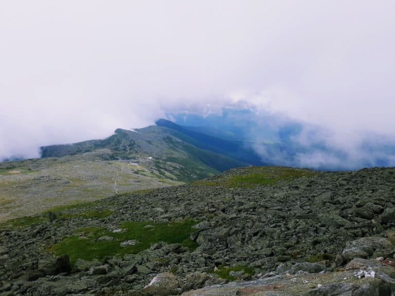
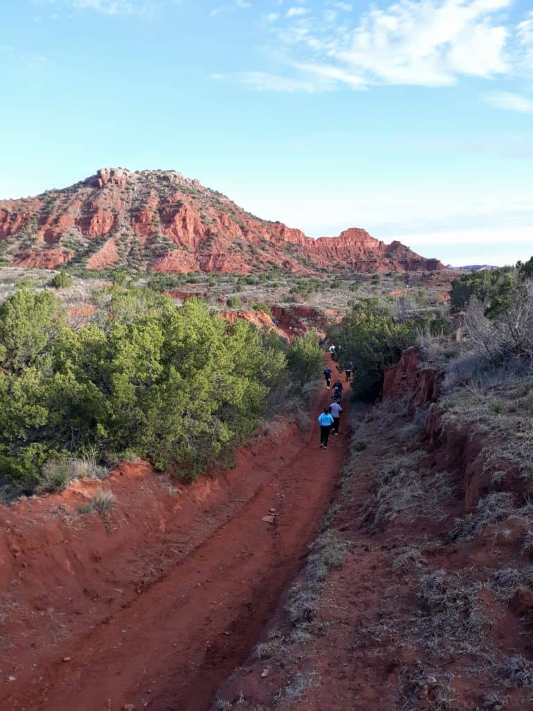
The North Kaibab Trailhead is a prime example of how the North Rim differs from the South Rim. Here, the pine forests are thick, and the canyon walls are a deep red. In fall, the resident aspen trees are blazing, interspersed among the pines! In fact, you’ll notice pines clinging to the canyon walls as you initially descend, and then they gradually thin and disappear. There is a silence and a solitude here that often cannot be found at the South Rim.
The North Kaibab Trail descends rapidly and steeply from the trailhead, so this portion tends to go pretty quickly. Don’t forget to take in the views though, most notably from your first landmark on the trail, Coconino Overlook.


Coconino Overlook: Mile 0.7
This overlook is the first among handfuls of stunning viewpoints you can expect to see when hiking the North Kaibab Trail in Grand Canyon! The trail continues quickly down following Coconino Overlook.


Supai Tunnel: Mile 2
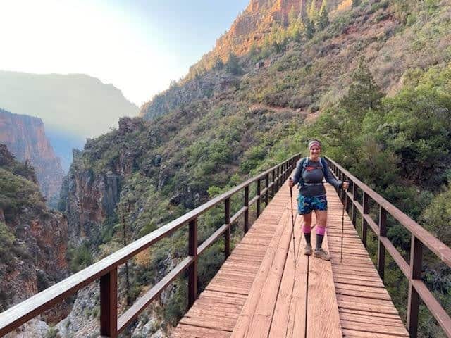
Chiseled straight out of the canyon wall, you will pass through the brief Supai Tunnel on your descent down. There are bathrooms and water here, but assuming you’ve kept a healthy pace you likely won’t need them. Besides, there are more suitable break spots coming up shortly after Supai Tunnel. Just after Supai Tunnel you will encounter the Redwall Bridge, a highly photographed spot on the trail that spans a chasm in the canyon wall. Simply breathtaking views here!


Roaring Springs Day Use Area: Mile 4.7
Either here at Roaring Springs Day Use Area, or in another couple tenths of a mile at the Manzanita Rest Area are good options for a first break stop, if necessary. There are bathrooms at Roaring Springs, but no water.
Manzanita Rest Area: Mile 5.1
A good option for a break spot, with bathrooms and water.
Cottonwood Campground: Mile 6.5
The first of 2 campgrounds along the North Kaibab Trail. There is water here, but no bathrooms. The steep descent down the North Rim begins to level out here, and you will encounter a good chunk of relatively flat trail between here and the Colorado River. The other thing you will notice is now that you are transitioning from canyon walls to canyon floors, those canyon walls begin to converge and become narrower, closing you into what begins to seem like a box. Hence the name, “the Box”, as this portion of the North Kaibab Trail is known as. It is not an official landmark, but it exists all the same.
These narrow canyon walls along the canyon floor, between approximately the Cottonwood Campground area and the end of the trail at Bright Angel Campground, are what create the stifling heat you have been forewarned about. We’re talking triple digits that sometimes hit 120 degrees.


So how do you handle the “Box”?
For this reason, it is highly recommended to start early and be through this portion by 10 AM, or 11/12 at the very latest, to avoid the hottest part of the day in the “Box”. Shade absolutely helps, and you can track the shade along the North Kaibab Trail on the day of your hike, to help your pacing. You’ll notice that the shade starts to evaporate by mid to late morning, hence the reason it is wise to be through the Box by noon at the latest.
Another strategy is to utilize a cooling towel, or even a cotton shirt, that you can soak in the various streams you may encounter. Being proactive with hydration, fueling, and electrolyte replenishment are crucial as well.
Besides the flatter and narrow qualities of this portion of the trail, you may also notice a few other surprises! While some may be surprised to find that there is such a significant portion of flat trail at the bottom between the North Rim and the South Rim (it’s not just a sharp “V” shape), other common surprises include the varied terrain and the abundance of water. There are unique “subway” tunnels and plenty of gentle streams that crisscross the canyon floor, and even a waterfall! That’s right, there is a waterfall on the North Kaibab Trail called Ribbon Falls.


Ribbon Falls Spur Trail (optional – not recommended for 1st time Rim to Rimers): Mile 7.9
It’s quite the surprise to find a waterfall in this desert environment, and for many it’s an opportunity that’s hard to pass up. Keep in mind the extra mileage though, especially if you are attempting a full Rim to Rim hike of 23.5 miles already, without adding on the Ribbon Falls spur trail.
Bright Angel Campground: Mile 13.7
The end of the North Kaibab Trail happens at Bright Angel Campground, only steps from the mighty Colorado River, and the heart of the Grand Canyon’s deepest reaches. While millions of people visit Grand Canyon National Park every year, only a select few get to enjoy the perspective from the bottom of the canyon looking up, or get to feel the raw power of the river standing over it on the silver suspension bridge, spanning the North and South Rims of the largest canyon in the world! If you ever start to doubt whether the training and preparation were worth it, this moment is one of the ones that will confirm your decision!


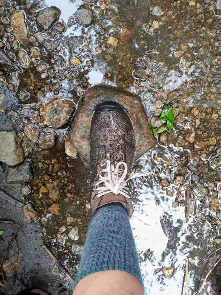
There are several other things you will find at the end of the North Kaibab Trail. In addition to Bright Angel Campground, there is Bright Angel Creek, the namesake water source that runs through the campground. Stop here, eat a meal, rehydrate, take off your socks and shoes, and soak your feet in the icy waters of Bright Angel Creek, while enjoying the shade of the surprisingly green oasis found here. I always bring a 2nd pair of socks so I can change into a fresh pair afterwards!
There’s also Phantom Ranch in the immediate vicinity, and the canteen where you can grab a cup of ice cold lemonade, or even send a postcard. Just be sure to bring cash for the canteen.
There’s water refill stations and bathrooms here, which you should definitely take advantage of if you are extending your hike out from this point.
Where to Now?
From here, you have a couple different options, which hopefully you have already finalized by this point. If you made it this far, you are way past the point of a shorter day hike on the North Kaibab Trail. You’re either committed to an overnight trip on the North Kaibab Trail, or you are likely continuing on to complete a Rim to Rim hike by connecting to the South Rim on the other side of the Colorado River.
Again, there are several accommodations here, that you will have to make arrangements for prior.
- Phantom Ranch (reservations by lottery system)
- Bright Angel Campground (permit required for overnight camping)
If you are lodging overnight and continuing back up the North Kaibab Trail the following day, the return trip is the same, just in reverse. Again, you can attempt to start early and be through “the Box” earlier in the day. Know where you want to stop for breaks and to refill water and use the restrooms. Also, keep in mind that the North Rim is higher in elevation and slightly steeper than the South Rim, so you will have a grueling climb out. Pace yourself. Remember, it’s 6,600 feet of elevation gain.
If you are continuing on for a full Rim to Rim hike (either after camping overnight here or just continuing on for a day hike), there is a TON more information to soak up about this 2nd portion of the Rim to Rim hike – the South Rim side. Your South Rim journey starts as soon as you cross over the Colorado River, where you will face the trail junction for the South Kaibab Trail and the Bright Angel Trails.
There’s a lot more information than can be summarized in this post. Hop over to my full Rim to Rim guide which includes both the North Rim (North Kaibab Trail) and South Rim (recommended Bright Angel Trail) breakdowns and trail reports, with plenty of pictures!


What’s Next?
If this sounds intimidating, that’s because it should be, but don’t let that stop you from experiencing one of the best trails in this National Park, and the entire country as well! Whether you do it for the insane beauty, the ultimate challenge, or the affirmation of a goal, just do it! But you don’t have to do it alone. Check out some of these additional resources that can help prepare you for the safest and most enjoyable experience hiking the North Kaibab Trail in Grand Canyon National Park, or beyond!
- First Timers Guide to Hiking the Rim to Rim in One Day
- Complete Rim to Rim Training Plan
- Complete Rim to Rim Packing Checklist
- Necessary Gear for Grand Canyon Trails
- Guide to Hiking Rim to River via South Kaibab and Bright Angel Trails
- South Kaibab Trail vs Bright Angel Trail
Want something more INDIVIDUALIZED? I offer 1:1 coaching services from a broad base of experience not only hiking multiple Rim to Rim and Rim to River hikes, but other challenging hikes across the country including Oregon’s technical Mt. Hood, the AT’s Mt. Katahdin, Colorado 14’ers, and the tallest peak in the lower 48 states at California’s Mt. Whitney! Let me help put your mind at ease by creating a customized training calendar, assessing your current readiness level, developing a packing list, and more! Check out what I offer below, and get started by filling out this INTEREST FORM.

PIN for LATER!