The 13 Best Easy Hikes in Grand Canyon National Park
Some destinations require a full day’s hike to reach the most stunning viewpoints. Luckily, this is not the case in the Grand Canyon! There are a handful of easy hikes in Grand Canyon National Park that will satisfy the cravings of every hiker, regardless of circumstances or abilities. And the best thing about these easy Grand Canyon hikes? They don’t sacrifice any of the splendor you’ve come to expect from this natural wonder! These top easy hikes are brimming with unforgettable and breathtaking scenery at every turn.
Disclosure: Below are some affiliate links-these are all products I highly recommend. I won’t make any recommendations on this page that I haven’t tested or personally used! Enjoy this guide to the 13 best easy hikes in Grand Canyon National Park!
Table of Contents
The 13 Best Easy Hikes in Grand Canyon National Park
These top easy hikes in Grand Canyon National Park include it all – forests, viewpoints, overlooks, and of course, canyons! This list is perfectly curated for the visitor searching for short, sweet, and easy, and includes easy hikes in the Grand Canyon’s North AND South Rims.

What to Know Before You Go
ENTRANCE FEES: $35 per vehicle, good for 7 consecutive days
HOURS: the South Rim is open daily year round, the North Rim is closed from mid October – mid May annually
BEST TIME OF YEAR TO VISIT: Spring and Fall for both the North and South Rim
LODGING: there are several Grand Canyon National Park campgrounds and National Park lodges to choose from within the park, and plenty of additional hotel, camping, and vacation rental accommodations can be found in neighboring Arizona towns like Tusayan, Williams, Flagstaff, Jacob Lake, Fredonia, and Kanab, Utah.
Check Availability for Your Trip Here!
Location of the Best Easy Hikes in Grand Canyon National Park
Grand Canyon National Park is located in northern Arizona, near the towns of Flagstaff and Williams. What many people may not realize is there are 2 separate and distinct regions of Grand Canyon National Park: the North Rim and the South Rim. And they are separated by about 5 hours of drive time! Deciding which rim you want to base your hiking out of is an important decision to make before arriving. If you want to hike at both rims, you will want to build in extra time for travel between the North Rim and the South Rim. Both rims have very unique characteristics, and both rims contain some of the best easy Grand Canyon hikes you will find on the following list.
Map of the 13 Best Easy Hikes in Grand Canyon National Park
Below are the locations of all 13 best easy hikes in Grand Canyon National Park, located on both the North and South Rims.
Locations of the 13 best easy hikes in Grand Canyon National Park
Best Easy Hikes in Grand Canyon National Park South Rim
These are the top 6 easy Grand Canyon hikes on the South Rim.
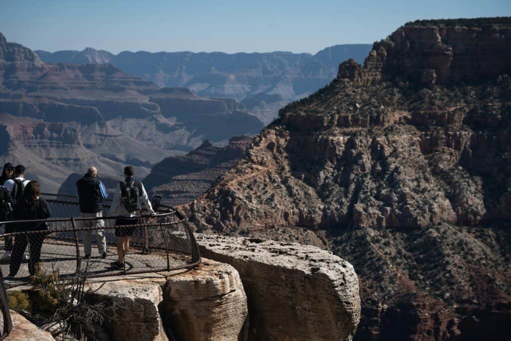
#1: Mather Point
Roundtrip Length: 0.6 miles out and back
Rating: Easy
Elevation Gain: 13 feet

Estimated Time to Complete: 10 – 15 minutes
Pet Policy: pets are NOT allowed
Mather Point is centrally located, with the trailhead starting right at the South Rim Visitor Center. It is right in the heart of all the action, which makes it very accessible and easy to add to any South Rim itinerary. And bonus – it contains one of the most breathtaking views in the entire park.
Mather Point is short, paved, wide, and contains almost zero elevation gain. So bring the whole family, including those strollers! There is a secure railing at the overlook for inquiring parents of young children.
#2: Yavapai Point
Roundtrip Length: 1.7 miles out and back
Rating: Easy
Elevation Gain: 82 feet

Estimated Time to Complete: 30 – 45 minutes
Pet Policy: pets are NOT allowed
Hiking to Yavapai Point is what I would consider the best “two for one” deal in Grand Canyon National Park! That’s because Mather Point is actually connected to Yavapai Point via the Rim Trail (which you’ll see next on this list). That means if you set off from the Visitor Center, you’ll reach Mather Point first, and then continue on to Yavapai Point. Two of the top two contenders for best views in the Grand Canyon, right next to each other.
Like Mather Point, Yavapai Point is a paved, easy, wide, family friendly and stroller friendly hike. The trail parallels the South Rim the entire time, so if you want non stop views, plus a glimpse of Phantom Ranch and the mighty Colorado River below, this is the easy Grand Canyon hike for you!
#3: Rim Trail
Roundtrip Length: 12.7 miles point to point
Rating: Easy
Elevation Gain: 583 feet

Estimated Time to Complete: varies
Pet Policy: leashed pets are welcome
The Rim Trail may not sound like it belongs on the best easy Grand Canyon hikes list, due to its 13 mile length, but consider that this largely paved, wide, and flat trail does not have to be hiked in its entirety. In fact, it rarely is, but is more popularly used as a connector trail to various locations along the South Rim. Also, there is a free park shuttle that runs throughout the South Rim, and can pick up and drop off at various locations. That means you can hike as much of the Rim Trail as you wish, and then pick up the shuttle to return.
Why is the Rim Trail a top easy hike in Grand Canyon National Park? Because there is SO MUCH to see along this trail. You have already seen Mather Point and Yavapai Point on this list, and they are both accessible from the Rim Trail. There’s also the quick access to various lodges on the South Rim, popular trailheads like the Bright Angel Trail and South Kaibab Trail, various museums, shops, and studios, and additional overlooks like Hopi Point, Powell Point, Maricopa Point, and Mohave Point. It’s the “multi-use” trail of the South Rim.
#4: Shoshone Point
Roundtrip Length: 2.1 miles out and back
Rating: Easy
Elevation Gain: 154 feet

Estimated Time to Complete: 45 – 60 minutes
Pet Policy: Leashed pets are welcome
Shoshone Point is located just a little east of Grand Canyon Village, so it is a little removed from the heart of the action. This means the possibility of slightly fewer crowds, and that can be a big draw to visiting Shoshone Point. Another potential bonus is Shoshone Point is leashed pet friendly!
This easy Grand Canyon hike is also unique in that it starts in a forest of ponderosa pines, which is rarer to find in the more desert-like environment of the South Rim. While the first few easy trails on this list were all paved, Shoshone Point is a natural surface consisting of dirt and rocks, though it is well maintained, wide, and easy to follow.
#5: Desert View Watchtower
Roundtrip Length: 0.4 miles out and back
Rating: Easy
Elevation Gain: 39 feet

Estimated Time to Complete: 10 – 15 minutes
Pet Policy: Leashed pets are welcome
Another short, easy, paved trail, this time located on the far eastern reaches of the South Rim. In fact, the “Desert View” area contains a Visitor Center, road, campground, picnic area, trading post, and a market and deli all with that namesake.
The Desert View Watchtower hike also happens to contain the highest point on the South Rim at over 7,700 feet in elevation, so the views from here are guaranteed to be stellar, including glimpses below of the Colorado River from a unique vantage point not visible from the heart of Grand Canyon Village further west. And yes, there is a stone watchtower perched over the canyon edge here, which helps to give this point the title of highest point on the South Rim. You can go inside, but free, first come first serve tickets are required due to a 25 person capacity inside the watchtower.
#6: Pipe Creek Vista
Roundtrip Length: 3 miles out and back
Rating: Easy
Elevation Gain: 127 feet

Estimated Time to Complete: 1 – 1.5 hours
Pet Policy: pets are NOT allowed
Pipe Creek Vista is located east of Grand Canyon Village, along the Rim Trail, just prior to arriving at the South Kaibab Trailhead. It is a great option for those seeking the views from this area, without the more moderate hikes like the South Kaibab Trail itself. While this is a slightly longer trail than others on this list, it is still low elevation gain and paved, making it very accessible and friendly to all ages and abilities. It is also centrally located – you can pick up the trail to Pipe Creek Vista from the South Rim Visitor Center, and it is also very close to Mather Point, if you want to double up on views. Pipe Creek Vista does tend to draw fewer crowds than some of the other easy hikes in the area, so that can be a big bonus for visitors. That slightly longer 3 mile length tends to thin out some of the crowds. However, if you’d prefer less than the full 3 miles roundtrip, there is also a parking lot located directly by Pipe Creek Vista. You can find it on Google Maps as “Pipe Creek Vista Parking Lot”, though parking is often limited here.
And that concludes the first list of the best easy hikes in Grand Canyon National Park – the South Rim!

Best Easy Hikes in Grand Canyon National Park North Rim
These are the top 7 easy Grand Canyon hikes on the North Rim. Remember – the North Rim closes annually from mid October – mid May, making these trails only accessible late spring through early fall!

#1: Bright Angel Point Trail
Roundtrip Length: 0.9 miles out and back
Rating: Easy
Elevation Gain: 144 feet

Estimated Time to Complete: 20 – 30 minutes
Pet Policy: Pets are NOT allowed
Not to be confused with the South Rim’s Bright Angel Trail, arguably the most hiked inner corridor trail in the park. The North Rim’s Bright Angel Point Trail is also one of the most popular hikes on this respective rim, and contains some of the best overlooks from the North Rim.
Relatively short, minimal elevation gain, paved, and conveniently located by the North Rim Visitor Center and North Rim Lodge. The Bright Angel Point Trail checks off all the characteristics of a great trail for all types of visitors.
#2: Cape Royal Trail
Roundtrip Length: 1 mile out and back
Rating: Easy
Elevation Gain: 65 feet

Estimated Time to Complete: 20 – 30 minutes
Pet Policy: pets are NOT allowed
A pleasant trail with a combo of canyon panoramas and forest views. The views from Cape Royal are intensified by the fact that this overlook juts out on a “peninsula” of land, creating the sensation of being suspended out over the North Rim. From here, you can see the famous Angel’s Window landmark, as well as the Colorado River far below. If you look hard enough in good conditions, you may even see the Desert View Watchtower looming on the horizon on the South Rim. This is a short, paved trail that is great for families, children, and hikers of all ages!
#3: Cape Final Trail
Roundtrip Length: 4 miles out and back
Rating: Easy
Elevation Gain: 495 feet

Estimated Time to Complete: 1 hour and 30 minutes – 2 hours
Pet Policy: Pets are NOT allowed
The Cape Final Trail does best what so many of the North Rim hiking trails do best – combine dappled forest canopy with stunning and expansive canyon views, a feat that is harder for the South Rim to accomplish. Just another reason the North Rim is so special!
The Cape Final Trail is on the longer side compared to the other trails on this list of the best easy hikes in Grand Canyon National Park. So it is a great option for those that wish to stretch their legs just a little further, and take in some of the rustic and less crowded views of the North Rim. It also contains almost 500 feet of elevation gain, which is on the healthy side of an easy rating, just before crossing over into moderate. So expect a little bit more of a workout.
#4: Grand Canyon Bridle Path
Roundtrip Length: 3.2 miles out and back
Rating: Easy
Elevation Gain: 259 feet

Estimated Time to Complete: 1 hour and 15 minutes – 1 hour and 45 minutes
Pet Policy: leashed pet are welcome
The Bridle Path is beautiful on its own, with its graceful and towering ponderosa pine groves, but it also serves as an easy “connector” trail to many of the functional spots on the North Rim. It connects the North Rim Lodge and Visitor Center with the North Rim Campground and even the North Kaibab Trailhead a few miles away. In fact, if you happen to be hiking a Rim to Rim hike from the South Rim to the North Rim, finishing at the North Kaibab Trailhead, the Bridle Path may play an important role for you. Unless you have arranged pick up and transportation, many South to North hikers find themselves walking an additional few miles along the Bridle Path to reach the North Rim Lodge after their hike.
Another bonus? This trail is pet and bicycle friendly! While it is rated easy, most of the elevation gain comes in two short, steeper sections, at both ends of the Bridle Trail. There are no grand overlook spots on the Bridle Trail, but it does offer the chance for a secluded stroll through the forest. If you want stunning overlooks, you can take the Bridle Trail over to the North Kaibab Trail and take a quick jaunt down to Coconino Overlook, one of the best viewpoints on this North Rim inner corridor trail.
#5: Widforss Trail (Short Route)
Roundtrip Length: 2.3 miles out and back
Rating: Easy
Elevation Gain: 272 feet

Estimated Time to Complete: 45 minutes – 1 hour and 15 minutes
Pet Policy: pets are NOT allowed
While the entire Widforss Trail is 10 miles in roundtrip length, this shorter version is perfect for an easy Grand Canyon hike. Another prime example of a heavily forested and peaceful North Rim Trail, with hidden surprises. Just when you think this trail is completely enveloped in pines, the canopy dramatically parts, giving way to some beautiful views across the canyon. On clear days, you can even make out the snow capped summit of Humphreys Peak, the highest point in Arizona, looming all the way from Flagstaff!
CHECK OUT: the 50 State High Points of the U.S.
The Widforss Trail parallels the North Rim edge for much of the trail (even the entire 10 miles), though you won’t always know that you’re that close thanks to the forest. But since it stays on the rim the entire time, there is very little elevation change, making this an easy hike on a gentle, natural surface trail of mostly pine needles and dirt.
#6: Point Imperial Overlook
Roundtrip Length: 0.1 miles out and back
Rating: Easy
Elevation Gain: 0 feet

Estimated Time to Complete: 5 minutes
Pet Policy: pets are NOT allowed
Not to be confused with the Point Imperial Trail, which is a moderate 5 mile long trail, that leads to the Point Imperial overlook. Though this trail is great for those searching for a moderate trail, if you are looking for a super short, easy, and paved hike with zero elevation gain, the Point Imperial Overlook portion is ideal, coming in at just 0.1 miles in length. It is in fact the shortest of these top easy hikes in Grand Canyon National Park.
While it may be a super short hike to Point Imperial, it is the highest point in the entire Grand Canyon National Park at 8,800 feet in elevation. From this vantage point, you are literally overlooking the entire park with no obstructions!
#7: Roosevelt Point Trail
Roundtrip Length: 0.3 miles out and back
Rating: Easy
Elevation Gain: 13 feet

Estimated Time to Complete: 5 – 10 minutes
Pet Policy: pets are NOT allowed
Rounding out the list of the 13 best easy hikes in Grand Canyon National Park is the Roosevelt Point Trail. A classic wooded hike that contains a small loop with expansive views at the mid way point. Roosevelt Point provides a great vantage over the eastern portion of the North Rim, and because it is slightly removed from the heart of the North Rim, there are generally fewer crowds and more solace.
The small loop at the halfway point does contain nearly all of the minimal elevation gain, and there are some slightly rocky and uneven sections that may require a little assistance if hiked with very small children. But overall, this is a great family friendly trail.
And that concludes the top 7 best easy hikes in Grand Canyon National Park’s North Rim!

Tips for Hiking in Grand Canyon National Park
Regardless of whether you are hiking easy hikes in Grand Canyon National Park, or some of the tougher ones, like the popular Bright Angel and South Kaibab Trails on the South Rim or the iconic North Kaibab Trail on the North Rim, or maybe even a full Rim to Rim hike from one rim to the other, there are a few important hiking tips to keep in mind no matter where you hike!
- Always bring plenty of water!
- Always hike with ALL your day hiking essentials
- Always use sun protection
- Always stay on designated trails
- Always monitor children on trails
- Always respect wildlife by not approaching or feeding
- Always pack it in, pack it out, and leave no trace!
It also never hurts to start your hiking early in the day to avoid more of the crowds, and make any lodging accommodations as far in advance as you can!
Want More Grand Canyon Stuff??? Check out these related articles!
- First Timers Guide to Hiking Rim to Rim in One Day
- Complete Rim to Rim Training Plan
- Necessary Hiking Gear for Grand Canyon Trails
- Guide to Hiking Rim to River in Grand Canyon National Park
- South Kaibab Trail vs Bright Angel Trail
- Guide to Hiking the South Kaibab Trail to Bright Angel Trail
- Guide to Hiking the North Kaibab Trail to Bright Angel Trail
- Guide to Hiking the North Kaibab Trail
PIN for LATER!


