
Full Guide to the Humphreys Peak Hike: Highest Point in Arizona
Arizona, portrayed across Instagram through its painted deserts, red rocks, diverging canyons, and vast expanses. If you are lucky enough though, these won’t be the only images that come to mind at the mention of this state, if you choose to take on the Humphreys Peak hike! There are also a plethora of lush forests, full of aromatic pines and stark white aspens, with views that tower over those aforementioned canyons, deserts, and expanses of this state. In fact, from the highest point in Arizona, on a crystal clear day, you can actually see the Grand Canyon, the Painted Desert, and all the expanses in between, on this, the best of Flagstaff hikes. If that isn’t motivation enough to take on the Humphreys Peak Trail, then I don’t know what is!

Disclosure: Below are some affiliate links-these are all products I highly recommend. I won’t make any recommendations on this page that I haven’t tested or personally used!
The Humphreys Peak Hike
Below is the need to knows on the Humphreys Peak hike, from a full trail report, to gear recommendations for taking on the Humphreys Peak Trail!
Location of the Humphreys Peak Hike
Humphreys Peak is located in north central Arizona in Coconino National Forest. The trailhead for the Humphreys Peak hike can be accessed up a winding mountain road just a few minutes outside of Flagstaff, Arizona. Flagstaff makes for an excellent home base if you are planning to spend a day tackling the Humphreys Peak trail, or any other Flagstaff hikes.
Ironically, only a few hours drive north of Humphreys Peak visitors will encounter another phenomena of nature, the Grand Canyon. If you want the chance to stand amongst this canyon while viewing the highest point in Arizona on the horizon, check out the Widforss Trail on the North Rim Grand Canyon! You will be even more appreciative of just what it means to accomplish a summit hike of the highest point in Arizona from that unique vantage point!
Map of area surrounding the Humphreys Peak hike
Quick Facts on the Humphreys Peak Hike:
Location: Flagstaff, Arizona in Coconino National Forest
Length: 10.1 miles out and back roundtrip
Elevation: the summit is 12,633 feet
Elevation Gain: 3, 343 feet

Rating Level: Difficult (length / altitude / elevation gain)
Best Time of Year to Hike: Summer – you may encounter snow the majority of the rest of the year. Summer comes with two main threats: afternoon storms and wildfires. Be sure to check mountain-forecast.com for up to date peak weather on Humphreys, and be sure to check Coconino National Forest’s website for alerts before hiking.
Estimated Time to Complete: 4-7 hours
Fees: it is FREE to access the trailhead and hike Humphreys Peak
Facilities: there are bathroom facilities at the trailhead
Dog friendly: Yes – but with extreme caution and only if your dog is extremely experienced with mountain hiking (read the end of the blog post for my recommendations)
**Insider Tip: check the weather forecast ahead of time, and make sure to avoid brewing thunderstorms. Be off the summit by noon.
Humphreys Peak Hike: The Best of Flagstaff Hikes
The resident highest point in Arizona, Humphreys Peak, looms over the picturesque mountain town of Flagstaff, Arizona (which is worth a visit all on its own due to many other superb Flagstaff hikes), at an impressive elevation of 12,633 feet. If you are not familiar with northern Arizona, you may be surprised to discover just how mountainous this area is. There are a handful of incredible, heart-pumping Flagstaff hikes located in the Coconino National Forest, but my favorite is the Humphreys Peak trail to the top!

I did this hike on a foggy, overcast day, which is not uncommon during the Arizona monsoon season, but this day was particularly gloomy. At first I had mixed feelings about hiking completely enveloped in fog, worrying I would be “robbed” of the views. However, the weather turned out to lend this hike a sense of eerie fascination.
The Trailhead of the Humphreys Peak Hike
Finding the trailhead is an easy cruise just outside the city limits of Flagstaff on US-180 to Snow Bowl Road. Spend the night before in picturesque Flagstaff, or camp nearby in Coconino National Forest. Either way, you will be no more than a thirty minute drive to the trailhead for the Humphreys Peak trail.

Parking here is readily available, as are a handful of portable bathrooms. The trailhead borders a large, open pasture, full of native wildflowers and encompassing views! Hiking through the aspen groves and green pastures on the neighboring Aspen Nature Loop trail is not a bad add-on if you are looking for a warm up or cool down hike to your Humphreys Peak hike. There are also a handful of other Flagstaff hikes in the immediate area if you have a couple days to spend here.

The First 3 Miles of the Humphreys Peak Trail
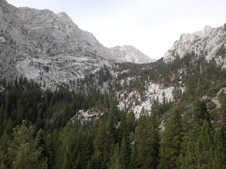
The initial few minutes on the Humphreys Peak trail takes you on a nice easy walk past the base of a ski lift, through the open pasture of wildflowers, and then slowly blends into the treeline of the Coconino National Forest and the Kachina Peaks Wilderness. The first three miles of the 5 mile ascent take you through the forest on a consistent uphill. It will get your blood pumping, but is not a terribly strenuous or overly challenging ascent and is not overly steep.
The forest here is thick, the trail is a manageable mix of “rooty” and small rocks, and the hike itself is one of the most deafeningly silent hikes I have taken in a while. And I say that as a compliment. I was thrilled to be able to say I was so distracted by all the little “pindrops” I was able to notice in this forest that is completely devoid of any audible traces of civilization. The shrill warning cries of multitudes of squirrels, the reverberating echoes of a lone woodpecker, the thundering crashes of dead limbs on the soft forest floor, and the gingerly crunching footsteps of deer trying their best to cross my path inconspicuously.
The fact that I actually had several deer cross my path in broad daylight should lend a sense to the type of quiet seclusion this trail possesses. It is also a feast for the foliage lovers, as you can find native wildflowers, mosses, and trees on this hike, my personal favorites being the aspens. Walking through groves of these trees is simply mesmerizing, and they are characteristic of many other Flagstaff hikes in the area, in addition to the hike to the highest point in Arizona.


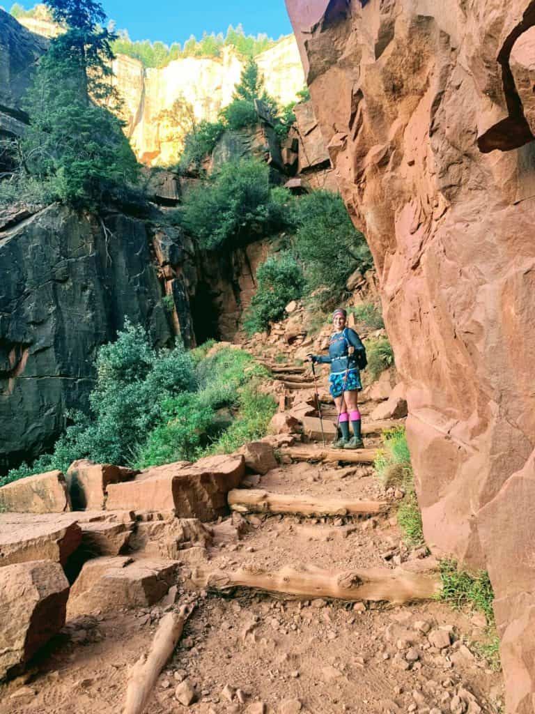
Following the switchbacks up, you will cross several expansive rock slides from avalanches past. These now stationary boulders are eerily motionless and covered in neon green moss, oddly contrasting testaments to the previous violent nature of the slides that deposited them there. Hikers do not actually have to traverse these rocky sections, up until the last mile or so of the ascent.

Above Treeline on the Humphreys Peak Hike
After the first four miles, once you have emerged from the treeline, there is plenty of evidence of the challenges of survival at this level of elevation. Very little grows here among the boulders, and this desolation coupled with the enshrouding fog of that day made for hauntingly beautiful views. No, I did not see the Grand Canyon or the Painted Desert, but I got views shrouded in mystery, straight out of a Lord of the Rings movie (my favorite movies, by the way!)

About a mile short of the summit, you will come to a saddle with a path leading away to the right towards the Weatherford Trail, and one continuing left to the Humphreys Peak trail summit. There is signage here, so it is easy to distinguish between the two paths. This is a great place (as long as the weather is cooperating) to stop and take a minute to soak in the views of the opposing side of the highest point in Arizona. Gorgeous golds, greens, and purples were shimmering in the afternoon sunlight that was peeking through the clouds on the day of my hike.

For the last mile, the terrain becomes more rocky and precarious, and my pace had to slow considerably to allow for very intentional footing. Mist seemed to hang in the air here, which also lent for more slippery conditions on the ground. The trail also becomes harder to spot in the midst of the barren exposure, but luckily there are signs posted frequently throughout the last section up to the summit. If you feel you are confused and losing the trail, just look up ahead as I found there was always a signpost within eyesight. Also beware of the three false summits you will encounter!
The Summit of the Humphreys Peak Trail
At the summit of the Humphreys Peak trail, you will find a simple wooden sign with the inscription, “Dook’O’Osliid” (the Navajo name for the peak), propped up among a handful of barren boulders, accompanied by cold temperatures and strong winds. I did need my Outdoor Research Helium II waterproof and windproof hard shell jacket and my trusty Buff at this point for the first time during the hike, and would recommend bringing them, although you may not need them for the first four miles of this hike if completed in the summer during good weather. As far as the views went, I just had to use my imagination, but the feeling of standing at the top was still completely worth it!


I did not stay long at the top, because the number one rule for hiking the Humphreys Peak Trail is to be off the summit by noon to avoid the frequent afternoon storms. Four hours and fifteen minutes up, two hours and forty-five minutes down, seven hours total. And I barely missed the afternoon rainstorm that began to pummel me as I drove away from the trailhead!
9 Recommendations for the Humphreys Peak Hike:
The Humphreys Peak hike is intended to be a day hike, and is very doable as such. That being said, I still have several recommendations to make for those looking to take on the highest point in Arizona. These same recommendations would also be applicable to many of the other day or backpacking treks on other Flagstaff hikes in the area.
•Chapstick – it is cold and windy at the top, I would not survive comfortable without it!
• A lightweight, easily packable, fully waterproof and windproof outer shell jacket – storms and wind are frequent (the best fully waterproof and windproof jacket on the market is Outdoor Research’s Helium II jacket! And it only weighs a couple ounces making it perfect for a daypack and day hike!)
•Hiking boots. like my Vasque Breeze GTX boots OR superb trail runners with the best cushion and grip, like HOKA One One Speedgoat Trail Runners – rocky terrain at the top calls for good support and grip, especially in potentially wet conditions. I personally hiked the Humphreys Peak Trail in my HOKA One One Speedgoats, as they have the best cushioning and unbeatable traction and grip. I use them for all my day hikes and long distance trail runs.
•Hiking socks – your footwear is only as good as the hiking shoes you pair with them. Blisters are one of the quickest and most surefire ways to derail a day hike like the Humphreys Peak Trail! I used to be extremely blister prone on my long day hikes, until I discovered Hilly Twin Skin socks! These socks are perfect for hiking, because they are lined, and this lining helps to deter friction and thus deters blister formation!
•Plenty of water – I drank three liters ( here’s my own personal recommendation for a Platypus hydration bladder on Amazon) I love this model of Platypus hydration bladder because it has a wide mouth that is very easy to fill, empty, clean, and dry!
•Snacks – not the most strenuous high point in the Southwest, or even the most strenuous of the area Flagstaff hikes, but still lengthy and at higher elevation. Bring the right kind of snacks to replenish your energy. Snacks should be lightweight and easy to pack, and high energy! Here are a few of my trusted favorite hiking snacks!
Download your own handy hiking snacks checklist HERE!
•A day pack loaded with all your day hiking essentials! I love my Camelbak Helena 20 liter day pack. It is perfect for long day hikes, has excellently cushioned shoulder straps and sternum straps for all day support, is water bladder compatible, and has the perfect amount of space to hold all your hiking essentials, including water, snacks, and emergency gear!
Download your own Hiking Essentials Checklist HERE!
•Trekking Poles – these can be very helpful on the Humphreys Peak Trail, especially near the top and on the descent. My favorite trekking poles ever are the highly reputable Black Diamond trekking poles. I prefer this model with the cork handles, as it prevents slippage from sweaty palms, something other brands and models cannot achieve with plastic or rubber handles that can easily become more slippery, and thus less trustworthy.
•A sense of imagination – it seems pretty common that your views will be obstructed by the weather, don’t let that stop you from attempting this hike!
•A sense of curiosity – you may just get distracted by all of the wildlife you will see! Enjoy it to the fullest, it is what makes this hike special. Just be sure to be mindful of your surroundings and practice safe and responsible hiking etiquette at all times!
•Descend by noon – but use common sense! Noon is not a hard and fast rule. If you see storms and lightning developing at any time, get to cover. Check out these other 5 hiking mistakes NOT to make!
•Hiking with dogs – Yes, I believe this is a dog friendly hike, as long as your dog is comfortable and familiar with rocky and somewhat jagged terrain, especially at the summit. I would recommend paw protection if your furry pal has not had a chance to toughen up their paws naturally on other rocky hikes. And don’t forget to hydrate your pup as well!
So even though I had to use my imagination when it came to the panoramic views at the summit, there still is nothing quite like the feeling of being at the top of any state, and Arizona did not disappoint! So the next time you are in Arizona, by all means go to the canyons and deserts and red rocks, but do not forget about the forests! And the hike to the highest point in Arizona!
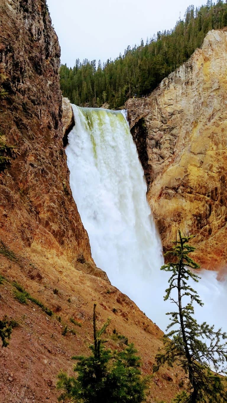
Curious About Other Southwest State High Points?
Read More: In addition to the highest point in Arizona, check out my guides to hiking other lofty southwestern high points, like Mt. Whitney in California, New Mexico’s Wheeler Peak, Texas’s Guadalupe Peak, or Utah’s King’s Peak! Whether you are planning to hike solo or with a group, always ensure you are being safe by avoiding these 5 critical hiking mistakes!
What About the Other State High Points in the U.S.?
***Learn about Each One of Them with your FREE 50 State High Points Download!
PIN for LATER!


Nive post and hike
Wow those views are dreamy and seems absolutely worth the effort thanks for sharing, looking forward to it now!
Michelle, it is definitely worth the effort! I hope you have a chance to hike it soon!
You are right. Arizona does bring up images of dry rocky canyons and I would never think of it in terms of such lush greenery and foggy mountains. Thanks for sharing this post 🙂
Ameeta, thanks for your comment. Arizona is such an amazingly diverse state!
Great post. Very informative.
Thank you, glad it was helpful!
Were there any decent spots to camp on the way up? We are taking our kids and generally like to break up hikes of this length into 2 days for them. When we did Wheeler Peak we camped at Williams Lake and that was a good way to break it up for them, but I know most people do this one in a day, so I am having trouble finding helpful info on places to camp on the way up. Great post!
Hi Tilli,
As far as I am aware, there are no camping spots enroute to the summit on the actual trail. There are places to camp in nearby Coconino National Forest in the surrounding Humphrey’s Peak base, and in the surrounding Flagstaff area, but as much as I know, that’s as close as you can get.
Tilli, we just did this hike. While I wasn’t specifically looking for campsites, there was a sign at elevation 11,400 saying “No camping above this elevation”. This is shortly before “The Saddle”, and still in the trees. Based on the sign, I *guess* that means camping below that elevation is allowed. (Anyone know otherwise?)
Than you