
The 17 Best Day Hikes in Northern New Mexico
In my quest to hike to the summits of all 50 state high points in the U.S., one of the first ones on my list was New Mexico, one of my all time favorite states due simply to its eclectic and varying terrain. New Mexico is home to the Wheeler Peak hike, the highest point in New Mexico. There’s no better way to spend a day hiking in this state. But what if you are visiting northern New Mexico and not planning to hike Wheeler? Or what if a hike like Wheeler Peak draws you into the region, but you want to extend your stay and take on a few more hikes? Luckily, this area is bursting at the seams with endless outdoor opportunities, and here is a collection of the best day hikes in northern New Mexico!

Disclosure: Below are some affiliate links-these are all products I highly recommend. I won’t make any recommendations on this page that I haven’t tested or personally used! Enjoy this guide to the best day hikes in northern New Mexico!
Table of Contents
Best Day Hikes in Northern New Mexico
I decided to explore a few of the best day hikes in northern New Mexico during the couple days I had before hiking Wheeler Peak. I choose to depart my home state of Texas and head west towards Wheeler Peak along the northern route of state highway 64.
Along this path, I knew I would have the chance to pass an area brimming with a multitude of adorable and picturesque little mountain towns, such as Eagle Nest, Angel Fire, Santa Fe, and Taos, to name a few. Each have their own offerings to satisfy any outdoor enthusiast, and thus I was able to choose a few highlights from each. So if you have a day or two or more to spend in northern New Mexico, here are a few of its gems.
This guide to the best hikes in northern New Mexico will explore hikes in 4 regions:
- Eagle Nest
- Angel Fire
- Taos
- Santa Fe
Location of the Best Hikes in Northern New Mexico
The best hikes in northern New Mexico are broken down into these 4 regions, which you can locate on the map below:
- Eagle Nest
- Angel Fire
- Taos
- Santa Fe
Know Before You Go
Here are some common questions to know before taking on these best hikes in northern New Mexico.
- When is the Best Time to Hike in Northern New Mexico?
Generally speaking, the shoulder seasons of spring and fall are the ideal time to hike in northern New Mexico. Early spring may still see some snow, as may late fall, especially at higher altitudes. Summer is also doable, though it can get hot between June and August, and hiking mountaintops may expose you to some strong sun. However, this can be mitigated with an early morning start and sun protection. You will likely encounter snow in the winter. Only hike trails in the snow if you are experienced, and have the proper gear including the right footwear, like microspikes, and the right layers. See below for some of my recommended gear.
- How Can I Check Mountain Weather Beforehand?
It is always advisable to check the weather before any hike, but especially mountain hiking at higher elevation. Always aim to be off a mountaintop and descending by noon as a general rule. I always check Mountain Forecast before any of my mountain hikes, as the forecast is specifically targeted to a specific peak, not just the general region. Weather at the base of a mountain can be drastically different than at the top!
- Are Trails Ever Closed?
Yep they close, especially during summer when there are droughts and potential for forest fires. In fact, I was barely able to hike Wheeler Peak in Taos, before Carson National Forest closed do to potential forest fire hazards. So it is always good to check National Forest websites, if that is where your hike is located, to make sure there are no alerts or closures.
- Where Can I Find a Good Trail Map?
There are several good options out there for hiking apps with downloadable trail maps. I personally use AllTrails.
- Can I Bring My Dog?
Yes, these trails are open to dogs, just make sure they are leashed, and follow proper etiquette for hiking with dogs, including packing out waste. Also, if you are taking on a difficult hike like Wheeler Peak, the highest point in the state, make sure that if you are bringing your dog, they are used to that particular kind of hiking, and have a proper foundation for that kind of stamina.
- What Gear Do I Need to Hike in Northern New Mexico?
- Trail Runners
- Waterproof Hiking Boots
- Performance Socks
- Daypack
- Hydration System and Water
- Trekking Poles
- Layers
- Sun Protection
- Navigation
- Microspikes (for winter hiking)
- Snacks!
Curious what snacks I carry in my pack for my day hikes?
-
-
- Sandwich
- Beef Jerky
- Trail Mix / Nuts
- Tuna Packets
- Applesauce Pouches
- Squeezable Peanut Butter
- Honey Stinger Waffles
- GU Energy Gels
- Banana
- Carrots
- RX Bars
- NUUN Tablets / Electrolytes
-
- And finally, the 10 Day Hiking Essentials!
Download your own Day Hiking Essentials Checklist HERE!
Best hiking in Eagle Nest
The best part of arriving in Eagle Nest was actually the approach. Tracing along the Cimarron River, you just begin to pick up the outlying border of Carson National Forest and its foliage. Right on the outskirts of town, there is a small hill and once you have crested the top, you are treated to one of the most stunning mountain lakes, Eagle Nest Lake, that I have ever witnessed. When the summer sun hits the water at just the right angle, as it was on my approach, that water rivals the aquamarine color of even the most tropical Caribbean waters.

We actually checked out Eagle Nest Lake from several different access points, but my favorite was the overlook on the eastern side of the lake. There is a small turnoff from Highway 64 that was all but empty on this day, save for one father and son fishermen. Other than that, me and the Middy pup had the shoreline and its views to ourselves to explore.
This lake is bordered by two slopes that converge on its horizon, and also offer views of the charming main town of Eagle Nest. On the eastern side of the lake there were no marked trails, but plenty of expansive shoreline to walk along and enjoy the penetrating solitude and silence. Continuing further along highway 64 will take you to Eagle Nest State Park, which offers miles of hiking trails, boating and water sports, and camping.

Best hiking in Angel Fire
For my stop in Angel Fire, I wanted to experience what this town had to offer in terms of its hiking, so my first choice was the Elliott Barker Trail just outside of town.
Elliot Barker Trail
- Length: 5.5 mile roundtrip loop
- Elevation Gain: 1,089 feet
- Rating: Moderate
- Dog Friendly: Yes – must be leashed
- Estimated Time to Hike: 1.5 – 2.5 hours
This is a 5.5 mile roundtrip loop trail, and offers its visitors their first real taste of all that Carson National Forest has to offer, making it one of the best day hikes in northern New Mexico.
This trail has its roots in old logging routes that have been connected over time to wind through miles of pines. The path alternates between wide open pastures with waving prairie grass and blooming wildflowers, to tall ponderosas, aspens, and various other native foliage. The trailhead from Highway 64 takes you past a weathered fence into the first of several open expanses of shimmering green groundcover.

My Middy pup, who is closing in on forty pounds, was at times completely engulfed in grass (and loved every second of it)! One other quirky thing I loved about this trail was the prairie dog town that greets visitors at the very onset. I have a soft spot for these critters and could have watched them popping in and out for hours, although Middy was completely oblivious to their shrill warning calls and theatrics!
After passing through the initial pasture, you come to a small pond glazed over with algae and adjacent to several clumps of towering cattails. It is a beautifully humble spot to stop and cool off, or sit and have a snack in the sunshine.
Continuing on from the pond, the trail begins to consistently climb until its crest. There were several other spots where the canopy broke allowing for carpets of grass and wildflowers and soaring views of Angel Fire and Wheeler Peak.
This is a perfect day hike for anyone looking for a moderately challenging, consistently inclined, varied trail. An added bonus for me was that even with the high ratings and seeming popularity of this hike, I only saw one other group of hikers on the trail.


Oeste Vista Loop
- Length: 2.5 mile roundtrip loop
- Elevation Gain: 597
- Rating: Moderate
- Dog Friendly: Yes – must be leashed
- Estimated Time to Hike: 45 – 60 minutes
Another great day hike in Angel Fire is the Oeste Vista Loop. This hike features a moderately steep uphill climb, and the resident aspens add a nice touch to the scenic views.
Best Hiking in Taos
Taos is home to some epic mountain hiking, including the highest point in the entire state at Wheeler Peak!
Wheeler Peak and Williams Lake
- Length: 7.9 miles out and back roundtrip
- Rating: Difficult – this is a challenging hike that exposes visitors to steep, multiple switchbacks, craggy, uneven rock fields, and extended hiking time above treeline. It is a Class 1 hike however, and is non-technical. The trail is well marked. The Wheeler Peak Trail can be summed up like this: there are 3 main portions of the trail. The first part is shaded and in the trees, on dirt trail. The second part is emerging from treeline, and becoming exposed to the elements like wind and full sun. The third part is still exposed, but the final part of the trail changes from dirt trail to scree field.
- Elevation: 13,159 feet
- Elevation Gain: 2,979 feet

- Red Tape: None – there is no fee to access the trail head for the Wheeler Peak hike, and a permit is not required. Parking is free.
- Best Time to Hike: Summer is going to be the most user-friendly time to hike, specifically June through September. In the winter months, snow accumulation and/or ice would definitely add a completely other element of challenge to this hike. Just arriving at the trail head might be tricky in the winter, as it would be necessary to navigate some dicey mountain roads. Shoulder months of spring and fall are doable, though you may still face the possibility of environmental conditions including snow. When it comes to Wheeler Peak, always check the mountain forecast HERE before attempting your hike. Keep in mind that afternoon showers are common in summer and early fall, so be sure to aim to be off the summit and making your way back into treeline by noon.
- How Long Does It Take to Hike Wheeler Peak? An average of around 6 hours
- Always check updates from the Carson National Forest website, in case of closures. Occasionally it happens, such as due to wildfires.

Wheeler Peak is arguably at the top of the list for best hikes in northern New Mexico, if not the entire state! In my own personal quest to summit all 50 U.S. state high points, New Mexico was #2. Now, 44 state high points later, the Wheeler Peak hike is still one of my all time favorite hikes. What makes it so special?
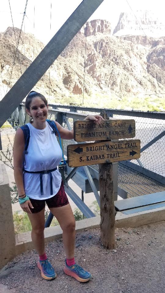
First off, you start off in the idyllic Toas Ski Village. After parking at the trailhead for the Williams Lake Trail (which later splits with the Wheeler Peak Trail), you will start off hiking through dappled forest with towering pines, past moss blanketed boulder fields, and up to the split with Williams Lake. You can take the split to enjoy Williams Lake on the way up to Wheeler Peak, or on the way back down. Either way, when you get to the split, right will take you to Williams Lake, and left will continue to take you up the mountain towards the highest point in New Mexico.
Once you emerge from the treeline, that is when Wheeler Peak really starts to put on a show. Depending on the time of year, you may hike past bright yellow wildflowers, while admiring the staggering panoramic views surrounding you, with Williams Lake below getting smaller and smaller. Wildlife sightings are common, including mountain goats and marmots.
Near the summit, you will encounter challenging switchbacks and tricky scree fields, but the payoff is reaching the peak, and seeing all of Taos from that unique vantage point!
For a complete trail report, as well as info on logistics and gear recommendations, check out my Guide to the Wheeler Peak Hike.

From the beginning, the highlight of Taos for me was always going to be Wheeler Peak. But what if you are visiting Taos and not planning on hiking Wheeler? Fortunately, I checked out a day hike that is a favorite among the locals, that offers its own unique taste of the high desert life of Taos.
The South Boundary Trail:
- Length: 48.1 mile out and back roundtrip
- Elevation Gain: 7,828 feet
- Rating: Hard
The South Boundary trail is also located along Highway 64 just southeast of downtown Taos. Although in Carson National Forest, it has a noticeably different feel to it than the Elliott Barker Trail and Wheeler Peak Trail did. The canopy is not as thick, the pines are not as towering, and there was a noticeable absence of lush open pastures. I felt that this trail gave an accurate representation of the dryer, high desert terrain.


Upon entering from the trailhead, visitors first cross a wooden bridge over a small creek, and continue towards the right for the South Boundary trail. There is a small, unmarked, mile long nature trail that runs to the left after crossing the bridge.
South Boundary begins its steady ascent almost immediately, and though it is not overly steep, it is challenging in its consistency. Most people on the trail are probably not doing the full hike, but just a portion of it, like I did, as a day hike. Again, the views are stunning as the town of Taos below peeks through the foliage.
I encountered a few tips to this trail to be aware of. First, it is also a mountain biking trail, and so hikers, especially those with dogs or children, need to be aware and mindful of who else is on the trail.
Second, because there is less canopy, it is a sunnier and therefore hotter hike, and plenty of water is an absolute must!
Third, this trail is incredibly accessible and convenient due to its location right outside Taos, but the downside is that it is popular and therefore busier, which I experienced even on a random Monday morning.
Fourth is location, again. Super convenient, but right off the highway. That means you can clearly hear the highway traffic and the eighteen wheelers chugging their way through the mountain passes even several miles up. It does have an effect on the sense of solitude and ambiance.
Fifth, there are several side trails that branch off of the South Boundary Trail, which at times made it a little difficult to determine where the official trail was. The signage could be improved up on slightly. Make sure you have route finding navigation handy, like a downloaded AllTrails map.
Lastly, this hike, although pleasantly challenging, felt slightly more monotonous than my other stops, in that the terrain did not feel as varied. Due to time constraints, I was only able to hike up two miles before turning back, but did not see much change in the terrain of those four roundtrip miles. To be fair though, there is much, much more of the South Boundary Trail that I did not see, and it is a favorite among the locals.
After having completed the four miles roundtrip and working up a sweat I decided to take the Middy pup towards the left of the trailhead along the nature trail. I have to say I enjoyed this part more than the official South Boundary trail, although it was considerably less challenging and should be categorized as more of a leisurely hike.
The best part of this nature trail was that it did offer varied terrain, as well as running parallel to a small creek through its entirety. The pines here at the base seemed to morph back into the kind of towering pines seen at Elliott Barker, and there were intermingled sprinklings of tall brush and wildflowers. It is a great trail if you have a dog that enjoys playing in gentle, shallow water, or if you are the kind of hiker that appreciates a little extra shade on a summer day! Once again, the only downside to the nature trail was its proximity to highway 64 and its constant background noise.


Other Best Hiking Trails in Taos
La Vista Verde Trail
- Length: 2.3 mile out and back roundtrip
- Elevation Gain: 229 feet
- Rating: Easy
- Dog Friendly: Yes – must be leashed
- Estimated Time to Hike: 45 – 60 minutes
This is an easy Taos favorite, with gentle elevation gain and characteristic Taos views. But the major payoff is the stunning views of the Rio Grande Gorge, which is what makes the La Vista Verde Trail an easy favorite for locals and visitors alike!
Gavilan Trail
- Length: 6.6 miles out and back roundtrip
- Elevation Gain: 2,342 feet
- Rating: Hard
- Dog Friendly: Yes – must be leashed
- Estimated Time to Hike: 3-5 hours
The Gavilan Trail is a uphill challenging hike with a hefty amount of elevation gain, for those searching for a mountain workout. Beware, the last 1,000 feet are the hardest! But there is a beautiful meadow along the trail that is arguably the best part and the most scenic views of the entire trail.
West Rim Trail
- Length: 3.7 miles out and back roundtrip
- Elevation Gain: 236 feet
- Rating: Easy
- Dog Friendly: Yes – must be leashed
- Estimated Time to Hike: 1 – 2 hours
The West Rim Trail is another short and relatively easy Taos hike that has epic views of the Rio Grande Gorge! Enough said!
Devisadero Trail
- Length: 5.6 mile roundtrip loop
- Elevation Gain: 1,335 feet
- Rating: Hard
- Dog Friendly: Yes – must be leashed
- Estimated Time to Hike: 2 – 3.5 hours
The Devisadero Trail is located right outside of Taos, and is a popular uphill mountain hike, for those looking to get in their elevation gain while summiting a peak! The Devisadero Trail is difficult in places with some resident switchbacks, but the terrain is diverse, and the views are unforgettable!
Best Hiking in Santa Fe
These trails highlight the best of the high desert and mountainous region that is Santa Fe, New Mexico!
Picacho Peak
- Length: 3.8 miles out and back roundtrip
- Elevation Gain: 1,230 feet
- Rating: Moderately Hard
- Dog Friendly: Yes – must be leashed
- Estimated Time to Hike: 1.5 – 2.5 hours
You can get a lot of bang for your buck with the Picacho Peak Trail. For a relatively short trail, it packs in a good chunk of elevation, with some steep inclines and mountain uphills. So if you are looking for the perfect trifecta of short day hike, excellent hiking workout, and stellar views overlooking beautiful Santa Fe, than this is the trail for you!
Kasha Katuwe Tent Rocks National Monument
All of the trails at Kasha Katuwe Tent Rocks National Monument are prime ways to witness the unique topography of this region, filled with mesmerizing rock formations and hoodoos. The trails here are all short and can appeal to families, ages, and abilities of all kinds!

Nambe Lake Trail
- Length: 6.7 miles out and back roundtrip
- Elevation Gain: 2,080 feet
- Rating: Hard
- Dog Friendly: Yes – must be leashed
- Estimated Time to Hike: 3-5 hours
Hike to Nambe Lake on this trail. The lake itself might be humble, but it is quite a scenic workout to get there. Enjoy this popular favorite of Santa Fe, with mountain views over the valley on the way up!
Atalaya Mountain Trail
- Length: 6.2 miles out and back roundtrip
- Elevation Gain: 1,797 feet
- Rating: Moderately Hard
- Dog Friendly: Yes – must be leashed
- Estimated Time to Hike: 2.5 – 3.5 hours
This hike checks it all. Deep in the heart of Santa Fe National Forest. The perfect length for a perfect day hike. Challenging uphill ascents to payoff views at the top! Another favorite of locals and visitors alike.
Bandelier National Monument
Bandelier National Monument is one of the most interesting destinations in northern New Mexico, not only for the beautiful views and engaging trails, but for the way that is mixes these with fascinating cultural and historical backgrounds. This beautiful canyon country is home to cliff dwellings, petroglyphs, and other signs of early human presence.
There are both short and long trails for hiking at Bandelier. The best and most popular trail to see the historical sights of Bandelier is the Pueblo Loop Trail (Main Loop Trail). You can check out a trail map here, courtesy of the National Park Service.
Dogs are not allowed at Bandelier National Monument.

Dale Ball Trails
The Dale Ball Trails is actually not just one trail, but a hiking area that contains a handful of trails totaling 25 miles worth of outdoor explorations. Dogs, hikers, and runners are all welcome. There are easy and hard trails, for new and advanced hikers.
Grasshopper Canyon
- Length: 3.4 miles out and back roundtrip
- Elevation Gain: 301 feet
- Rating: Easy
- Dog Friendly: Yes – must be leashed
- Estimated Time to Hike: 1 -2 hours
A really fun, relatively short trail, that is right off Interstate 25, literally, the parking for the trailhead is on a pull off from the interstate. Being right off the highway, and right outside of Santa Fe, makes this trail very appealing in accessibility. What makes this trail fun, besides the vibrant forest surroundings of Santa Fe National Forest, is the frequent stream crossings! There are a lot of them on this trail, so watch your footing and take your time with the crossings! Just make sure that if you are concerned with getting wet feet, to wear waterproof hiking boots, like my waterproof Vasque Breeze GTX hiking boots!
Deception Peak
- Length: 6.6 miles out and back roundtrip
- Elevation Gain: 2,601 feet
- Rating: Hard
- Dog Friendly: Yes
- Estimated Time to Hike: 3 – 5 hours
With a foreboding name like Deception Peak, you might feel intimidated to hike this trail. But the name simply comes from the fact that Deception Peak is viewed as a false summit of nearby Lake Peak, which you can also reach by hiking this trail. This trail is steep, challenging, and contains just a touch of technicality, so be ready!
So next time you are in the Land of Enchantment and are looking for the best day hikes in northern New Mexico, whether it is for several days or just passing through, it is worth taking the time to stop and sample a few of the unique offerings this region has to offer its hikers!
BONUS: No matter where your hiking ventures take you, be prepared with the ONLY day hiking checklist you will EVER need!
RELATED ARTICLES:
- Complete Guide to Wheeler Peak
- Guide to White Sands National Park
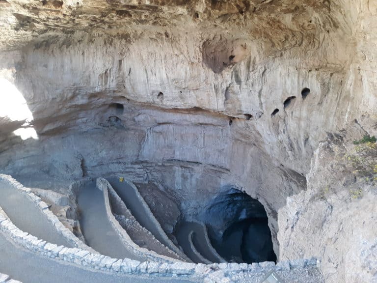
- What to Do at Carlsbad Caverns National Park
- 8 Fun Outdoor Adventures in Carlsbad New Mexico (besides the Caverns)!
- Hiking the Backcountry Alkali Flat Trail in White Sands
PIN for LATER!


Thank you for the recommendations! I was wondering if you had a favorite of the three? We are debating about Wheeler Peak, but don’t know if we would be able to make it all the way up. Is the Williams Lake still worth going to if we’re not going to Wheeler Peak? Thank you!
I think Taos is my favorite of the three, and yes, Williams Lake is still a short but very scenic portion of the Wheeler Peak Trail that would be worth checking out. Williams Lake is somewhat on the smaller side, more of a large pond, but it’s still a very nice spot if you were looking to do a shorter version.