The Best Outdoor Things to Do in Fort Davis Texas
It is a true treat to discover small towns in Texas that still hold deeply to their old west roots. Towns that are ruggedly appealing, without any pretention. And it is even better when these richly rooted towns are coupled with a wealth of outdoor opportunities. This is the case with Fort Davis, Texas. This humble town in the heart of west Texas boasts an impressive canvas of outdoor adventures for all types of active travelers, wrapped up in a charming, quintessential small town that perfectly reflects Texas’s old west. From parks like Fort Davis National Historic Site, Davis Mountains State Park, and Davis Mountains Nature Preserve, which contain the best of Fort Davis hiking, to more relaxed botanical garden strolls, to neighboring outdoor offerings in sister small towns like Marfa, Balmorhea, and Monahans, to stellar overnight Fort Davis camping spots, this guide to the best outdoor things to do in Fort Davis, Texas easily covers all an active traveler could hope for, whether you have a day, a weekend, or longer to spend in Fort Davis, Texas!

Disclosure: Below are some affiliate links-these are all products I highly recommend. I won’t make any recommendations on this page that I haven’t tested or personally used! Enjoy this guide to the best outdoor things to do in Fort Davis, Texas!
Table of Contents
Best Outdoor Things to Do in Fort Davis, Texas
No matter where you are in Fort Davis, Texas, this region really shines! But it’s the outdoor adventures that really make it an endearing spot and bountiful active travel destination for hikers, trail runners, campers, and active explorers all around!
This guide to the best outdoor things to do in Fort Davis, Texas includes:
- Location of Fort Davis, Texas
- Map of the Best Outdoor Things to Do in Fort Davis, TX
- The Best Fort Davis Hiking
- Fort Davis National Historic Site
- Davis Mountains State Park
- Davis Mountains Preserve
- Chihuahuan Desert Research Institute and Botanical Gardens
- Fort Davis Camping
- Accommodations in Fort Davis, TX
- Other Outdoor Attractions Nearby Fort Davis

Location of Fort Davis, Texas
Fort Davis is located in remote west Texas, close to other old west towns including Alpine, Texas. This particular area is littered with small sister towns, such as Marfa, Balmorhea, Pecos, and Monahans. The closest large towns would be considered Midland/Odessa and El Paso. The closest airports are also Midland Odessa and El Paso.
Driving Distances:
- Alpine, TX to Fort Davis: 30 minutes
- Marfa, TX to Fort Davis: 20 minutes
- Balmorhea, TX to Fort Davis: 35 minutes
- Pecos, TX to Fort Davis: 1 hour and 20 minutes
- Monahans, TX to Fort Davis: 1 hour and 50 minutes
- Midland/Odessa, TX to Fort Davis: 2 hours and 30 minutes
- El Paso, TX to Fort Davis: 3 hours
Map of the Best Outdoor Things to Do in Fort Davis, TX
Use the map below to view the locations of the best outdoor things to do in Fort Davis, TX.
Fort Davis Hiking
The highlight of any list of best outdoor things to do in Fort Davis, Texas, has to begin with Fort Davis hiking opportunities! There are just so many to choose from! Yet one thing that binds them all together is their ruggedness. Hiking in Fort Davis is largely secluded, and trails that are considered popular for the area likely will seem sparsely trafficked compared to other popular mainstays in more visited destinations in Texas.
The hiking trails here also prove once more that Texas is not all flat, and there are true mountains in this state! Fort Davis hiking trails take full advantage of this, with many trails incorporating challenging grades, invigorating uphills, stunning views, and unique topography and terrain. Fort Davis and its resident Davis Mountains were made for hikers and trail runners alike! There are several great parks to choose from when sampling the best of Fort Davis hiking!

Fort Davis National Historic Site
While the namesake historic Fort Davis fort is the most obvious first impression here, Fort Davis National Historic Site also packs in some exciting mountain trails in addition to its history, which you can read more about here.
***Entrance fees to the park are $10 per person or $20 per vehicle, and the park is open daily (with the exception of a few holidays) from 8 AM – 5 PM.

As far as Fort Davis National Historic Site’s hiking goes, there are a couple great trail options! And all of them contain spectacular views of the historic fort and its remaining remnants as well!
Several of Fort Davis National Historic Site’s trails connect together to form a lopsided loop that winds through the onlooking Davis Mountains. These connected trails together are the Hospital Canyon Trail (0.7 miles), the North Ridge Trail (0.3 miles), and the Tall Grass Loop (0.8 miles).
These connected trails are considered moderate to challenging, with the Hospital Canyon Trail climbing up the overlooking ridge in the fort’s background, and the North Ridge Trail proceeding over the spine of the ridge, before beginning the descent amid the Tall Grass Loop.
These three trails are considerably more challenging than the shorter trails in “the valley” of Fort Davis National Historic Site, but the views from atop the ridge overlooking Fort Davis are mesmerizing, and definitely worth the work! To access these 3 trails in a clockwise direction, look to start with the Hospital Canyon Trail to the left of Fort Davis National Historic Site.


There are flatter and shorter trail options below, on the same “ground level” as the fort. These trails are more pathlike and gentle at heart, but provide up close views of Fort Davis National Historic Site, as well as the surrounding towers of stacked mountain peaks. Some of these “flat land” trails include the Cemetery Trail (0.2 miles), and the brief Photographer’s Trail, immediately adjacent to the Visitor’s Center.
***For a PDF view of all the hiking trails at Fort Davis National Historic Site, visit this link!

Davis Mountains State Park
Davis Mountains State Park seamlessly and beautifully blends together the unique topography and terrain of this region. Its mountains are comprised of part igneous rock stacks and slabs, and part gentle grasslands. Some of its peaks jut erratically into the sky, while some are blanketed by soft expanses of prairie.
All of Davis Mountains State Park is ruggedly remote, and its trails equally engaging! It is also the prime destination for those looking to partake in some of the best of Fort Davis camping, discussed in more detail later in this post.

Davis Mountains State Park Hiking
There are 7 hiking trails in Davis Mountains State Park, ranging in lengths from 0.6 miles to almost 6 miles in length. Trails that climb hills and ridges, trace along canyons, wind through juniper forests and grasslands, and trails that are dotted with historical remnants!
If you are looking for shorter, gentler hiking trails in Davis Mountains State Park, there is the 0.6 mile long roundtrip Headquarters Trail, which intermingles views of Keesey Canyon and old lava flows. This trail is located in the heart of Davis Mountains State Park.
Or consider the just short of 2 mile roundtrip Montezuma Quail Trail, located adjacent to the Headquarters Trail. This loop contains just a bit more elevation gain than the Headquarters Trail, with a brief ascent that offers some stunning views of the wild expanses, as well as the historic Indian Lodge. This trail also incorporates an enclosed wildlife viewing blind, the Emory Oak Wildlife Viewing Area, found at the trailhead.
***Both the Headquarters Trail and the Montezuma Quail Trails connect to the Indian Lodge Trail, a longer and more robust hiking trail found in the park, and perfect for those looking to extend their hiking. In fact, the only way to complete the Indian Lodge Trail is to connect to either the Montezuma Quail Trail or Headquarters Trail at the eastern terminus of the Indian Lodge Trail, in order to complete the Indian Lodge Trail.
There are several intermediate day hikes available in Davis Mountains State Park. These include the 3 mile roundtrip Indian Lodge Trail, a personal favorite, whose trailhead can be found immediately next to the historic Indian Lodge. If hiking the Indian Lodge Trail from its western trailhead in a clockwise direction, you would start at the trailhead at the Indian Lodge parking lot, and then immediately begin climbing up prairie covered peaks, jutted with rough rock.
The Indian Lodge Trail has its highlight at the top of the ridge, whose overlooks boast the best views of the Davis Mountains, as well as the switchbacks up the scenic Skyline Drive park road. To descend down the Indian Lodge Trail takes careful footwork through narrow and uneven terrain, before reaching the terminus at the connecting branch with the Montezuma Quail Trail and the Headquarters Trail. Either of these trails will complete the loop for you and drop you back onto the main park road, but the Montezuma Quail Trail is a slightly shorter version than the Headquarters Trail.


There is also the 3.2 mile roundtrip Old CCC Trail, which connects to the Skyline Drive Trail to complete the loop trail, or, if hiked even further, connects to neighboring Fort Davis National Historic Site. This old CCC road has been around since the 1930’s, and is used for mountain biking in addition to hiking.
The Skyline Drive Trail parallels the park’s scenic Skyline Drive, and climbs some impressive elevation along its 5.2 mile roundtrip length. It includes the Keesey Canyon Overlook, as well as several historical park buildings. The Skyline Drive Trail connects with the Old CCC Trail for completion.

The final two hiking options will require more of your day, but are the most immersive trails in Davis Mountains State Park. Both are located in the northern portion of the park, and both require a gate code to access the trails, so be sure to inquire with the park rangers when entering the park if you plan to do either, or both, hikes.
The Limpia Creek Trail is a 5 mile roundtrip trek, which does connect with its other backcountry hiking trail, the Sheep Pen Canyon Loop Trail, for completion. The Limpia Creek Trail starts off easily and flatly, then climbs at its junction with the Sheep Pen Canyon Loop Trail.
The Sheep Pen Canyon Loop Trail is the longest hike in Davis Mountains State Park, at 5.6 miles roundtrip. This plateau-ed hike emphasizes the high desert surroundings, including waving grasslands and juniper forests, and peaceful vistas. There is also primitive camping along the Sheep Pen Canyon Loop Trail.
***Both the Limpia Creek Trail and Sheep Pen Canyon Loop Trails are considered multi-use, for hiking, mountains biking, and equestrian use. There are equestrian campsites located at the trailhead of the Limpia Creek Trail, and primitive campsites located along the Sheep Pen Canyon Loop Trail.
***You can find a PDF version of all the hiking trails in Davis Mountains State Park here.
And after you’re done hiking, don’t forget about the scenic 4.5 mile Skyline Drive, the park’s high elevation, point to point, scenic drive. It’s not just a scenic drive, but also a chance to enjoy many of the designated lookouts and old structures located along the way!
And good way to end a day of hiking and exploring in Davis Mountains State Park is to visit the white-washed historic Indian Lodge, which also houses a down to earth restaurant inside, the Black Bear Restaurant.
***Day use entrance fees for Davis Mountains State Park are $6 a person.


Davis Mountains Preserve
The Davis Mountains Preserve is yet another hiking destination in Fort Davis, Texas, in addition to the Fort Davis National Historic Site and Davis Mountains State Park. Set just a little further outside of the actual town of Fort Davis, this spot really highlights what it means to hike remotely.
Hewn by the elements out of the area’s characteristic rock, this region surprisingly houses a host of delicate canyon water sources and springs. If you are looking to hone in on arguably the best attraction at the Davis Mountains Preserve, that would be Madera Canyon.
The Madera Canyon Trail exposes this unique balance between arid, seemingly inhospitable land, encompassing a surprisingly vibrant and rich ecosystem. It’s also a trail to take advantage of higher altitude hiking, at 6,000 feet elevation.
The Madera Canyon Trail is 2.4 miles roundtrip, and contains several engaging features. Some patches of rough and uneven rock trails, stream crossings, cliff dropoffs, moderate grades, and views of neighboring Mount Livermore, an 8,000 foot peak.
Local wildlife is also abundant in this area, including javelina, bobcat, mountain lion, black bears, elk, and golden eagles. Texas madrone trees, a unique beauty also found along Guadalupe Mountains National Park’s McKittrick Canyon Trail, another west Texas highlight, adds extra appeal to this hike.
***The Madera Canyon Trail is open daily from sunrise to sunset.

Chihuahuan Desert Research Institute and Botanical Gardens
While the Chihuahuan Desert Research Institute is primarily the home of a succulent rich botanical garden, it also offers several short hikes in addition. So it is not only a great place for some shorter trails, but it is also a chance to get educated on the local flora and fauna simultaneously! And don’t forget to check out the small outdoor mining exhibit at the entrance, with a large collection of old mining tools on display, as well as local minerals mined from the region!
***The Institute is open Mon., Tues., Thurs., Fri., and Sat., from 9 AM – 5 PM. Entrance fees are $6.50, and can be booked online on the Institute’s website here.

In addition to the short nature trail that leads from the Visitor’s Center to the succulent greenhouse, there are a couple other hiking trails located at the Chihuahuan Desert Research Center.
The Upper Loop Trail is a short loop found immediately adjacent to the Visitor’s Center. It is considered an easier hike, and is 0.5 miles in length. Another shorter hiking trail is the 0.33 mile loop Hummingbird and Butterfly Trail, which encompasses the Pollinator Garden. The surroundings are rockier with rugged outcroppings, larger boulders, and impressive views.
Modesta Canyon Trail and Clayton’s Overlook are 1.75 mile and 1.5 mile long trails respectively, are are more challenging in their terrain. The Modesta Canyon Trail incorporates grasslands, natural springs, and canyon hiking among igneous rock formations. Clayton’s Overlook climbs a moderately challenging hilltop. If you want to take on both the Modesta Canyon Trail and Clayton’s Overlook Trail, the Outer Loop Trail has it all! This 2.5 mile roundtrip loop includes both these other trails. For a trail map, visit the park’s website here.
Checking out the impressive succulent collection at the Institute’s Botanical Garden is a relaxing and well-rounded way to close out any outdoor explorations of this area. Several hundred unique succulents that showcase the local flora and fauna of the surrounding Chihuahuan Desert can be found in the greenhouse, a short walk from the Visitor’s Center. As you follow the path to the greenhouse, enjoy the labeled local residents found along the trail.


Fort Davis Camping
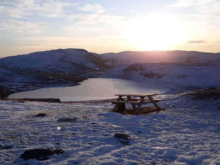
The best spot in Fort Davis for camping is Davis Mountains State Park. This state park, nestled below the stacked mountains and rolling hills, offers unrivaled night skies and remote camping!
There are 3 designated campgrounds at Davis Mountains State Park. There is also primitive camping, with a 4 mile walk in and an elevation gain of 800 feet, so be prepared! Campsites at Davis Mountains State Park can be reserved in advance online here.

Accommodations in Fort Davis, TX
If camping is not on your agenda, there are plenty of other accommodation options in and near Fort Davis, TX. This includes:
- RV parks
- Historic hotels like the Harvard Hotel and Hotel Limpia
- Vacation Rentals
- Hotel Chains in nearby Alpine, TX
Book your Accommodations Here!
Other Outdoor Attractions Near Fort Davis, Texas
There are several other outdoor adventures to be had near Fort Davis, Texas, including several state parks and small towns.
Balmorhea State Park
Balmorhea State Park offers something unique in the way of Texas state parks, and it’s the main reason this park shows up on many “best state parks in Texas” lists, as well as being a popular family vacation spot topper. There is no hiking here, but there is plenty of water! Balmorhea State Park actually houses a cavernous pool that is extensive enough to actually allow for scuba diving, as well as more leisurely enjoyment!
Marfa
Marfa is renowned as a artist haven, and it makes true on that promise. There are plenty of art galleries and unique shops in Marfa, but there are also some fun outdoor options for those who prefer that route.
One fun outdoor thing to do in Marfa is to go on an outdoor artwork/sculpture scavenger hunt. There are a handful of interesting and quirky outdoor exhibits, such as the standing columns at “Actual Contact”, an outdoor installation that illuminates at night. Or the standing stones at “Stone Circle”, that are wired to play music on full moon nights. Or the monolithic highway side murals at “Little Reata”. Just a quick jaunt through Marfa’s main streets will provide little discoveries, from historically ornate buildings and architecture, to muraled old vehicles.


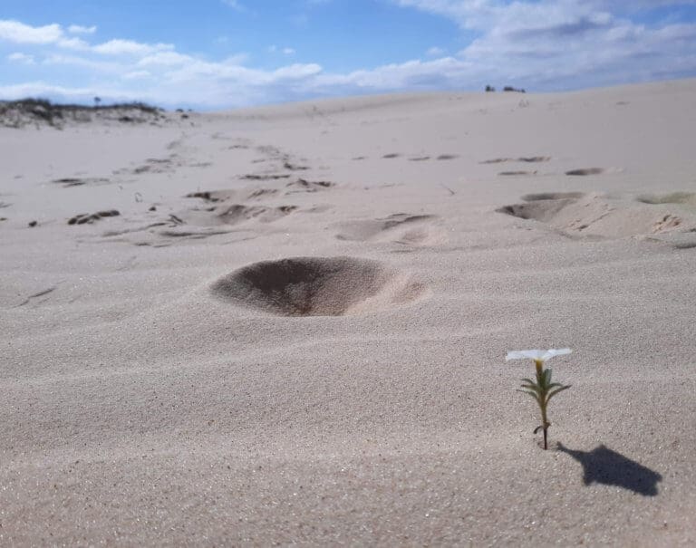
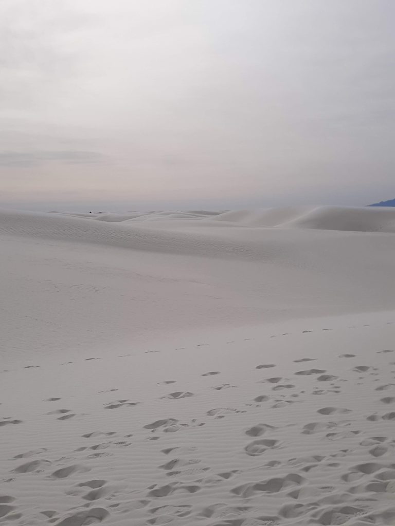
Monahans Sandhills State Park
Located a little over an hour from Fort Davis, Texas, lies another rare gem of west Texas state parks, Monahans Sandhills State Park. A completely different world from Fort Davis, this tiny state park offers something no other state park in Texas can – sand dunes! Miles of sand dunes, on which you can sled, hike, and camp! Check out this sister post to learn more about visiting Monahans Sandhills State Park!

Finally, though it’s not the most strictly “outdoor” venture in Fort Davis, Texas, a stop at the McDonald Observatory is a must if in the area. It will leave you with an overwhelming appreciation for a particular realm of the outdoors. Check out the night viewings, guided tours, and other ways to appreciate this unique look at the west Texas sky!
***Interested in other TEXAS active travel destinations! Check out my list of my favorite Texas adventures!
PIN for LATER!