How to Hike Mount Elbert: The Highest Point in Colorado
There’s a lot of reasons to hike Mount Elbert! To climb Mount Elbert is to conquer the highest point in Colorado, the highest point of the Rocky Mountains, the 2nd highest point in the contiguous United States, and finally, an epic 14’er trail! As far as state high point hikes go, the Colorado high point trek is one of the best! As far as 14’er summits go, this is one of the most attainable and a great beginner 14’er peak to gain confidence and experience on. As far as classic Colorado trails go, this one has all the characteristics of hiking in this state that you have come to love – majestic forests, rugged peaks, wildflower pastures, and crystal alpine lakes! Hiking Mount Elbert is not an endeavor you should just wake up and do on a whim, it takes intentional planning and preparation, and this guide covers everything you need to know to reach the highest point in Colorado, all the way from the Mount Elbert trailhead to its summit!
Length: 9 miles roundtrip out and back
Elevation: 14,433 feet
Elevation Gain: 4,400 feet

Estimated Time: 6-9 hours (it took me 8 hours roundtrip to complete)
Rating: Difficult to Very Difficult (depending on experience and acclimatization)
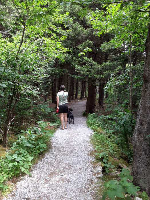
Dog Friendly: Yes, though I personally would not recommend bringing your pup unless they are VERY familiar with this type of length, level of exertion, and rocky terrain.
Best Time of Year to Hike: summer
Fees: FREE – there are no fees required for the Mount Elbert hike
Permits: there are no permits required for the Mount Elbert hike
Parking and Facilities: there is ample parking at the trailhead, but it fills up VERY QUICKLY, especially during peak season and on the weekends! There are bathroom facilities at the trailhead, but plan on a long line.

Disclosure: Below are some affiliate links-these are all products I highly recommend. I won’t make any recommendations on this page that I haven’t tested or personally used! Enjoy this guide to hiking the highest point in Colorado!
Table of Contents
Guide to Hiking Mount Elbert Colorado
A couple key factors go into planning to hike Mount Elbert. The logistics, location, and beginning of the Mt. Elbert trailhead, training to climb Mount Elbert at steep grades and high elevation, and being knowledgeable about the specifics of the Mount Elbert Trail and the summit of the Colorado high point, are a few things covered in this guide.
- Background Info and Location
- Logistics and Planning
- Training and Preparing to Hike
- Full Trail Report
- Gear Recommendations

Get ready to climb Mount Elbert and the highest point in Colorado!
Location of The Highest Point in Colorado
Mount Elbert Colorado is located in central Colorado, in the San Isabel National Forest. It is the highest point of the Rocky Mountains as well as the highest point in Colorado. Only one peak in the lower 48 states dominates Mount Elbert, and that is Mount Whitney, the state high point of California.
Mount Elbert is just one peak in a string of stunning and challenging neighbors, including some other big names in the 14’ers category, such as Mount Princeton, Mount Yale, and Mount Massive just to name a handful.
*Ironically, Mount Elbert is located immediately adjacent to Mount Massive, the 2nd highest peak in Colorado. Some diehard Mount Massive fans feel that it is more deserving of being the state high point, and there were even efforts to help “push” Mount Massive into the lead in the past, but alas Mount Elbert is still the highest point in Colorado today!
The two nearest cities to Mount Elbert are Twin Lakes and Leadville. Leadville is slightly larger and has more amenities and options for out of towners than Twin Lakes. Though there are National Forest campgrounds at the surrounding are of Mount Elbert’s base, they are competitive and fill up quickly.
If you find yourself needing to lodge in town prior to climbing Mt. Elbert, my recommendation is the town of Leadville. There are a handful of small and boutique hotels, and a handful of vacation rentals available. Leadville conveniently rests at just over 10,000 feet in elevation, so it is an ideal location to begin acclimating to the altitude, just by being there! And acclimating to the altitude correctly and intentionally is one of, if not the most important, factor in a successful Mt. Elbert hike! Leadville also has a handful of great restaurants to eat at, for carbing up in advance of your hike, to feasting post hike in celebration and recovery!
Map of the area surrounding Mount Elbert
Preparing to Hike Mount Elbert
Before we get to the details of the Mt. Elbert trailhead and the Mt. Elbert hike, it is important to focus on the importance of being physically and mentally ready to climb Mount Elbert and its over 4,000 feet of elevation gain. Not everything you read online is an accurate depiction of hiking Mount Elbert.
As I was preparing to hike Mount Elbert, one of the most common things I read from others’ experiences was that Mount Elbert was a relatively easy 14’er to summit. I feel the need to delve more into this statement, as reading this and then stopping there in your preparation would be a mistake for many!
The Mt. Elbert hike is NOT EASY! However, in comparison to other 14’ers, it is easIER! For locals who hike Colorado trails and live at higher altitude, it is easier! For those with at least moderate experience at higher altitude hiking and uphill climbs of this type elevation gain, Mount Elbert will be easier! Reaching the Colorado high point will not be easy if you don’t regularly hike at incline, or don’t have access to higher altitude trails, or don’t acclimate properly before hand.
Looking for some training exercises that can help you get ready no matter where you live?
Take me, for example, a Texan coming from the low elevation plains of my state, where the average elevation gain on a 7 mile hike might be less than 500 feet! For someone like me, reading that Mount Elbert is relatively easy could be very misleading! Luckily, I knew that climbing Mount Elbert would involve training before hand, and proper acclimation to the altitude before hiking the highest point in Colorado!
All that being said, Mount Elbert is considered to be among the easier 14’ers in Colorado to summit. It is a Class 1 with zero technical aspects to it. It is pretty straightforward as far as 14’ers go, which again, makes it EASIER IN COMPARISON! If you are looking to conquer your 1st 14’er and gain some summit experience at that altitude, then absolutely, Mount Elbert is an ideal candidate and a great place to start!
When is the Best Time to Hike Mount Elbert?
What WOULD make hiking Mount Elbert harder to hike? The time of year. The best time of year to hike Mount Elbert is the summertime, specifically May through October, when there is the least chance of snow or ice on the trail. It is possible to hike Mount Elbert in the fall, winter, or early spring, in those winter conditions, but this is only recommended for very experienced winter hikers who are familiar with winter conditions and possess the proper winter hiking gear.
How Long Does it Take to Hike Mount Elbert?
There is no set answer on this, and no hiker should ever hold themselves to a specific time. It depends on your pace, your breaks, and how you adjust to the altitude. The average time it takes to hike Mount Elbert is 7-9 hours.

Training to Hike Mount Elbert
So how do you train to climb Mount Elbert? If you are a local with access to the type of terrain and topography you will see while hiking Mt. Elbert, then by all means, practice on what is available to you right outside your front door!
Try to do as many uphill hikes, at higher altitude, with at least a couple thousand feet in elevation gain, and close to 7 or 8 miles. Mix those hikes in with strength training, cross training exercises, and high intensity interval training routines a couple times a week prior. I would recommend following this training routine for 2 or 3 months prior to hiking Mount Elbert, if you consider yourself fairly new to hiking, and specifically hiking mountains and/or high altitude hikes.
Download your own HIIT Home Workout Routine HERE!
Now, if you aren’t a local, how can you adequately train to hike the highest point in Colorado? Let’s say you live in a place like central Texas – what can you do?
1). First, I would make sure to be doing some strength training/high intensity interval training several times a week for a couple of months leading up to climbing Mt. Elbert. I have created a guide to 6 hiking training exercises that you can do from literally anywhere, including exercises like squats, steps ups, and lunges.
2). Second, create a high intensity interval training routine you can use in conjunction with your strength training several times a week! I’ve created one I personally use HERE!
3). Thirdly, cross train! In addition to the above recommendations, try to mix in cross training opportunities, such as going for a run (with hills even better), kayaking, biking, Pilates, etc. Hiking is a full body workout, so it is good advice to engage all the muscle groups to get your body firing on all fronts!
4). Get creative! One of the best ways to get creative when training for Mount Elbert, or any 14’er, is to take the stairs and inclines when you can! Walk that little extra distance when you can. Find some hills in your own neighborhood. Take the stairs in a parking garage or school stadium. Just be sure to look around and use what you have readily available. If you use a gym, you can also find plenty of ways to train on incline that way as well.
5). Lastly, and this is important, you do need to try to find a suitable trail to practice on, at a similar distance. If you live somewhere like Texas, you simply aren’t going to find a trail that closely resembles Mount Elbert, considering the highest point in Texas at remote Guadalupe Peak has an elevation of 8,750 feet and a gain of under 3,000 feet.
However, do your best to find a trail, ideally 5+ miles in length, with as much elevation gain as possible. For example, my training trail is my local multi-use trail that is 7 miles in length, with 500 feet in total elevation gain. It is a humble trail, but it still serves as a valuable part of my training regimen. I approach this trail with the mindset that I have to give it all I have, at the fastest pace possible, with as few breaks as possible, to get the most out of it. And when I need to up my elevation gain, I can always do loops on the sections with the most gains.
And I believe that is the key. Even a 7 mile trail with 500 feet elevation gain can be extremely beneficial, if you train on it by giving it 100% of your effort every time, at your best achievable and sustainable pace. Doing a longer distance, all effort hike like this at least once a week can greatly help prepare you to hike Mount Elbert, when done in conjunction with the accompanying recommendations of strength training, HIIT training, and cross training.
Last Minute Prep Ideas for Hiking Mount Elbert
The most important and final step in preparing to hike Mount Elbert is acclimating to the high altitude, especially if you live at low altitude. Being adequately prepared for high altitude is probably the best tip I can give for prepping to climb Mount Elbert.
In my experience, acclimating to high altitude is ideally done over 3 days. 3 days is the sweet spot for me, but 2 days is ok. I would not recommend only 1 day of acclimating prior to embarking on the Mount Elbert hike, unless you are a local already acclimated.
I would recommend giving at least 2 days prior to hiking Mount Elbert to acclimate at higher altitude, especially for those coming from lower elevation. Again, staying in Leadville, the closest town to Mount Elbert, and a town at over 10,000+ feet elevation, is ideal. During those 2 days prior to hiking Mount Elbert, go on a short, several mile long warm up hike, ideally at high altitude, to help acclimate. There are a handful of great warm up hikes easily accessible to Leadville. I used the AllTrails app to locate my warm up hikes. The Mineral Belt Trail is also a great trail that is located right in the heart of Leadville itself, which is perfect due to Leadville already sitting at high altitude.
Do not underestimate the importance of acclimating, as altitude sickness is a very real possibility when hiking at 14,000 feet. I have seen the effects of altitude sickness several times in my hiking experience, and it has to be taken seriously.
In my own opinion, the hardest aspect of the Mount Elbert hike is the altitude, not the steepness. Though the altitude makes traversing the steep grade harder of course! I myself began to struggle with the altitude just below the summit of Mount Elbert, but I had acclimated properly, knew what to watch for, and knew how to respond.
Mount Elbert is a VERY popular trail. You will be hiking Mount Elbert with possibly hundreds of others, many of whom may fly by you. Do not allow this to change your own trajectory. Know your pace, drink plenty of water, and rest when you need to. Set your eyes on that next large stack of boulders a hundred feet up the trail, and know that you will take your next break when you get there. Break it up that way, and repeat all the way up if necessary! Do not overdo it or push harder than you know you should, as that is when altitude sickness can creep up!
If the early warning signs of altitude sickness progress, that is your sign to begin descending.
Another tip involves meal planning. If you have read any of my other active travel guides to exploits such as training for long distance running or long distance cycling training regimens, then you may have picked up on my belief that meal planning in the days leading up to a big physical challenge is an important prep step. And I think that it goes for climbing Mt. Elbert as well.
In the days before this big, challenging hike, be mindful of possibly upping your intake of healthy carbs, such as sweet potatoes, oat meal, and whole grain pastas and breads. And especially partake in plenty of these the night before you hike Mount Elbert.
Finally, while completing the Mt Elbert hike, make sure to eat snacks frequently and hydrate consistently. That will also help to not only fuel a successful climb of Mount Elbert, but also with the altitude and preventing sickness. Think snacks that are lightweight and easy to pack, easily digestible, with high energy intake.
*Insider Tip: so what snacks exactly are in my pack for the Mt Elbert hike? Here’s a few of my favorites:
- peanut butter and jelly sandwich
- meat and cheese sandwich
- RX bars
- beef jerky sticks
- squeezable peanut butter packets
- squeezable applesauce packets
- tuna packet
- NUUN tablets
- GU energy gels
- Trail Mix
Before your hike, make sure to check the weather forecast for Mount Elbert. Not just the area near it, as weather patterns can be very different at the base of a mountain or mountain range, than it is on a summit, especially a 14’er summit! The best way to check the forecast for Mount Elbert is at mountain-forecast.com.
mount elbert trail report
Here’s a glimpse by glimpse guide to climbing Mt. Elbert, from arriving at the Mt. Elbert trailhead, to summitting the highest point in Colorado and the highest point in the Rocky Mountains!

Quick Facts on the Mount Elbert Hike
(there are multiple routes up to climb Mount Elbert, but this post will refer to the standard route on Mount Elbert’s Northeast Ridge, also referred to as the North Elbert Trail)
Trail from the parking area to the summit of Mount Elbert
Length: 9 miles roundtrip out and back
Elevation: 14,433 feet
Elevation Gain: 4,400 feet
Estimated Time: 6-9 hours (it took me 8 hours roundtrip to complete)
Rating: Difficult to Very Difficult (depending on experience and acclimatization)
Dog Friendly: Yes, though I personally would not recommend bringing your pup unless they are VERY familiar with this type of length, level of exertion, and rocky terrain.
Best Time of Year to Hike: summer
Fees: FREE – there are no fees required for the Mount Elbert hike
Permits: There are no permits required for the Mount Elbert hike
Parking and Facilities: there is ample parking at the trailhead, but it fills up VERY QUICKLY, especially during peak season and on the weekends! There are bathroom facilities at the trailhead, but plan on a long line.

Arriving at the Mt. Elbert Trailhead
The Mt Elbert trailhead will pull up on Google Maps. It is located a short distance away from Leadville, and is easily accessible. Getting there is not the hard part, parking is.
One of the most important things to know about the logistics of hiking Mount Elbert, is the parking situation at the Mt. Elbert trailhead. Parking is insane, as this is a very, very popular hiking area, and in very close proximity to another beloved 14’er, neighboring Mount Massive. You will have hikers parking for both in the immediate area of the Mt. Elbert trailhead.
During weekdays, you should plan to arrive by 6 am to secure a good parking spot. But on the weekends, especially in the summer, you are going to want to be arriving around 5 am! Yes, 5 am, and that is not an over-exaggeration!
There is a large parking area at the immediate entrance to the Mt. Elbert trailhead, there is nearby parking at the trailhead for Mount Massive, and there is overflow parking and street parking. Sounds like a lot, but on a summer weekend, that will ALL be filled up by 6 am!
If you arrive after 6 am, just be prepared to park a half mile or more away. Might not sound like much, but consider how that will feel to have to walk an extra mile on top of hiking the highest point in Colorado! Also as a side note, there are campgrounds available in the area of the Mt. Elbert trailhead as well, for those looking to camp nearby.
There are no entrance fees or parking fees to park at the Mt. Elbert trailhead, or to park at the overflow or street parking areas in the immediate area of the Mt. Elbert trailhead.
There are bathroom facilities at the Mt. Elbert trailhead, but there will be a line more than likely, so if you don’t want to wait, bring a roll of toilet paper and responsibly create your own outdoor bathroom facility.
There is a simple informational placard at the onset of the Mt. Elbert trailhead, before starting off down the Mt. Elbert trail. The Mt. Elbert trailhead is shaded and in deep forest. It does start out at a gentle and consistent grade for the first mile or so.

Approaching Treeline on the Mount Elbert Hike
As you proceed off that first mile or so, the closer you get to the treeline, the more the trail begins to increase in grade and steepness. There really are very few sections of relative flat after that first mile. In the initial section after the Mt. Elbert trailhead, there will be two different junctions, but both are clearly marked and just continue to follow the signage for Mount Elbert.
You will notice the grade increase as you approach treeline, but it does not arrive at its full steepness until after emerging from the treeline. Treeline occurs just short of 12,000 feet. There is no cover once passing the treeline on your way to the summit of Mount Elbert.
 Leaving behind the treeline on the Mount Elbert hike
Summiting the Highest Point in Colorado
Once leaving treeline, it is all uphill from there, and at a challenging steepness and consistent grade the rest of the way. There is also no cover from the elements, and it can get quite gusty and cold at times. Now may be when you need to break out your Outdoor Research Helium II jacket. Sunscreen is also a must, as the strength of the sun can definitely be felt from this altitude.
Once above treeline, it is important to note that you must pay attention to the weather. Afternoon storms are very common here, and on many high altitude summits, and as an important rule you should always aim to be off the summit before noon! Hence another reason to start at 5 or 6 am!
When you first emerge from treeline, you’ll notice what appears to be a summit, but just know that there are actually 2 false summits you traverse before actually reaching the true summit of the Colorado high point! Psychologically, it helps to know that those initial views are false summits.

After passing the first false summit, the way up to the second continues in challenging steepness and grade, and also begins to get more rocky and uneven. This rockier scree terrain continues to the summit.
After passing the 2nd false summit, the last few hundred feet before reaching the top of Mount Elbert actually level off and are a brief respite from the steep uphill.
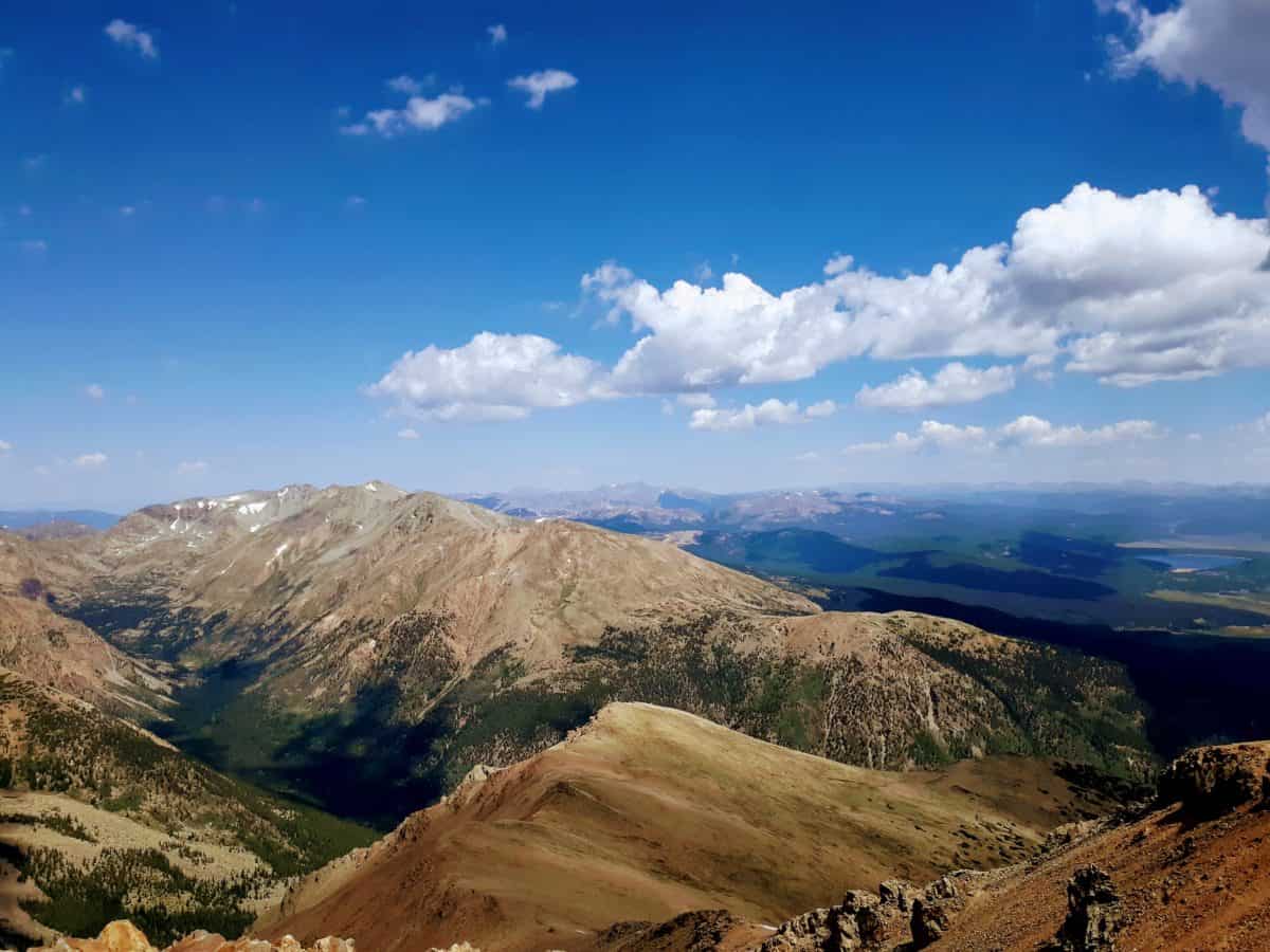
The summit of Mount Elbert is overwhelming, and it is truly amazing just how much you can see from that vantage point! It is a very rewarding view, especially for those who have been dreaming of conquering a 14’er! The summit is fairly large and can accommodate a lot of hikers. Opinions on that may vary, but just don’t expect to have the summit to yourself. There were probably 70 other hikers at the top the day I completed my Mt. Elbert hiking. Enjoy the shared morale with your fellow hikers!
There are also a few wind shelters at the top, and plenty of good resting spots for taking a break and taking in the panoramic views, if the weather allows of course! There are neighboring lakes, the town of Leadville, and neighboring peaks like Mount Massive, to behold from this vantage point on top of the highest point in Colorado and the highest point in the Rocky Mountains!

Descending the Mount Elbert Trail
Descending Mount Elbert the way you came is about as straight forward as the way you came up. There are other trails that arrive at the summit, so make sure that you take the North Mount Elbert Trail down, the same one you took up. You may see signs for the South Mount Elbert Trail, but that is a different trail.
This is not one of those trails where the downhill goes much faster than the uphill. Because of the rockiness and steep grade, going downhill needs to be done carefully and with precision. It can be brutal on the legs, so make sure to have adequate footwear, and reliable trekking poles if you prefer (I will give more personal recommendations on gear below).
Also, given the large amount of hikers that partake in climbing Mt. Elbert, expect for there to be traffic jams and bottle necking on the descent. And again, aim to be descending off the summit of Mount Elbert no later than noon, and always be vigilant in watching the weather, especially while above treeline.
Once reaching treeline again, enjoy the returning shaded canopy and dense forest, and maybe stop for a break on one of the fallen logs that populate the trail just inside treeline!

Gear Recs for Hiking Mt. Elbert
Do not attempt to just wing this ascent up Mount Elbert, be prepared with the right gear!
Gear Quick Links
- Vasque Waterproof Hiking Boots
- Hilly Twin Skin Socks
- Platypus Water Bladder
- Camelbak Helena 20 Daypack
- Black Diamond Trekking Poles
- Outdoor Research Lightweight and Waterproof Helium II Jacket
- Columbia Hiking Pants
- Icebreaker Wool Tank
- Icebreaker Long Sleeve Wool Base Layer
- BUFF
- Emergency Tent / SOL Bivy
- Snacks
Now Let’s Take a Closer Look at that GEAR!!
- #1 – footwear! You will need a sturdy, reliable, hiking boot for this hike. I prefer a hiking boot with ankle support, due to the rocky and uneven nature of the last half of the ascent up Mount Elbert, and for the additional support and sturdiness required for the rocky and dicey descent. On a high altitude hike, it is also important to me that my hiking boots are waterproof, due to the potential to encounter wet conditions. This waterproof hiking boot is my go to, and has seen me up and down a multitude of rocky, high elevation summits across the country – get yours here on Amazon!
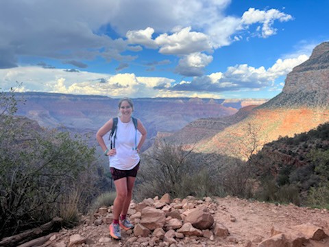
- footwear again! I’m referring to socks this time. Your feet are obviously important on an endeavor such as this, and it is really important to take care of them with not only a reliable pair of hiking boots, but a reliable pair of hiking socks as well. Nothing can ruin a hiking experience quicker than blisters! I used to be extremely blister prone, until I discovered these Hilly Twin Skin socks! The “twin skin” helps to mitigate and prevent the friction that can cause blisters. Haven’t had a single blister since switching to Hilly’s, even on some of my longest day hikes, like the 21 mile long Mt. Whitney hike, or the Grand Canyon’s Rim to Rim hike!
- water transportation system! Pack what you will need, as there are no refill spots on this hike. I would recommend 3 liters for this day hike. I love my wide mouthed Platypus hydration bladder, because it is easy to hydrate on the go, and the wide mouth is super easy to clean and dry afterwards! And it fits nice and snuggly in my favorite day pack, my Camelback Helena Pack, which you can get here on Amazon also!
- trekking poles! I don’t use trekking poles on all my hikes, but I do on hikes like this! I know they will help save my legs on the steep grade and rocky terrain. Get the best in the business with these Black Diamond adjustable trekking poles on Amazon! I love this particular model because the cork handles absorb sweat better and are super reliable to grip!
- outer layer! A good rule of thumb is to always be coming down from the summit of any mountain peak before noon to avoid afternoon thunderstorms, but it is wise to still carry on you an outer layer that is water proof and wind proof, in case you encounter some showers before making it back under treeline. It is tricky to find a fully waterproof outer layer that is also lightweight, but Outdoor Research struck the perfect balance with their Helium II jacket, which weighs only a couple of ounces and compresses down extremely small.
- hiking pants! I wore pants on my Mt. Elbert hike, even in July, because I knew the weather above treeline and at the summit could potentially be much colder and gustier that at the Mt. Elbert trailhead. This is partially a personal preference as to what hiking bottoms you choose to go with, but if you are a hiker who prefers hiking pants, than these Columbia water resistant ones are top notch! Breathable yet durable, water resistant, and equipped with plenty of storage options.
- breathable tops! I choose to layer my tops for climbing Mt. Elbert, and went with both a tank base layer and long sleeve base layer that I could interchange as necessary. No matter what my hike is, or how I am layering for that hike, I always go with merino wool. I have yet to find a better performing fabric for the outdoors! This is my all time favorite merino wool tank that I practically live outside in, OR you can grab this breathable merino wool layering long sleeve that will keep you warm at all your chilly summits!
- buff, buff, buff! If there was one item of my hiking inventory I simply could not live without, it would be my Buff! Investing in one of these changed my hiking experience forever! Buffs are incredibly multi-functional and can be used for a ton of different hiking experiences and environments! You can roll them and use them as a headband to cover your ears and keep your hair in place. You can wear them extended as a neck gaiter, or pull it up over mouth and nose in extremely frigid temperatures, like that time I ran a half marathon on the ice sheet in Greenland! Buffs are reversible, colorful, breathable, and multi-dimensional, as well as compact and easy to pack and carry. You will not regret adding a Buff to your hiking inventory, and you can grab them here on Amazon for an extremely reasonable price!
- sun protection! Bring Chapstick for your lips, a hat to cover your face, and sunglasses to help shield your eyes if necessary. The strength of the sun is intensified here at the high altitude of Mount Elbert Colorado!
- snacks! Bring appropriate snacks for climbing Mt. Elbert! Good ideas for compact, easy to pack and carry, beneficial trail snacks include tuna packets, beef jerky, nuts, bananas, dried fruit, peanut butter, or energy bars that combine certain of these elements. Here’s what I usually include on my mountain treks.
- peanut butter and jelly sandwich
- meat and cheese sandwich
- RX bars
- beef jerky sticks
- squeezable peanut butter packets
- squeezable applesauce packets
- tuna packet
- NUUN tablets
- GU energy gels
- Trail Mix
And there you have it, a glimpse at what it looks like to conquer Mount Elbert, the highest point in Colorado! If you have ever dreamt of hiking a 14’er, it is quite a rewarding and worthy endeavor, and one that you will remember for a long time! If so, the Mount Elbert hike is an ideal candidate, and a great fit for both newbies to 14’ers, or those who are experienced and looking for a timeless classic!
BONUS! Interested in learning about more state high point hikes that take place at high altitude? Be sure to check out the highest point in New Mexico at Wheeler Peak, the highest point in Utah at King’s Peak, and the highest point in Arizona at Humphrey’s Peak!
Want to know about the state high points of all 50 U.S. states?
*Grab your FREE 50 state high points graphic HERE!
PIN for LATER