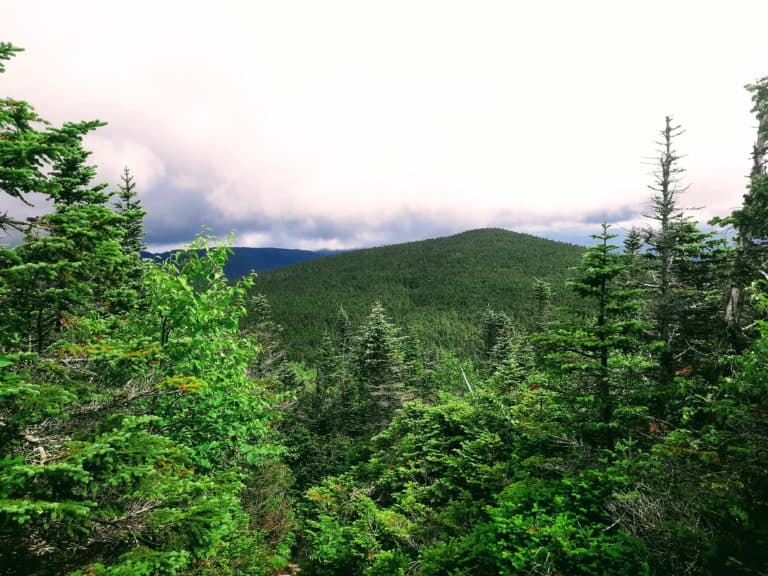
The Mount Mansfield Hike: The Highest Peak in Vermont
Mount Mansfield Vermont is unique among U.S. state high points. Witness the highest peak in Vermont on the Mount Mansfield hike, or drive up the breathtaking Mount Mansfield Toll Road, or both! The great thing about Mount Mansfield is there are options for every type of active traveler who wishes to view all of Vermont, including the stark alpine life and foggy views from this 4,393 foot summit! Everything you need to know about hiking or driving Mount Mansfield Vermont can be found in this guide!

Disclosure: Below are some affiliate links-these are all products I highly recommend. I won’t make any recommendations on this page that I haven’t tested or personally used! Enjoy this guide to the Mount Mansfield hike!
Table of Contents
Guide to the Mount Mansfield Hike in Vermont
Taking in the views from the highest peak in Vermont will instantly transport you to a place unlike any other in the United States! Filled with sheets of rocky bedrock, wisps of fog, stunning panoramas, and stark alpine life, this state high point is a world its own! And you can choose whether you want to experience it all by hiking the Mount Mansfield trail options, or driving the suspenseful and exhilarating Mount Mansfield Toll Road!

Location of the Highest Peak in Vermont
Mount Mansfield is located in northern Vermont, near the quaint mountain town of Stowe. You can hike Mount Mansfield on several trail options, or you can drive up the Mount Mansfield Toll Road, which is located near the Stowe Mountain Resort. The entrance to the Mount Mansfield Toll Road can be found off of Mountain Road 108, north of Stowe.
Mount Mansfield Vermont and surrounding area
Hiking Mount Mansfield Vermont
If you want to hike Mount Mansfield, you are in luck with several trail options ranging in length and difficulty, approaching from both the west and east sides of Mount Mansfield. Here are several popular route descriptions:
From the West:
If you wish to hike Mount Mansfield from the west, your starting point will be Underhill State Park. From Underhill State Park, the two hiking routes are the Sunset Ridge Trail and the Laura Cowles Trail.
Quick Facts on the Sunset Ridge Trail:
Length: 5.2 miles out and back roundtrip
Elevation Gain: 2,536 feet

Rating: Hard
Estimated Time to Hike: 2 hours
Best Time to Hike: Summer – Early Fall
Dog Friendly: Yes – leashed dogs are welcome
- Arguably the best views of the three Mount Mansfield hike options, because much of the trail is above treeline. This does mean that the trail is more exposed, so care has to be given to weather conditions.
Quick Facts on the Laura Cowles Trail
Length: 4.5 miles roundtrip loop
Elevation Gain: 2,555 feet

Rating: Hard
Estimated Time to Hike: 1.5 hours – 2.5 hours
Best Time to Hike: Late spring – Early fall
Dog Friendly: Yes, leashed dogs are welcome
- Laura Cowles is more direct than the Sunset Ridge Trail, thus it is steeper. But it is also more forested and thus more sheltered from any potential weather that comes with the exposure on Mount Mansfield.
From the East:
Approaching from the east is the Long Trail. This is one of Vermont’s most cherished and well known trails. It is almost 3,000 feet in elevation gain, so it is challenging.
Quick Facts on the Long Trail:
Length: 4.6 miles
Elevation Gain: 2800 feet
Rating: Hard
Estimated Time to Hike: 1.5 hours – 2.5 hours
Best Time to Hike: Late spring – Early fall
Dog Friendly: Yes, leashed dogs are welcome
- The Long Trail is the steepest and possibly most difficult of the three hike options, but it is the most popular ascent from the east face of Mount Mansfield Vermont. (If you choose to drive up the Mount Mansfield Toll Road, it is possible to pick up the last 1.3 miles of the Long Trail from the parking lot and thus hike the very end to the actual summit)!
As you can see, all three of these Mount Mansfield hike options are somewhat similar in length and elevation gain. It really depends on which direction you plan to approach from, and whether you want some protection from exposure, or want to brave above treeline for more stellar views!

Driving the Mount Mansfield Toll Road
There are several well known toll roads in this region, one of the most notable big names nearby belonging to Mount Washington, New Hampshire. However, the Mount Mansfield Toll Road humbly puts on its own show in this secluded little pocket of the country.
Driving the Mount Mansfield Toll Road is the easiest way up the mountain, but it is fun and exhilarating all the same. You can still witness a shady drive through the surrounding forest at the onset, and the excitement of emerging through treeline into another world at the top! And even if you choose to drive up to the Mount Mansfield peak, the good news is you can STILL hike part of the ascent to the top.
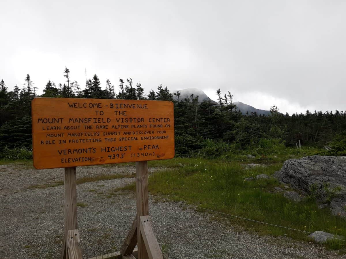
The Mount Mansfield Toll Road ends just barely beneath the actual summit of Mount Mansfield. After parking at the Mount Mansfield Visitor Center adjacent to the parking lot on the summit, at the termination of the Mount Mansfield Toll Road, you will find the short 1.3 mile remainder of the Long Trail.
The trailhead for this portion of the Long Trail to the summit is just past the white Visitor’s Center building, and this portion of the Long Trail will take you 600 feet in elevation gain to the actual summit of Mount Mansfield! This brief summit hike is brimming with unique alpine life along the way, as well as those unforgettable views from the highest peak in Vermont!
Quick Facts on the Mount Mansfield Toll Road
Entrance: north of Stowe on Mountain Road 108.
Length: 4.5 miles one way to the summit
Cost: $25 per vehicle, $9 per additional passenger.
Hours of Operation: Daily from 9:30am- 4:30pm (weather permitting)
Restrictions: No trailers, RV’s, or campers. No motorcycles, bikes, or scooters. Be prepared to descend in your vehicle in first gear due to the grade.

Gear Recommendations for Mount Mansfield Vermont
If you plan to drive to the summit of Mount Mansfield, you will not need much more than a vehicle (that fits with the above restrictions). If you plan to partake in one of the popular Mount Mansfield hike options, you will need more.
- hiking boots! These waterproof boots come with the support, stability, and grip you will need for hiking Mount Mansfield’s steep slopes!
- hiking socks! Your hiking boots are only as good as your hiking socks. My favorite hiking socks are made from unbeatable merino wool, which is moisture wicking, breathable, quick drying, and odor resistant! This is the combination necessary to avoid blisters on any hike.
- water transport system! All the hikes up Mount Mansfield are day hikes, but it is still important to bring enough water for your day. For hikes like these, I use my Camelback Helena daypack, which conveniently fits my 3 liter Platypus wide mouthed water hydration bladder. I love this specific water hydration bladder because it is wide mouthed, which is super easy to clean and dry after use!
- the right fabrics! For hiking, it is extremely beneficial to wear fabrics that are moisture wicking to prevent blistering and trapped moisture, breathable, quick drying, and odor resistant. The best fabric to accomplish this is merino wool. This is my favorite merino wool tank that I practically live in, and this merino wool layering long sleeve is perfect for dropping temperatures and gusty winds!
- weather resistant outer shell! Because hiking to the summit of Mansfield involves hiking above treeline, it is important to be prepared for extreme weather conditions. It is a good idea to prepare by taking along a weather resistant outer shell, like the fully waterproof and windproof Outdoor Research Helium II jacket!
- trekking poles! I do not bring along trekking poles for every hike, but I will bring them when there is a certain degree of steepness and incline. These hikes are relatively short, but they can be difficult in steepness, so it is a personal call in regards to how much you may need to utilize a pair of trekking poles. These poles are the best in the business!
*This is not an exhaustive list of day hiking gear you might need for the Mount Mansfield hike. Get your own Day Hiking Checklist HERE!
Other Must Do’s Near Mount Mansfield Vermont
There are a TON of other outdoor opportunities close to Mount Mansfield!
Underhill State Park
Located on the west side of Mount Mansfield, Underhill State Park has hiking and camping options of its own. There are four hiking trails to the summit of Mount Mansfield from Underhill State Park. You can also witness some unique alpine life existing here, typical of that type of flora and fauna usually found in Arctic regions.
Smugglers Notch State Park
Smugglers Notch State Park is a day use and campground area located in a mountain pass outside of Stowe, Vermont. This park’s cliff lined borders are perfect for climbing, bouldering, and cave exploring, in addition to several great hikes!
Mount Mansfield State Forest
In addition to Underhill and Smuggler Notch State Parks, Mount Mansfield State Forest also houses Little River State Park and Waterbury Center State Park, so there’s plenty of outdoor explorations to be had in this state forest, including camping and hiking on trails like the Long Trail!
If you are looking for opportunities outside of hiking, Mount Mansfield State Forest has two options – the Stowe Mountain Resort and Smugglers Notch Resort, both excellent options for skiing!
Bingham Falls
Located along Mountain Road 108 north of Stowe, is a special attraction, Bingham Falls! This deeply forested area is home to a 40 foot cascading waterfall known as Bingham Falls, which can be accessed from a short, easy, 0.5 mile hike on the Bingham Falls Trail. There is only a brief steep section of the trail near the base of the falls.
There it is, all the faces of the highest peak in Vermont, and all the tips to get the most out of your visit! If you want to check out another awesome state high point hike nearby, check out the hike to the highest point in New York at Mount Marcy! It is one of my favorite hikes, and one of the top experiences in the Adirondacks!
Curious about other state high point hikes?
Grab this FREE download of all 50 U.S. state high points!
RELATED ARTICLES:
- 50 State High Points of the US
- Hiking Mount Marcy: the Highest Point in New York
- Guide to Hiking and Driving Mount Washington
PIN for LATER!