Top 3 Hiking Trails in Ruidoso NM
Ruidoso New Mexico is a small town haven for outdoor lovers. This underrated mountain town is surprisingly only a short drive away from one of the most barren deserts in the Southwest, but you wouldn’t know it from the surroundings here! If you are looking for the best of Ruidoso hiking, check out these top 3 hiking trails in Ruidoso, NM!
- Grindstone Canyon Trails
- Cedar Creek Recreation Area
- Alto Reservoir / Eagle Creek Trail

Disclosure: Below are some affiliate links-these are all products I highly recommend. I won’t make any recommendations on this page that I haven’t tested or personally used! Enjoy this guide to the top hiking trails in Ruidoso NM!
Table of Contents
Guide to the Top 3 Hiking Trails in Ruidoso NM
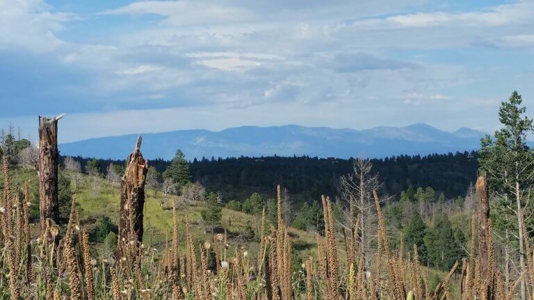
For your convenience, I’ve narrowed down this list to the top 3 hiking trails in Ruidoso, NM. In this mountainous region, bordered by the White Mountain Wilderness to the north, and Lincoln National Forest to the south, rest assured that there are far more than just 3 hiking trails near Ruidoso. But for the best of the best, located right near the heart of Ruidoso (where most visitors are probably based), these are the top 3 trails.
These top hiking trails in Ruidoso combine majestic forests, pristine mountain lakes, and the serene calm of a highly underrated mountain destination!

Location of Ruidoso, NM
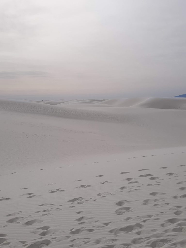
Ruidoso is located in south central New Mexico. It is surrounded by the White Mountain Wilderness and Lincoln National Forest. It is only an hour away from another stunning New Mexico destination, in a starkly contrasting environment – White Sands National Park!
CHECK OUT: 6 Best Hikes in White Sands National Park
In fact, within about a 3 hour radius of Ruidoso, you can hit up THREE National Parks: White Sands National Park, Carlsbad Caverns National Park, and Guadalupe Mountains National Park, in neighboring Texas!
CHECK OUT: Best Southwest National Parks Road Trip
Map of the Best Hiking Trails in Ruidoso NM
Use this map below to locate the 3 best hiking trails in Ruidoso: Grindstone Canyon, Cedar Creek Recreation Area, and Alto Reservoir/Eagle Creek Trail.
Map of the best hiking trails in Ruidoso NM
Tips for Hiking in Ruidoso, NM
- Check the weather – mountain weather fluctuates unexpectedly, and elevation can cause rapid changes. Mountain-forecast.com is a great resource for checking summit weather forecasts specifically!
- Start early – less crowds, less potential for afternoon showers.
- Dress in layers – due to the above mentioned potential for weather changes and fluctuating conditions/temperatures. A lightweight, fully waterproof outer layer is a great item to carry for pop up showers.
- Bring all necessary day hiking essentials
- Bring plenty of healthy hiking snacks
- Download offline maps – if you use an app or similar, download offline maps due to some areas having limited cell coverage.
- FREE hiking – these top 3 hiking trails in Ruidoso are all FREE! FREE parking, FREE access.
- Familiarize yourself with your trail – know your chosen trail beforehand (trailhead location, elevation gain, distance, etc.)
- Know your abilities – don’t bite off more than you can chew, some of these trails are rated hard and are full day hikes
- Watch for signs of altitude sickness – some of these trails climb near 8,000 feet, which is where some individuals might begin to experience signs of altitude sickness.
- Watch for wild horses that live in the area, you may spot them on the trails or just out and about in Ruidoso
- Respect wildlife – there are plenty of elk and deer on the trails, give them plenty of space!
- Bathrooms are located at the trailheads or on the trails of all 3 of these top trails in Ruidoso
Best Hiking Trails in Ruidoso NM
#1: Grindstone Canyon Trails
- Parking/Facilities: there is plenty of parking at the trailhead. There are also restrooms and a picnic area.
This hiking trail(s) in Ruidoso is #1 for a reason. It combines all the best things about mountainous hiking, plus there are options for families, as well as all ages and abilities. You can spend an hour here, or a whole day!
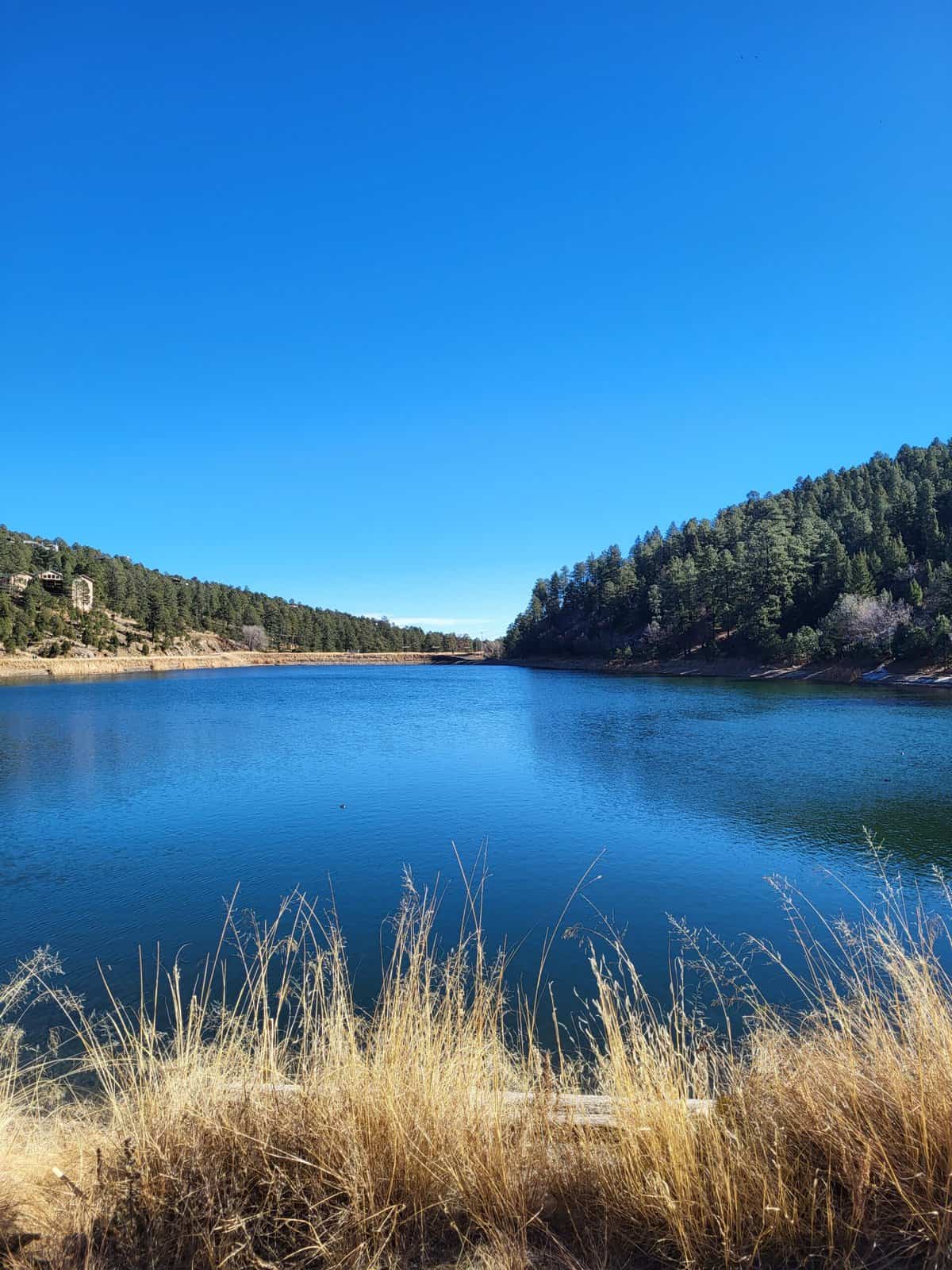
Grindstone Canyon surrounds Grindstone Lake, a picturesque, calm, and strikingly blue lake nestled at the base of the surrounding mountains. There are several trail options here, ranging in length and difficulty level. There are also plenty of options for simply sightseeing along the shore, with numerous picnic tables, benches, and fishing docks located adjacent to the parking area.

There are 4 main trail routes to hike at Grindstone Canyon:
- Grindstone Lake to Winchester Road
- Grindstone Lake Loop
- Grindstone Mesa Loop
- Grindstone Lake Extended Loop
All 4 start in the same location, at the main trailhead located by the parking lot, on the north side of Grindstone Lake.
Grindstone Lake to Winchester Road Trail
- Length: 1.9 miles roundtrip out and back
- Rating: Easy
- Elevation Gain: 232 feet
- Estimated Time to Complete: 45 – 60 minutes

This is the easiest and shortest trail option at Grindstone Lake. This trail route starts off overlooking Grindstone Lake below, before meandering on through patches of exposed sun and shady forest.
*Note that this trail option doesn’t officially end at a designated spot or “turnaround” location. It is part of a larger loop trail. You can stop and turn around at any point, but this length is a popular turn around location, and maintains the easy rating before any bigger climbs.
Grindstone Lake Loop
- Length: 6.7 miles roundtrip loop
- Rating: Moderate
- Elevation Gain: 797 feet
- Estimated Time to Complete: 2.5 – 3 hours

The Grindstone Lake Loop departs from the same trailhead and follows the same trail as the previous route option, it just keeps going. You can see from the elevation chart above that as the trail continues on, the elevation gain occurs more significantly. This is where this loop trail gets its moderate rating, thanks to some switchbacks and decent climbs.
The name “Grindstone Lake Loop” is somewhat misleading, as this trail does NOT actually loop around the entirety of Grindstone Lake. In fact, most of the trail occurs in the forest surrounding Grindstone Lake. But rest assured, there are plenty of expansive, unobstructed views at the start and finish of this loop trail.
Grindstone Mesa Loop
- Length: 9 miles roundtrip loop
- Rating: Moderate
- Elevation Gain: 1,213 feet
- Estimated Time to Complete: 3 – 4 hours

As with the previous two trail options, the Grindstone Mesa Loop starts at the main trailhead, and continues on to a climb up to Grindstone Mesa, which rests just shy of 8,000 feet in elevation.
This is somewhat a wonky, lopsided, “lollipop” trail more than a true loop trail. The trail follows the “stick” of the lollipop about 3 miles in, before encountering the loop portion of this trail that circles around Grindstone Mesa itself. The loop around Grindstone Mesa occurs from Mile 3 – Mile 6, at which point the trail joins back up with the “stick” for the last 3 miles. So really, half this trail is a loop, and half is a loop.
As you can see from the elevation chart above, the main elevation gain is the ascent up to Grindstone Mesa. Once at the mesa, the loop around is relatively flat, followed by the descent back down to Grindstone Lake. Therefore the majority of the difficulty on this trail option is in the first ⅓ of the hike.
Grindstone Lake Trail Extended Loop
- Length: 11.3 miles roundtrip loop
- Rating: Difficult
- Elevation Gain: 1,233 feet
- Estimated Time to Complete: 4 – 6 hours

This is the longest and hardest trail option at Grindstone Lake. It starts off from the same main trailhead, passes Grindstone Lake, climbs to Grindstone Mesa, passes the mesa, and continues on before gradually descending back down through the forest to the south side of Grindstone Lake, where it winds around the western shore back to the main trailhead on the north side of the lake. It is difficult elevation gain, but simple when put in visual terms: a steady climb up, and a steady climb down. Likely won’t see many other hikers on the trail for the 2nd half past Grindstone Mesa. This is a great option for those looking for a full day hike, or trail runners looking to get in some good distance.

#2: Cedar Creek Recreation Area
- Trailhead Location
- Parking/Facilities: there is parking at Cedar Creek Recreation Area. There are restrooms located at the Sam Tobias Campground and day use picnic areas along the trails.
Cedar Creek Recreation Area is a network of multi-use trails that weave their way through the dense forests of Ruidoso, providing a whopping 30 MILES of trail networks for hikers, bikers, trail runners, horseback riders, campers, and picnickers. It is the only hiking spot on this list that does not contain a lake at its heart. But the stunning forest canopy more than makes up for that, which is why it is rated #2.
My favorite things about Cedar Creek? It has a “locals” vibe, as in, this is where a lot of the locals come to get their workout in. Second, it is deafeningly silent and still. Third, at most times, there will be less people on the trails at Cedar Creek than at Grindstone Canyon or at Alto Reservoir, next on this list. Also, this huge system of trails is conveniently located just steps from Highway 48, one of the main roads through Ruidoso. Lastly, as mentioned before, there are about 30 MILES of trails in this trail system, which means there is literally something for everyone and all skill levels.
Cedar Creek offers undulating trails with lots of frequent ups and downs, making this a fun and exciting trail system for hikers, trail runners, and mountain bikers who frequent this area. You can customize how much and how hard you want to hike here, based on how you put together your preferred route from the network of mutli-use trails. No matter how you hike Cedar Creek, it will keep you on your toes.
The main (and most popular) trails here are the T121 and T121A paths. Then there’s also the T90 Fitness Trail, which contains several exercise stations, like a pull ups station, along its 1.3 mile trail.
Trail intersections are marked, and there are maps located at the trailhead. I would highly recommend not only an offline map, but taking a picture of the trailhead maps before starting off.
The Sam Tobias Campground is located within the network of trails at Cedar Creek. There are also some day use picnic areas within sight of the trails as well.

#3: Alto Reservoir / Eagle Creek Trail
- Trailhead Location
- Parking/Facilities: there is plenty of parking at the trailhead. There are also restrooms and picnic areas.
Eagle Creek Trail at Alto Reservoir
- Length: 2.1 miles roundtrip loop
- Rating: Easy
- Elevation Gain: 170 feet
- Estimated Time to Complete: 45 – 60 minutes

Alto Lake is the smaller sibling of Grindstone Canyon, and is just as peaceful and serene in a smaller, humbler way. Alto Reservoir is extremely accessible, located right off the main road through Ruidoso.

Eagle Creek Trail is the main trail that circles Alto Reservoir. This 2 mile long trail is rated easy, and is the perfect length for those looking for a shorter trail that doesn’t sacrifice on views. It circles the entirety of Alto Reservoir, with a short jaunt into the forest on the eastern portion of the loop trail.
On the west side of Alto Reservoir, you might notice a small pond separated from the main body of Alto Reservoir. The signs will indicate that this is a kids fishing pond, specially designated for children to fish in. A nice touch!


And there you have it, the top 3 hiking trails in Ruidoso NM! A perfect way to sample the best of the outdoors in this beautiful mountain setting. Looking for more to do in the area?
Nearby Attractions to Ruidoso NM
- White Mountains Wilderness – this wilderness area lies to the northwest of Ruidoso, and contains some excellent hiking trails in addition.
- Lincoln National Forest – this is the National Forest that contains all 3 of these top hiking trails in Ruidoso. There are more hiking trails and activities in addition within Lincoln National Forest, including Sitting Bull Falls, one of the top 8 outdoor things to do in Carlsbad, NM.
CHECK OUT: National Park vs National Forest: What’s the Difference?
- Inn of the Mountain Gods – this is a more touristy area at the stunning resort of Inn of the Mountain Gods, but it is still a beautiful place to take a short stroll outside.
- White Sands National Park – White Sands National Park is only an hour drive from Ruidoso, and contains a shockingly different desert environment, full of ivory sand dunes perfect for sledding or hiking on!
- Carlsbad Caverns National Park – New Mexico’s underground National Park is a truly one of a kind destination!
- Guadalupe Mountains National Park – another underrated outdoor destination, this time only 3 hours away in neighboring west Texas. This National Park not only contains some stellar hikes, like these top 8 rugged trails, but it is also home to the highest point in the entire state at Guadalupe Peak! You can find out more about this mountainous National Park in this park guide!
CHECK OUT: Guide to the 50 U.S. State High Points
- Wheeler Peak – speaking of state high points, New Mexico’s own, Wheeler Peak, lies about 5 miles north of Ruidoso, in the mountain town of Taos.
 Inn of the Mountain Gods in Ruidoso NM
PIN for LATER!