How to Have the Best Southwest National Parks Roadtrip
The Southwest is a region that is on fire with diversity and beauty! Where else can you find mesmerizing canyons, striking red rock, towering forests, majestic mountains, stark dunes, graceful rivers, and deafeningly silent deserts? Places you could literally spend a lifetime exploring, hiking, and camping in? Destinations with unforgettable sights and invigorating adventures? The best way to experience the best of the Southwest is to roadtrip through the 5 National Parks that show it off the best! Do you have 9 days? Then you can personally witness the best of this Southwest National Parks roadtrip yourself!

Disclosure: Below are some affiliate links-these are all products I highly recommend. I won’t make any recommendations on this page that I haven’t tested or personally used! Enjoy this guide to the perfect Southwest National Parks roadtrip!
Table of Contents
Planning Your Southwest National Parks Roadtrip
So which 5 National Parks are included on this Southwest National Parks Roadtrip? Those would be:
- Grand Canyon National Park, AZ
- White Sands National Park, NM
- Carlsbad Caverns National Park, NM
- Guadalupe Mountains National Park, TX
- Big Bend National Park, TX
These 5 National Parks are spread out, from west to east respectively, across the 3 Southwestern states of Arizona, New Mexico, and Texas.
For the purposes of this Southwest National Parks roadtrip itinerary, I will be moving from WEST TO EAST. This is because I prefer to start with Grand Canyon National Park, the one park on this itinerary that most people know the most about and is most recognizable to the majority of travelers. Start with Grand Canyon National Park to get a feel for what is in store, but save the destinations that may end up being more of a surprise to you for later as you progress through your Southwest National Parks roadtrip!

Location of the 5 Southwest National Parks
As you move from west to east, you will have a chance to experience Arizona’s Grand Canyon National Park, New Mexico’s White Sands and Carlsbad Caverns National Parks, and Texas’s Guadalupe Mountains and Big Bend National Parks. Below you can explore a map of the parks, cities, towns, attractions, and hiking trails mentioned in this post. You can also get a visual on the mapped out itinerary of this Southwest National Parks roadtrip from west to east.
All noted attractions from this Southwest National Parks roadtrip
A point to point route map for this Southwest National Parks itinerary
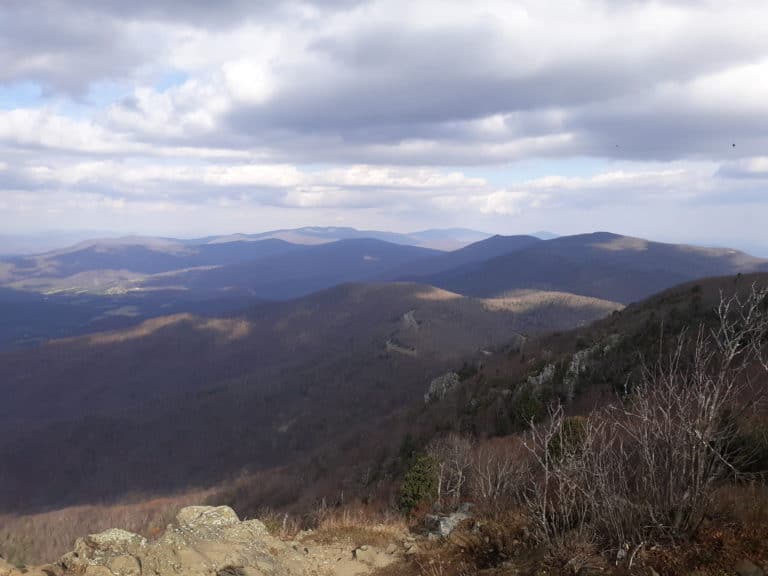
Grand Canyon National Park is located in northern Arizona. The main regions of Grand Canyon National Park are:
- Grand Canyon West
- the North Rim
- the South Rim
This itinerary will explore the North Rim and the South Rim. The nearest towns to Grand Canyon National Park’s North Rim are Jacob Lake, Fredonia, and Kanab, UT. The nearest towns to the South Rim are Tusayan, Flagstaff, and Williams. The nearest major airport is Phoenix International Airport, though Flagstaff also has a regional airport.
Moving east from Grand Canyon National Park, the next National Park is White Sands National Park, in southern New Mexico. The closest town is Alamogordo, and the closest major airport is in El Paso, Texas. New Mexico is also home to the next National Park on this itinerary, Carlsbad Caverns National Park. Carlsbad Caverns is located in southeastern New Mexico, and is actually a close neighbor of Guadalupe Mountains National Park. In fact, these two parks actually share the same mountain range as home, the Guadalupe Mountains! Carlsbad is the closest city to the park. The closest airports are El Paso and Midland/Odessa, in addition to a small airport in Roswell.
Guadalupe Mountains National Park is only about an hour from Carlsbad Caverns National Park, but is actually located in neighboring Texas. The closest town for lodging and amenities continues to be Carlsbad, New Mexico. And the closest airports to Guadalupe are also El Paso, Midland/Odessa, and Roswell.
Finally, Big Bend National Park is located in southwestern Texas. Big Bend is quite remote, and the closest towns are Terlingua, Lajitas, Alpine, and Marathon. The closest airport is in Midland/Odessa, Texas.
Day 1 of Your Southwest National Parks Roadtrip: The South Rim
You can go west to east or east to west on this Southwest National Parks roadtrip, but I prefer west to east, because as you head east, chances are there are more surprises in store with some of the lesser familiar National Parks on this itinerary! So Day 1 starts in Grand Canyon National Park!
I would highly suggest spending a minimum of 2 days in Grand Canyon National Park, so that you can experience both the South Rim and the North Rim. They are drastically different in both appearance and vibe, and both deserve a spot on your roadtrip itinerary.

I would recommend starting at the South Rim. It is closer to any airports you might need to fly into, there are more lodging and amenities, and it is closer to cities that you might need as a jumping off point, like Flagstaff or Williams.
Start Day 1 early by arriving at the South Rim in the morning. You could spend your time walking along the top of the South Rim, visiting the Visitor’s Center or the shops, but if you have one day at the South Rim, I would highly recommend spending the majority of it hiking the South Rim. One popular all ages and all visitor friendly trail is the Grand Canyon South Rim Trail. This flat and paved trail is also wheelchair accessible and dog friendly. It provides easy views that parallel the South Rim, in a point to point format. It is the easiest and most traveled South Rim trail, with plenty of shade, and shuttle stops along its 13 miles in length.
Another great option for a short day hike is the South Kaibab Trail, and you can approach it several different ways. Descend approximately 1 mile down into the canyon (2 miles roundtrip) to reach Ooh Aah Point with its breathtaking dropoff views. Approximately 3 miles down (6 miles roundtrip) and you will reach Cedar Ridge and Skeleton Point, another beautiful panorama of Grand Canyon’s cliffs and canyons.
It is important to be aware that there is no water on the South Kaibab Trail, and very little shade. Temperatures in Grand Canyon can become deceptively hot very quickly, even in shoulder seasons like May or October. Do not attempt to hike into the canyon without several liters of water and a daypack full of the 10 hiking essentials, as well as good common sense. Grand Canyon may be one of the most visited National Parks and the South Rim can appear more touristy and therefore safer, but it does not make the canyon any less deserving of respect.
Anything more than Ooh Aah Point and Cedar Ridge/Skeleton Point should be considered more than a moderate day hike.
Another fantastic option for hiking into the canyon from the South Rim is on the Bright Angel Trail and its many switchbacks. Again, the views are the ultimate payoff, just keep in mind that you may want to plan on only hiking in a mile or two or three, because you will have to come back up, and the ascent is where the real work is. Always consider what your roundtrip effort and time will be!
The upside of the Bright Angel Trail is there are “resthouses” with water and bathrooms approximately every 1.5 miles as you descend towards the Colorado River. 1.5 miles down from the South Rim you will reach the 1.5 Mile Resthouse, a good turn around spot for a shorter 3 mile roundtrip hike. If you go about 3 miles down, you will encounter the 3 Mile Resthouse and then shortly after Indian Garden, a serene little oasis on the trail, and a good turn around spot for a sizeable day hike. Again, be absolutely prepared for hiking in the Grand Canyon, no matter which trail you take. Occasionally there is no water at a resthouse, even on the Bright Angel Trail.
What makes almost each and every trail in Grand Canyon National Park spectacular, is that most likely you will either be hiking parallel along the rim, or hiking into the canyon. Either way, it is a hiking destination unlike any other!
***Optional Add On: If you are up for a truly epic challenge, and you have an extra couple of days to spare, consider a Rim to Rim hike. Now a Rim to Rim hike is not an activity you just show up on a whim to do. It is an event you should prepare for and train for months in advance. But it is a truly unforgettable way to experience Grand Canyon. A Rim to Rim hike involves starting on one Rim of the Canyon, descending down to the base of the canyon, reaching Phantom Ranch at the bottom, crossing the mighty Colorado River, and ascending up the opposite Rim. Many people take on this challenge in one day, while others camp at Phantom Ranch or canyon campgrounds, though it is extremely hard to secure lodging at Phantom Ranch or the campgrounds.
For a full trail report on the Rim to Rim hike, check out my write up here with all the details! If you are curious about what it takes to prepare for, train for, and conquer a Rim to Rim hike, visit my post on my personalized Rim to Rim training guide!
And don’t forget to check out the Yonderlust Ramblings shop with plenty of handy printables, workout trackers, and training trackers to help you get organized and stay intentional in pursuing your active travel goals!
End of Day 1: Depart the South Rim and Travel to the North Rim
By mid afternoon, after hiking or checking out the sights of the South Rim, get ready to depart for the North Rim, and leave behind the more touristed area of Grand Canyon National Park. It is true, the North Rim and South Rim are a surprisingly long driving distance apart from each other, but it will be totally worth it to see the side of Grand Canyon that only about 10% of its visitors ever witness.
The drive from the South Rim to the North Rim takes about 4 hours by car. Lodging at the North Rim is much less available, and it might be a good time to look into options like camping or boondocking, in addition to other traditional lodging options. There is the North Rim Lodge, and some accommodations at the small outpost of Jacob Lake as well. Check out the park website for all National Park overnighting options.
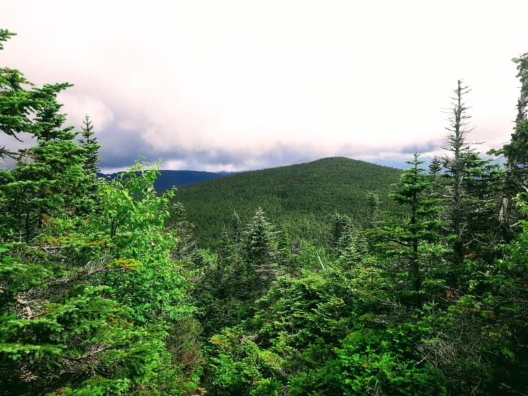
The North Rim has a much different look and feel to it. The first thing you will likely notice is there are far fewer tourists. The North Rim has a more “local” and “natural” feel to it. Its appearance is also different from that of the South Rim. Where the red rock dominates in the South, the North Rim also has lush, deep forests. The aspen trees that populate the North Rim are also stunning, especially in fall!

Day 2 of Your Southwest National Parks Roadtrip: the North Rim
As in the South, the great thing about hiking at the North Rim is the option to hike along the rim of the canyon, or hike down into it. I would highly recommend spending Day 2 on a North Rim hike. There are several great day hikes to choose from. One of my favorites is the North Kaibab Trail (sibling to the South Rim’s South Kaibab Trail). The North Kaibab Trail departs the North Rim in stunning foliage and traverses a downhill descent through tunnels, past waterfalls, and completely enveloped by stunning forest and canyon scenery.
You can take the North Kaibab Trail down just short of 5 miles to Roaring Springs, a delicate and graceful waterfall. This will add up to be a hefty day hike, with a roundtrip close to 10 miles, and the second half consisting of substantial uphill gain,so be adequately prepared!

Or, as mentioned earlier in my South Rim recommendations, if you have extra time and want to take on a really memorable and meaningful challenge, you can take on the Rim to Rim hike from the North Kaibab Trail down to the heart of the canyon, past Phantom Ranch, and over the Colorado River, to the point where North Kaibab meets with the South Kaibab Trail and the Bright Angel Trail on the other side of the river on the South Rim, and you can choose which of the two you wish to take up the South Rim. If you are interested in pursuing this goal, make sure to check out my sister posts on the Rim to Rim full trail report, and my guide to training for a Rim to Rim hike in one day. Again, this is not a hike you just show up and do on a whim – it takes months and months to prepare for and should be taken very seriously!
Another of my favorite North Rim day hikes is the 10 mile roundtrip Widforss Trail, which terminates at the stunning vista at Widforss Point. This multi-faceted and diverse trail takes you along the canyon rim, and on clear days, you can even see the state high point at Humphrey’s Peak looming in the distance from Flagstaff. Towering pines grace this trail, until you reach Widforss Point and the expanse opens up to take in all the grandeur of the Grand Canyon. Even though this is a longer day hike at 10 miles, there is minimal elevation gain and the trail is mostly flat and well maintained.

For shorter day hikes, the Cape Royal Trail and Point Imperial Trails are both short, easy hikes that are family friendly and under a mile each, with unbelievable views. Either of these trails are absolute stunners at sunrise and sunset as well!
While you are at the North Rim, I would highly recommend checking out the North Rim Visitor Center, and also popping into Jacob Lake, the tiny gas station/restaurant/lodge on the way into the North Rim of the Grand Canyon. There’s a small restaurant with good food and some of the best cookies, plus a gift shop. You can book lodging there as well, and Jacob Lake makes for a good home base for any of the hikes that are at the North Rim.
For the purposes of this Southwest National Parks roadtrip itinerary, I would plan to spend Night 2 at the North Rim, or somewhere in the near vicinity. The next stop is White Sands National Park, which is 11 hours drive time east.
Day 3-4 of Your Southwest National Parks Roadtrip: Drive from the North Rim to White Sands
The 11 hour drive can be done in one day if preferred, but I would opt to make this a 2 day drive, and spend the night in between in the charming Southwest town of Albuquerque, and do some local exploring while you are there. There are plenty of things to do in Albuquerque, as well as plenty of lodging and amenities.
It is approximately an 8 hour drive from the North Rim to Albuquerque. On Day 3, get into Albuquerque, have a meal, and settle in. On Day 4, choose an activity to explore in Albuquerque, and then plan to finish the drive to White Sands, which is 3.5 hours from Albuquerque.
Albuquerque is the quintessential Southwest, with turquoise spattered around town, green chile everything, and a rich outdoor scene that is closely tied to the resident Sandia Mountains. I firmly believe that the best way to experience a place is to actively experience it, so look into one of these active outdoor adventures for your time in Albuquerque….and then maybe follow that up with a green chile hamburger and some sightseeing around town, before heading out to White Sands.

The ABQ Biopark is a unique setting that houses a zoo, aquarium, botanical gardens, and beach in Albuquerque. Or travel to the top of 10,378 foot tall Sandia Peak via the Sandia Peak Tramway, a cable car that transports you 3 miles up to a secret world at the top of the Sandias. Here you will find a high altitude collection of hiking trails, along with a restaurant at the top where the tramway stops. You can check out some cool art at Petroglyph National Monument, where you can hike and find thousands of carved rock images left behind by New Mexico’s original inhabitants. The Paseo del Bosque Trail is another great active option for your Day 4 morning, with its 16 miles of flat and easy walking and biking trails, that run alongside the Rio Grande River. This city trail passes some of Albuquerque’s major sights, as well as restaurants.
Any of these Albuquerque activities are a great way to see and experience this town. In the afternoon on Day 4, plan to head towards White Sands National Park. The nearest towns with lodging, vacation rentals, and amenities to White Sands are Alamogordo and Cloudcroft, New Mexico. It is approximately 3.5 hours driving from Albuquerque to either Alamogordo or Cloudcroft. Plan to spend the night of Day 4 in one of these towns located near White Sands National Park.
If you are not lodging in a hotel in one of the nearby towns, there are also plenty of public and private campgrounds located within about an hour of White Sands National Park. The park website is a good source with several suggestions for camping nearby.
Day 5 of Your Southwest National Parks Roadtrip: White Sands National Park
White Sands National Park is unlike any other National Park in this country! It is an alien landscape that, even when standing in the middle of it, will have you wondering how it exists in the middle of the New Mexico desert! There is a magic to White Sands, and an appeal to both children and the child in every adult! There are some serious and grown up hiking opportunities here, but there is also so much opportunity to just let loose and have some fun participating in the most popular White Sands activity: sand sledding!
White Sands makes this activity as easy as possible. Just show up, bring your own sled or rent one from the Visitor Center, and then drive down the main park road, Dunes Drive, until you find a spot you want to sled! The biggest and most popular dunes are located a couple miles down in the interior of the park, but you literally just park, climb a dune,and slide!

You will have so much fun sliding, that you may not even notice the chance to actually get a little workout in as you climb the dunes. Climbing dunes is not an easy task, especially in full sun, so make sure that you have plenty of hydration and snacks. There is a water refill station at the Visitor’s Center, but there are no water stations past that, so make sure to fill up!
I would recommend arriving to White Sands as early as possible, to avoid full sun exposure in the glaring and stark ivory environment. Definitely try out sand sledding to your heart’s content (no visit to White Sands would be complete without it), but also be aware that there are a handful of hiking trails to explore should you choose to include them on your visit as well.

White Sands National Park’s 6 hiking trails range in length from easy half mile boardwalk hikes, to the 5 mile backcountry hike at the Alkali Flat Trail. Each trail is worth exploring the different geology that makes up White Sands. The Alkali Flat Trail is in a league of its own though, and should not be taken lightly. I would not recommend the Alkali Flat Trail to families with young children, as it can be misleading just how challenging it is to hike 5 miles in sand. There is also no water on the Alkali Flat Trail, and it is very remote and isolated in the backcountry. That being said, it is one of my all time favorite hikes in any National Park, just because it is so unique!
With an early start at White Sands National Park on Day 5, you can spend most of the morning between sledding, hiking, driving Dunes Drive, picnicking, etc. Even in the winter, White Sands can warm up by the afternoon, especially in the reflective environment, so you will probably want to time to end your visit after lunch. It is then on to New Mexico’s other National Park, Carlsbad Caverns.
It is about 3.5 hours from White Sands National Park to Carlsbad Caverns National Park. There are plenty of lodging options and amenities in the town of Carlsbad, which is only 30 minutes or so from the actual park. My favorite place to lodge when visiting Carlsbad Caverns National Park is White’s City, located immediately before the entrance to the park. While this older hotel might not be much to look at from the outside, the rooms are spacious and affordable, and the premises are quiet. And you can’t beat the location for proximity to Carlsbad Caverns National Park (and Guadalupe Mountains National Park the following day – White’s City is the ideal home base for both parks and both days). If you prefer, Carlsbad itself is also a very ideal home base location for your explorations of both Carlsbad Caverns National Park and Guadalupe Mountains National Park on days 6 and 7.
Plan to spend the evening of Day 5 in the vicinity of the park and/or Carlsbad. Aside from Carlsbad Caverns, there are 8 other exciting outdoor adventures in Carlsbad, if you choose to add one to your Day 5 late afternoon or evening itinerary.
Day 6 of Your Southwest National Parks Roadtrip: Carlsbad Caverns National Park
Day 6 will include Carlsbad Caverns as the main stop, with travel time to Guadalupe Mountains National Park in the afternoon. Most visitors to the Caverns will choose to explore the Caverns on the Natural Entrance Trail and the Big Room Trail, but just know there are ranger guided hikes, above ground hiking, and special programs to check out that might make you want to extend your time here. You can find out more information on all of these in this guide to Carlsbad Caverns National Park.
That being said, for the purposes of this Southwest National Parks roadtrip itinerary, we will focus on the highlight of the park being a tour through the traditional part of the Caverns.

The heart of Carlsbad Caverns National Park is “the Big Room”, which you can tour at your own pace. To access the Big Room, visitors can hike the Natural Entrance Trail, or take the elevators. The Natural Entrance Trail is 1.25 miles each way, and has an elevation difference of 750 feet. This makes for a very steep trail, and takes about an hour to complete. Note that the Natural Entrance Trail is not accessible, and strollers are not allowed. Again, there is an option to take elevators both ways to get down to the Big Room and back up to the surface.
Once beneath the surface, the Big Room Trail is the most popular trail at Carlsbad Caverns National Park. The Big Room Trail is 1.25 miles roundtrip in length, and is mostly flat. Here you can see other worldly formations of all kinds, and even a rope ladder used in the early 1900’s for exploration. There is an optional shortcut for the Big Room Trail that reduces the distance to 0.6 miles, if needed. Be sure to check out my guide to Carlsbad Caverns National Park to get all the info you need beforehand, like what to expect, what to wear, and what else there is to do above ground.
***Also, please note that there is a reservation system in place for Carlsbad Caverns National Park, and tickets and timed entries must be purchased in advance.


The second half of Day 6 includes driving to Guadalupe Mountains National Park, a short one hour drive away from Carlsbad Caverns. If you have time, choose an additional outdoor activity from this list in nearby Carlsbad, like Sitting Bull Falls, or the Pecos River. Or opt to spend that additional time exploring Guadalupe Mountains National Park.
***Don’t forget – White’s City or Carlsbad are both excellent bases for exploring both Carlsbad Caverns National Park and Guadalupe Mountains National Park, since both parks are only about an hour from each other!
If you choose to spend the afternoon of Day 6 at Guadalupe Mountains National Park, then here are some suggestions for short afternoon hikes. Guadalupe Mountains National Park actually shares the same mountain range as Carlsbad Caverns National Park, so some parts of Guadalupe may have a similar feel to it as Carlsbad Caverns. However, Guadalupe also has a surprising amount of diversity and differing ecosystems, and it is fun to explore trails that will expose you to the rich diversity here. Guadalupe Mountains National Park has a lot – from desert shrubbery, to ponderosa forests, to lush canyons, to high altitude and challenging mountain summit hikes, to trails with historic buildings and ruins. In fact, the state high point of Texas is at Guadalupe Mountains National Park, but we will save that hike for Day 7!

As far as Day 6 goes, one great hiking option is the Devil’s Hall Trail. This 3.6 mile roundtrip point to point hike winds through a slot canyon and climbs some natural stairs to take you to one of Guadalupe’s more mysterious destinations. Or, check out a short part of the McKittrick Canyon Trail. This 20+ mile backcountry hike can be broken into shorter distances, and is just as enjoyable. There are two historic cabins on the trail, as well as the “Grotto”! McKittrick Canyon really shines in autumn with its surprisingly vibrant foliage, but it is a fun and surprising trail any time of year!
You can also check out The Pinery Trail, a short and easy 1 mile hike that contains native flora and fauna, as well as remnants of the old stagecoach station ruins! Guadalupe Mountains National Park has ties to the old stagecoach route, and it is part of what makes this park’s history so interesting.
CHECK OUT: The 8 best hikes in Guadalupe Mountains National Park
After getting a small sample of Guadalupe Mountains National Park, return to your lodging for the night of Day 6, and prepare to explore more of Guadalupe Mountains National Park on Day 7!
***Camping is available at Guadalupe Mountains National Park. There are 2 established campgrounds, as well as primitive backcountry camping. Check out this guide to Guadalupe Mountains National Park for all the info you need if you wish to camp!
Day 7 of Your Southwest National Parks Roadtrip: Guadalupe Mountains National Park
You can spend as much of your day 7 in Guadalupe Mountains National Park as you like, but I would challenge you to spend the majority of the day there hiking the state high point hike at Guadalupe Peak! This 8.4 mile roundtrip hike packs a punch of almost 3,000 feet in elevation gain, disproving the myth that Texas is all flat! It does take an average of 6 – 8 hours for most people to complete, so if you decide to hike Guadalupe Peak, then plan on most of Day 7 being spent on that.
While Guadalupe Peak is definitely challenging, it is a very doable day hike for most age ranges and ability ranges. It also has a fascinating blend of scenery and topography on the way to the summit, and there is a primitive campsite just beneath the summit for those who wish to extend their itinerary by an extra night, and catch a sunset and sunrise at the tallest point in Texas!


If you decide that Guadalupe Peak is not a suitable option for your itinerary, you can always check out some of the other aforementioned trails in Guadalupe Mountains National Park, or explore some others like the Smith Springs Trail or Manzanita Springs Trail, both shorter and more moderate hikes in the park.
***If not hiking Guadalupe Peak and satisfied with the amount of hiking that you were able to do on Day 6, it is possible to shorten your roadtrip itinerary by one day at this point, skip the 2nd day at Guadalupe Mountains National Park, and head on to the final destination at Big Bend National Park. But I would highly recommend exploring a 2nd day at Guadalupe. Its remoteness and secludedness are a real treat and the outdoor activities available here are a real surprise!
After your time in Guadalupe Mountains National Park, plan to continue on in the direction of the final National Park on your Southwest National Parks roadtrip – Big Bend National Park! My recommended home base for Big Bend National Park is the Chisos Basin Campground (or Lodge), due to the close proximity to several standout trails. It is about 4.5 hours from Guadalupe Mountains National Park to the Chisos Basin region of Big Bend National Park.
***If you decide to hike Guadalupe Peak on Day 7 and spend the majority of the day doing that, then you may want to secure lodging in one of the towns on the way to Big Bend, like Fort Davis, Alpine, or Marathon (find out why Fort Davis is my personal favorite), to avoid arriving in Big Bend late at night (especially if you are planning to camp – you will want the daylight hours to get set up). If you end up doing shorter hikes in Guadalupe, or skipping the 2nd day of Guadalupe and continuing on straight to Big Bend, then you can plan to arrive in Big Bend on the night of Day 7.
Day 8 of Your Southwest National Parks Roadtrip: Big Bend National Park
Big Bend National Park is massive, with different entrances and regions spread across it. But for the purposes of this roadtrip itinerary, I would choose the Chisos Basin as home base for exploring Big Bend National Park on Day 8. You could easily spend a week here in Big Bend National Park, but I would recommend a minimum day and a half.
Big Bend National Park has a lot of cherished and iconic outdoor adventures, but it is special in that boating and kayaking is one of the popular ones, thanks to the role that the Rio Grande River plays in this National Park. So when coming up with an itinerary for Big Bend National Park, I would absolutely include time to partake in some of the water opportunities here!

If you ended up staying in one of the small west Texas towns of Fort Davis, Alpine, or Marathon on the Night 7, then you will likely arrive in the Chisos Basin area in mid morning of Day 8. For Day 8, I would settle into the Chisos Basin, whether that is at the campground in an rv or tent camping, or lodging at the Chisos Lodge. Another option is to look into lodging at Terlingua, a small town on the west side of Big Bend National Park, not far from the entrance. Terlingua is an adventure in itself, with its historic roots and unique flair.
I would start Day 8 off in Big Bend National Park with a hike. One of my all time favorites, the Window Trail, can actually be found in the Chisos Basin Campground. The trailhead for the Window Hike is located in the campground itself. The Window Trail is a 5.2 mile roundtrip hike, that traverses through a canyon landscape. The trail starts out in the open expanses of Big Bend, and slowly proceeds to continually narrow until you are bordered by towering canyon walls and cliffs, and find yourself navigating up a natural “staircase” in the canyon, dodging small puddles and ribbons of water from the resident stream, until you climb the final set of rock hewn stairs to the termination of the trail – a elemental carved opening in the canyon wall that overlooks a beautiful vista of the region. It is perhaps one of the most unique “windows” to be found on any trail!

Another one of my favorite hikes in Big Bend is the Lost Mine Trail, also located just a few minutes drive from both the Chisos Basin region and the Window Trail. The 4.8 mile Lost Mine Trail offers a completely different take and different views from the Window Trail. The Lost Mine Trail provides visitors with a brief but challenging uphill hike, overlooking peaks and valleys, to a final payoff that is a stunning summit panorama! The elevation gain on the Lost Mine Trail is challenging, but it is relatively short and consistent.
CHECK OUT: The 10 best hikes in Big Bend National Park

Between those two hikes, you will probably be feeling pretty accomplished at the end of Day 8. Head back to your campsite, lodge, or accommodations in Terlingua for Night 8. If you are in Terlingua, don’t miss out on the chance to eat at the Starlight Theatre, a historic location in town!
Day 9 of Your Southwest National Parks Roadtrip: Big Bend National Park
Day 9 should be all about Santa Elena Canyon, an iconic landmark that provides opportunities to explore Big Bend by land and by water! There are several companies that provide guided kayak and boating tours (if you don’t have your own to bring), and I would highly recommend looking into one of these guides and securing a boating/kayaking guided tour for Day 9.
Whether you have your own vessel or opt to partake in a guided tour, you will soon find yourself at the Rio Grande River’s edge in Santa Elena Canyon. This is the ideal “putting in” spot for water goers. It is a very brief walk from the parking area for Santa Elena Canyon, to the shoreline of the Rio Grande River. You will have to haul your kayak or boat from the parking area to the shoreline in order to launch.

From there, prepare to navigate into one of the most iconic canyons in the country, Santa Elena Canyon. Pros can take an extended kayaking or boating tour longer through the canyon, even a multi day venture, but most guided tours consist of a couple hours exploration into Santa Elena Canyon. They will also likely include a pit stop or lunch break on the shores deep inside Santa Elena Canyon’s more remote areas, a once in a lifetime experience!
After your water activities are over, don’t forget there is an actual trail at Santa Elena Canyon you can choose to explore. The Santa Elena Canyon Trail is only 1.4 miles roundtrip, but actually climbs up the canyon wall to provide a bird’s eye perch and view over the Rio Grande River.

After exploring Santa Elena Canyon, my final recommendation for Big Bend National Park would be to go hot springing! The natural hot springs at Langford Hot Springs/Boquillas Hot Springs are my recommendations, and the when is up to you!
The Big Bend Hot Springs, also known as the Langford Hot Springs or the Boquillas Hot Springs, are about a 45 minute drive from the Chisos Basin region. It is up to you whether you wish to check out the springs in the afternoon or early evening of Day 9, or spend another night and check them out in the morning of Day 10 for a special sunrise experience! Either way, it is a unique part of Big Bend’s identity and history that should not be missed, as well as allowing visitors to get a glimpse of a different region of Big Bend National Park, its eastern side.
So there you have it, 9 perfect days on the very best Southwest National Parks roadtrip! Of course, you can customize this proposed itinerary to fit your specific needs, but I would recommend making time to see each of these 5 Southwest National Parks! They are all so unique, and each is irreplaceable in its ability to shine a light on its home region, geography, and wealth of outdoor adventures!
***Are you checking off the U.S. National Parks as you go?!
Check out the shop for a handy National Parks checklist
for keeping track of your completed National Parks!!!
PIN for LATER!