5 Alternatives to the Rim to Rim Hike
2025 has been a hard year for hikers in the Grand Canyon. Closures like the Bright Angel Trail, re-working logistics, rerouting North to South hikes into South to North hikes, and now the North Rim full closure until at least May 2026, effectively ending Rim to Rim season for 2025 as of July 13th. As sad as all this news has been, it needs to be said that the most important thing to focus on is the preservation of life and that no lives have been lost. Everything else is recoverable. Which brings me to a very popular question right now – what are the best Rim to Rim alternatives? Both in the Grand Canyon itself, or beyond? More than likely, if you had a Rim to Rim hike planned for 2025, you’ve already been training and planning, and understandably don’t want to let that go to waste. And you don’t need to. Let’s take a look at a couple solid alternatives to the Rim to Rim hike, and compare them in terms of logistics, challenge, scenery, and location. I will even go so far as to try and argue how it might even be better – that doesn’t mean I’m saying a hike is necessarily better than the Rim to Rim, but it’s encouraging to hear that lots of hikes out there have their own pros!
- Mt. Whitney, California
- Half Dome, Yosemite National Park, California
- Cactus to Clouds, California
- Rim to River, Grand Canyon National Park, Arizona
- Zion Traverse (segments), Zion National Park, UT

Disclosure: Below are some affiliate links-these are all products I highly recommend. I won’t make any recommendations on this page that I haven’t tested or personally used! Enjoy this guide to the top 5 alternatives to the Rim to Rim hike!
Table of Contents
Alternatives to the Rim to Rim Hike in the Grand Canyon
Here’s the top 5 best alternatives to the Rim to Rim hike, in terms of similar specs, epic scenery, personal challenge, and training/prep requirements. In no particular order.
#1: Mt. Whitney, California
If you asked me what my favorite hike in the world is, some days I’d say the Rim to Rim hike, and some days I’d say Mt. Whitney. That’s how much I adore this trail. The highest point in the lower 48 states, in case you’re keeping track of your 50 state high points like I have been.
The Basics:
- Distance: 21.2 miles roundtrip
- Elevation Gain: 6,663 feet
- Permit Required: Yes (in quota season)
- Best Time of Year to Hike: summer
How’s it Similar to the Rim to Rim?
- Distance and Elevation Gain – The distance and elevation gain will look familiar. In terms of pure physical challenge, this is on the same par. In fact, Mt. Whitney actually packs slightly more elevation gain than a Rim to Rim, even when taking the more challenging South to North route of a Rim to Rim. Of course, this is a true mountain hike, ascend first and then descend, versus the Rim to Rim’s “reverse mountain” hiking where you finish on the uphill.
- Training – Other similarities include a similar training plan for Mt. Whitney (you’ll want to train for this months in advance) focused on sustained endurance and climbing.
- Gear – you’ll need good gear for Mt. Whitney, suited for a full day hike – much like the Rim to Rim.
- Fueling and Hydration – this is a strenuous, full day (or overnight) hike, and you’ll need to be very intentional in knowing what fuels and methods of hydrating work best for you. There is slightly less emphasis on mitigating heat compared to a Rim to Rim, but it still needs to be a high focus due to the altitude and strenuous nature of this hike.
- Start Times – you’ll want to start early for this one too, but instead of starting early to beat the heat, you’ll want to start early to be descending from the summit before noon – mountain hiking 101. Always check summit weather before you start a high altitude hike, because weather at the base can be drastically different than the top. I use mountain-forecast.com when hiking peaks like Mt. Whitney.
- Overnight or Day Hike? – like the Rim to Rim, you can choose whether to tackle Mt. Whitney as a day hike (my preferred way) or an overnight. There are several campgrounds to choose from for backpackers. The pros and cons are similar to deciding between an overnight or day hike Rim to Rim. You’ll have to make your choice at the time of entering the Mt. Whitney lottery.
- Permits – there is a pesky permit system in place during quota season (May-Nov), which just happens to be the optimal time to hike Whitney. The large majority of those who hike Whitney do so during quota season, but only if they won the infamous annual Mt. Whitney lottery. There is a Mountaineers Route, but that should be reserved for very experienced mountaineers only. Unfortunately, the application period for the annual lottery takes place in February, which means it has already closed for this year.
- Bragging Rights – you hike across the biggest canyon in the world on a Rim to Rim, but on Mt. Whitney, you hike to the tallest point in the contiguous U.S. And fun fact, it just happens to be an hour away from the lowest point in the U.S. at Badwater Basin, Death Valley National Park. Makes for a fun post Mt. Whitney hike side trip!
What’s Different?
- Altitude – The altitude is the big difference here, and what might make this harder for some people. This is a 14’er, and so you will need to acclimate prior. I usually allow myself at least 3 days before to acclimate for hiking Whitney (because I don’t live near altitude), which is something I don’t have to do for a Rim to Rim. I also have to keep a close eye on any symptoms during the hike itself. Fortunately, there’s a handful of high elevation warm up up hikes in the immediate area of Whitney. You can take a look at a couple of my personal favorites in my full Mt. Whitney trail guide and Mt. Whitney training plan.
- Best Time – summer! Won’t hear that on a Rim to Rim hike. July and August are great times of year to hike, when the snow melt is gone, and before new snow arrives.
- Route – there’s really only one route for a standard climb. You can choose to hike in from other surrounding areas (like backpackers coming on the John Muir Trail linking up), but on the mountain itself, there is one standard route. No deciding between North – South or vice versa.
- Logistics – once you win the permit, logistics are WAAAAY easier in my opinion. It’s easier to get lodging nearby, there’s no shuttles necessary, plenty of parking, etc.
- Scenery – instead of red rock canyon, you get groves of forests and stark white moonscapes of the higher altitudes. From near the summit, you can see Sequoia National Park in the background. One is not better than the other, but they are both absolutely breathtaking.
What Makes Mt. Whitney Better?
Mt. Whitney is not necessarily a better hike, but it has some pros for those looking for alternatives to a Rim to Rim hike.
- Logistics – easier
- Heat Mitigation – not really an issue
- Crowds – thanks to the lottery system, way less crowds both in the area and on the trail itself
What I Don’t Like about Mt. Whitney – it all mostly comes down to whether you win a permit or not. If you don’t, it’s kind of the end of the road until the next year. And it’s very hard to win the lottery. I apply EVERY year, and I have about a 20ish% success rate. And I utilize all the “tips”, like choosing a weekday vs. weekend, having a small group (1 in my case), and opting for day permits vs. overnight permits (more day hike permits given out). And it’s still a low success rate. As far as the hike itself though (and the surrounding area), I love absolutely everything about it!

#2: Half Dome, California
California happens to have more than one good alternative to the Rim to Rim hike. This one has a lot going for it just by being located in beautiful Yosemite National Park.
The Basics:
- Distance: 16.5 miles roundtrip
- Elevation Gain: 5,305 feet
- Permit Required: Yes (lottery system)
- Best Time of Year to Hike: summer
How’s it Similar to the Rim to Rim?
- Elevation Gain – elevation gain is pretty spot on. Very similar in terms of physical challenge. Of course, this is another true mountain hike, ascend first and then descend, versus the Rim to Rim’s “reverse mountain” hiking where you finish on the uphill.
- Training – You’ll want a similar training plan in advance, focused on sustained endurance and climbing.
- Gear – you’ll need good gear suited for a full day hike, much like a Rim to Rim packing list.
- Fueling and Hydration – this is a strenuous, full day hike, and you’ll need to be very intentional in knowing what fuels and methods of hydrating work best for you. There is less emphasis on mitigating heat like on a Rim to Rim, but it still needs to be a high focus due to the strenuous nature of this hike.
- Start Times – you’ll want to start early for this one too, but instead of starting early to beat the heat, you’ll want to start early to be descending from the summit before noon – mountain hiking 101. Also, you want to start early to beat the crowds on the cables (more on this portion). The cable section to the summit is a lot less nerve-wracking when there’s less people queued up.
- Permits – yep, this is another one of the most popular permit required hikes in the US. While there are a few backdoor ways to try and snag unclaimed permits and such, much of it really boils down to whether you win the lottery on this one, much like Mt. Whitney.
- Crowds – it’s a National Park after all, so expect the same business on the trails, the same competitiveness in scoring nearby campsites, the same challenges with finding a parking spot, etc.
- Altitude – The altitude of Half Dome, rising to just over 8,800 feet, is similar to a Rim to Rim hike, especially the North Rim’s stats.
- Bragging Rights – you hike across the biggest canyon in the world on a Rim to Rim, but on Half Dome, you hike to another one of the most iconic landmarks in all of our National Parks. And conquering the cables is a feat unique to Half Dome.
What’s Different?
- Day Hike Only – nobody’s camping along the Half Dome trail itself. There is plenty of camping located throughout Yosemite National Park close by.
- Distance – a decent amount shorter than a full Rim to Rim, but still substantial at over 16 miles coupled with the elevation gain and the physical challenge of ascending the cables.
- Best Time – summer! Won’t hear that on a Rim to Rim hike. The best time to hike Half Dome is when the cables are up (more on what that means), which is Memorial Day weekend through early to mid October (generally after Columbus Day).
- Route – there’s a couple different ways you can come in on and hike Half Dome, with the Mist Trail (which merges with the John Muir Trail ) being the most popular. But they are all located relatively in the same vicinity.
- Logistics – once you win the permit, logistics are easier in my opinion. While there is lodging and campgrounds nearby, because it is a National Park it can still get pretty competitive. But there’s no shuttles or drop offs/pick ups to worry about arranging between rims.
- Scenery – instead of red rock canyon, you get lush forests and stunning waterfalls, plus the instantly recognizable face of Half Dome.
- Cables – in case you were wondering exactly what the cable section is, it’s the last 400 feet of vertical climbing up that iconic face of Half Dome to reach the summit. It is what it sounds like – cables anchored to the rock face, with wooden boards to step on as you haul yourself up those last few hundred feet. If you have a fear of heights, this can be extremely challenging. If there is bad weather, such as rain, it can make conditions worse due the cable section being slippery. This is a challenge completely unique to Half Dome. You can benefit from doing a little extra upper body training beforehand to help with this haul up. Gloves are life savers for this portion as well. The best advice for tackling the cables? Get there early so you don’t wind up stuck in a line of slow moving crowds trying to summit. The less time spent on the cables the better for most people! The cables go up Memorial Day weekend, and come down after Columbus Day in October (this also happens to be quota season for the annual lottery/permits).
What Makes Half Dome Better?
Half Dome is not necessarily a better hike, but it has some pros for those looking for alternatives.
- Logistics – easier
- Heat Mitigation – not really an issue
- Waterfalls – right off the trail! The Rim to Rim does have Ribbon Falls, but it’s harder to access than the stunners on the Half Dome Trail.
What I Don’t Like about Half Dome – it all mostly comes down to whether you win a permit or not. If you don’t, it’s kind of the end of the road until the next year. And it’s very hard to win the lottery. Yosemite National Park can get a little busy, crowded, and competitive during the summer (much like some parts of the Grand Canyon). And finally, I have yet to meet anyone who actually LOVES the cable section.

#3: Cactus to Clouds, California
If you’re keeping track, that’s three California alternatives to the Rim to Rim hike. Round out the California theme with the Cactus to Clouds hike. This is an under-rated challenge, largely because the scenery isn’t as dramatic, and perhaps because it isn’t located in a National Park, but in terms of a physical challenge, this one actually has a leg up on a traditional Rim to Rim hike. If you really want to find out how much you can climb in a day, the Cactus to Clouds is your ultimate testing ground. It literally contains the most elevation gain of any single day hike in the ENTIRE U.S. at 10,629 feet!
The Basics:
- Distance: 19.5 miles roundtrip
- Elevation Gain: 10,629 feet
- Permit Required: No
- Best Time of Year to Hike: early fall
How’s it Similar to the Rim to Rim?
- Distance – Distance is just slightly less than a Rim to Rim hike. The Cactus to Clouds is another true mountain hike, ascend first and then descend, versus the Rim to Rim’s “reverse mountain” hiking where you finish on the uphill.
- Training – You’ll want a similar training plan to implement far in advance, focused on sustained endurance and lots of climbing. You really want to be ready to climb.
- Gear – you’ll need good gear suited for a full day hike, much like a Rim to Rim packing list. Include heat mitigation gear if you are hiking in hotter months (which is not recommended).
- Fueling and Hydration – this is a strenuous, full day hike, and you’ll need to be very intentional in knowing what fuels and methods of hydrating work best for you. Heat is a big focal point on the Cactus to Clouds, which is why it is recommended NOT to hike in the summer. It gets scorching, and there’s little relief from exposure. You’ll need to have your hydration and fueling plan finely tuned, even in early fall, when it can still be warm in the desert of Palm Springs.
- Overnight or Day Hike? – you can do either on the Cactus to Clouds trail. You do need a permit to backpack, but permits are free. Camping is allowed in designated areas only.
- Start Times – you’ll want to start early for this one too, in order to avoid the heat, exposure, and have enough time to finish.
- Bragging Rights – you hike across the biggest canyon in the world on a Rim to Rim, but the Cactus to Clouds hike contains the most elevation gain of any single day hike in the U.S. – so there’s your bragging rights to finishing.
What’s Different?
- Altitude – San Jacinto Mountain, the home of the Cactus to Clouds trail, contains over 10,00 feet in elevation, considerably higher than the North and South Rims of the Grand Canyon. In fact, the elevation gain on a Cactus to Clouds hike is more similar to the elevation gain of a Rim to Rim to Rim (R3). Which is why you want to time your hike in the fall to avoid the heat, but also beat the incoming snowfall.
- Permits – NOPE. Finally. At least not complicated ones. If you camp overnight on the trail, you will need to secure a FREE, easy to snag wilderness permit beforehand.
- Crowds – there’s barely a whisper of a crowd on a typical day compared to the Rim to Rim hike. I foresee this hike getting more visitors during the 2025 season due to the closures affecting Rim to Rim hikes.
- The Tram – the Palm Springs Aerial Tramway runs from the summit to the base of San Jacinto Peak, and the majority of hikers take the tram down after summiting.
- Best Time – early / mid fall. Think late October and early November, though it varies from year to year. You basically want to go late enough to avoid the worst of the desert heat and exposure, but early enough to beat the snow. There’s also the tram to consider, which does close annually in the fall for maintenance (in 2025 it’s mid September – mid October), so you’ll want to work around those dates if you’re planning on using it.
- Route – there’s really only one route for a standard climb on the Cactus to Clouds. The biggest decision you have in terms of route is whether to take the tram down or hike down after summiting. I’d recommend taking the tram.
- Logistics – can I say there really aren’t any? Plenty of lodging nearby, choose tram or no tram, park nearby or take an Uber (because it’s in the heart of Palm Springs), no permits, no shuttles, no hassle. For those that have never planned for a Rim to Rim hike, it may seem that there are logistical arrangements taking up time, but for those that have planned a Rim to Rim hike, the logistics of a Cactus to Clouds will feel like nothing.
- Scenery – this is what gets most people, and why the Cactus to Clouds hike hasn’t blown up as much as the Rim to Rim hike. It’s the desert. And a lot of the views reflect that. The higher you climb the more you will see the environment morph into higher altitude terrain, but many would argue it’s not on the same playing field as the Grand Canyon. And to be fair I would agree. After all, it’s not surrounded by a National Park. It’s in the heart of Palm Springs. But there’s still plenty to appreciate about San Jacinto Peak.
What Makes Cactus to Clouds Better?
San Jacinto Mountain is not necessarily a better hike, but it has some pros for those looking for alternatives.
- Logistics – so, so, so much easier. This is the biggest advantage by far over a Rim to Rim.
- Climbing Challenge – if you want specific climbing bragging rights, you’ll earn them on the Cactus to Clouds.
- Crowds – minimal in comparison
What I Don’t Like about Cactus to Clouds – The scenery will probably leave you missing certain things, but it has plenty to appreciate. And while there is plenty to do in Palm Springs, it doesn’t contain the same surrounding wealth of natural, outdoor opportunities like the Grand Canyon does.

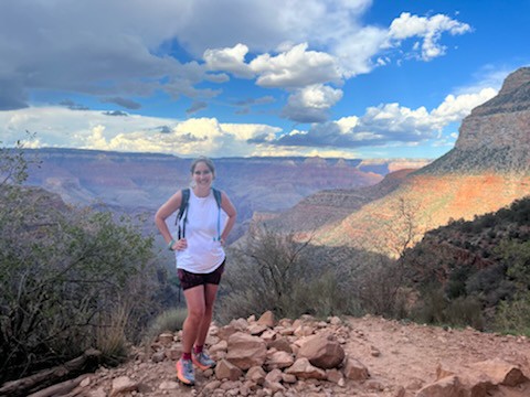
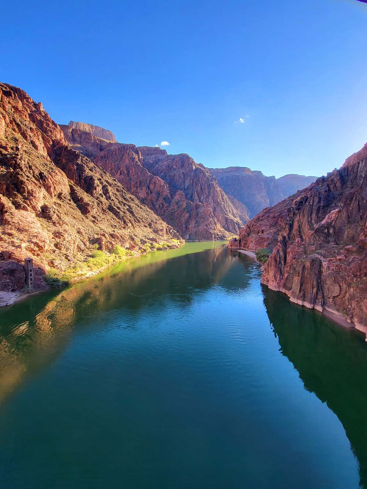
#4: Rim to River, Grand Canyon National Park
Luckily for those that already had plans to be in the Grand Canyon for their planned Rim to Rim hike, there is a great alternative also inside the Grand Canyon, and this one is about the closest replica to a full Rim to Rim you can get. That’s because it shares similar Grand Canyon corridor trails. It’s the classic Rim to River hike via South Kaibab and Bright Angel.
The Basics:
- Distance: 18.5 miles roundtrip
- Elevation Gain: 4,500 feet
- Permit Required: No (unless camping overnight)
- Best Time of Year to Hike: all year (with special care taken in summer)
How’s it Similar to the Rim to Rim?
- Distance and Elevation Gain – The distance is a hair less, and the elevation gain is just about identical to finishing a full Rim to Rim from North to South, because you’re exiting the same way. The physical challenge similarities are there, just a little less in terms of mileage endurance. As far as replicating a full Rim to Rim, the Rim to River hike is the best because it mimics exactly the “reverse mountain” structure of descending first and ascending last.
- Training – You’ll want to train for a Rim to River much the same way you’d train for a full Rim to to Rim. The main difference is your longest training hikes could be a little shorter compared to full Rim to Rim prep. Replicate your training plan to include an endurance focus and climbing focus, and make sure your fueling and hydration is on point, especially if going during the warmer months.
- Gear – you’ll need good gear suited for a full day hike, just like the Rim to Rim packing list.
- Fueling and Hydration – just as important as fueling and hydrating for a full Rim to Rim. Know how you plan to fuel, and test it out. Know your hydration plan and how you will balance and replace your electrolytes.
- Start Times – you’ll want to start early, especially in the warmer months. Ascending during the hottest part of the day is a recipe for trouble.
- Overnight or Day Hike? – like the full version, you can choose between an overnight or day hike Rim to River. You will need a permit to camp overnight on the South Rim corridor trails or at Phantom Ranch.
- Permits – only for camping overnight. But they are hard to snag.
- Altitude – similar to the full Rim to Rim. Not a major concern for hikers, especially when hiking just on the lower South Rim.
- Bragging Rights – you’re still hiking to the bottom of the biggest canyon in the U.S., and you can still see the Colorado River up close. That vantage point is one not every Grand Canyon visitor gets to see.
What’s Different?
- Best Time – you can hike a Rim to River year round, though summer requires special care because of the heat. Special care includes starting early to avoid ascending during the hottest part of the day, and if possible descending South Kaibab and ascending Bright Angel. South Kaibab does not have water and is much more exposed, making it more treacherous to ascend in the summer. I would personally never choose to do so in the summer. And winter can bring ice and snow which are not the best conditions for hiking steep trails. But the advantage of a Rim to River is that it is open year round, compared to the North Rim which closes seasonally from Dec 1st – May 15th.
- Route – like the Rim to Rim, there are different ways you can complete a Rim to River. Technically, a Rim to River can be done anyway that involves going down the South Rim to the bottom and back up. The vast majority of hikers descend the South Kaibab Trail to the Colorado / Phantom Ranch / Bright Angel Campground, and ascend the Bright Angel Trail. Why down South Kaibab and up Bright Angel? There’s a couple reasons: Bright Angel is slightly less steep, though it is longer. It has water, bathrooms, and campgrounds. It has some shade in parts. While South Kaibab is shorter, there is much more exposure and ZERO available water.
- Logistics – a lot easier compared to a full Rim to Rim, because you’re staying on the same side of the canyon. And there’s a lot more availability for lodging, shuttles, taxis, etc. One of my favorite things about Rim to Rivers is being able to call a taxi to pick me up from anywhere on the South Rim or nearby Tusayan (where there’s even more hotels). There’s also the free park shuttle that runs between stops on the South Rim. You just need to make sure its departures line up with your intended plans, as it varies from season to season.
- Scenery – you miss out on the North Kaibab Trail and the North Rim, but you get so much of the classic Grand Canyon vibes regardless. And personally, I think the South Kaibab Trail is the most stunning of the 3 Grand Canyon corridor trails. Not by much, but just slightly, especially at sunrise!
What Makes a Rim to River Better?
There are a few pros to completing a Rim to River, whether your plans are to use it to practice for a full Rim to Rim, or as a stand alone challenge.
- Logistics – way easier, no shuttles, lots of alternative transportation options (free shuttle, taxis, etc).
- Getting to descend South Kaibab in the morning for sunrise
- Not having to worry about a few of the toughest parts of a Rim to Rim hike in terms of heat and exposure – the Box and the Frying Pan
What I Don’t Like about Rim to Rivers – of course you’re missing out on the full Rim to Rim experience, including the North Rim and North Kaibab Trail, but I that is easier for me to stomach than the crowds. Depending on the season, you can expect a lot of crowds on the South Rim side. And a much, much, more touristy feel.

#5: Zion Traverse, Zion National Park, UT
The entire Zion Traverse hike in Zion National Park is about 47 miles long, so more like a Rim to Rim to Rim than a single Rim to Rim crossing. However, there are several great and popular ways to segment the Zion Traverse into a hike that resembles a full Rim to Rim. And bonus is that the scenery greatly resembles the canyons and red rock of Grand Canyon!
The Basics:
- Distance: Depends on which popular segment, but between 14 – 17 miles
- Elevation Gain: varies – some segments are net losses, others are ~ 3,000 feet of gain
- Permit Required: Yes
- Best Time of Year to Hike: all year (with special care taken in summer)
Here’s a look at some of the popular segments of the Zion Traverse, and how they relate to a Rim to Rim hike.
Segment #1: West Rim Trail: Lava Point to the Grotto (most popular)
- Distance: 14.5 miles point to point (need shuttle or drop off)
- Elevation: ~3,000 downhill net loss
Segment #2: West Rim Trail: the Grotto to Cabin Spring (and back)
- Distance: ~17 miles roundtrip (no shuttle needed)
- Elevation:~3,000 feet
How’s it Similar to the Rim to Rim?
- Training – you need to be trained for a hike like this, especially in warmer months when the elements become more of a player, but since the distance and elevation gain are less intense than a Rim to Rim, your training plan doesn’t necessarily need to include as long of training hikes, or as intense of climbing practice.
- Gear – you’ll need good gear suited for a full day hike, just like the Rim to Rim.
- Fueling and Hydration – can be just as important as a full Rim to Rim. There’s exposure, potential heat, and strenuous hiking that can take up a full day. You’ll need to fuel and hydrate properly. It’s not recommended to hike during the hottest parts of the day in the summer.
- Start Times – you’ll want to start early, especially in the warmer months.
- Overnight or Day Hike? – you can choose to camp, though these distances are very doable as a day hike. Summer is a very hot time of year to camp, but camping along these segments is popular in the spring and fall. Overnight permits are required and are hard to come by, of course.
- Permits – only for camping overnight. And they’re hard to get. Check Recreation.gov
- Altitude – similar to the full Rim to Rim. The elevations for these segments of the Zion Traverse range between 6,000 and 8,000 feet, very similar to the Grand Canyon.
- Best Time – you can hike segments of the Zion Traverse year round, but summer is the least ideal due to the oppressive and dangerous heat. Fall and spring are the more popular times.
- Route – like the Rim to Rim, there are different ways you can complete a segment of the Zion Traverse, as listed above with two of the most popular options.
- Logistics – the logistics can be challenging like a Rim to Rim. Maybe slightly less. A lot of that will depend on the segment you pick. Some segments, like Lava Point to the Grotto, are going to require a shuttle or personal drop off. Other segments can be completed as out and backs and not require transportation logistics. Just like the Canyon, peak times in Zion National Park can get very busy and competitive in terms of lodging, parking, transportation, etc. While you don’t have to deal with getting from one end of a canyon to another, that happen to be 5 hours apart, there’s still a hassle involved. And if you want to camp overnight, permits can be challenging to get.
- Scenery – similar in terms of canyon scenery and red rocks. Some sections of segments include forest as well, reminiscent of hiking a Rim to Rim on the North Rim side.
- Bragging Rights – completing an epic and tough canyon hike in one of the most beautiful National Parks of the southwest.
What’s Different?
- Distance and Elevation Gain – can be decently less in terms of both distance and elevation gain, though still extremely challenging in their own regard.
What Makes a Zion Traverse Better?
As you can see above, the Zion Traverse has more in common with a Rim to Rim than it does in differences. The challenge factor is the main difference. Personally, I don’t have a solid reason that this hike is better than a Rim to Rim, but it is a great similar alternative.
What I Don’t Like about the Zion Traverse – it’s not as physically challenging as a full Rim to Rim, and I personally like the challenge. The crowds and busyness of Zion during peak times is also a downside. It’s disheartening that the more popular segments also require shuttles or drop offs.

Runner Ups:
Here’s a few runner ups to consider. In some ways they have a lot less similarities to a Rim to Rim hike, but still honorable mentions to consider.
- The Enchantments – Alpine Lakes Wilderness, Washington
- McKittrick Canyon – Guadalupe Mountains National Park, Texas
- Angels Landing, Zion National Park, Utah (stand alone or add on to a Zion Traverse segment trip)
- Kalalau Trail, Na Pali Coast, Hawaii
- The Presidential Traverse, White Mountains, New Hampshire
PIN for LATER!