The Best Cuyahoga Valley National Park Hiking Trails and Camping
Ohio, with its subtle nod to alliteration, populated by its Cleveland’s, Columbus’s, and Cincinnati’s. Add one more to the list: Cuyahoga. If you are looking for a humble spot to get your active travel on, the only National Park in Ohio is the place! Not only will you discover the best of Cuyahoga Valley National Park hiking trails here, but you will find yourself walking through a tapestry of the best waterfalls in Ohio around every turn. Top off your visit with a Cuyahoga Valley National Park camping experience under the stars!
This guide to the best Cuyahoga Valley National Park hiking trails and camping includes:
- What to Know Before You Go
- Location of Cuyahoga Valley National Park
- Background on the Only National Park in Ohio
- Map of the Best Cuyahoga Valley National Park Hiking Trails
- The Best Cuyahoga Valley National Park Hiking Trails
- Cuyahoga Valley National Park Camping /Lodging Guide
- Additional Activities
- and don’t forget about the best waterfalls in Ohio!

Disclosure: Below are some affiliate links-these are all products I highly recommend. I won’t make any recommendations on this page that I haven’t tested or personally used! Enjoy this guide to the only National Park in Ohio!
Table of Contents
Cuyahoga Valley National Park Hiking Trails and Camping
While this guide covers everything you need to know to get the most out of your visit, the highlights here are obviously the Cuyahoga Valley National Park hiking trails, plus the chance to enjoy this slice of the outdoors overnight! Get familiar with the park’s “what to knows before you go”, location, and background, before jumping into the best hikes in Cuyahoga Valley National Park!

What to Know Before You Go
Entrance Fees: FREE!
Hours: Cuyahoga Valley National Park is open daily. Most areas are open 24 hours a day, with a few exceptions open from dawn til dusk, like Brandywine Falls.
Best Time of Year to Visit: late spring – early fall. Shoulder seasons are beautiful in Cuyahoga Valley National Park, with blooming foliage and mild temperatures in the spring, and brilliant fall colors and moderate temperatures in the fall. Summer highs can reach the mid 90’s and it can be quite humid, but this time of year still brings the most crowds to Cuyahoga Valley National Park. The park remains open in the winter, but due to the close proximity to Lake Erie and the subsequent weather patterns, temperatures can remain below freezing.
Closest Cities/Towns: Cleveland, OH (30 minute drive) and Akron, OH (15 minute drive)
Closest Airport: Cleveland International Airport and Akron – Canton Airport
Pet Policy: Leashed pets are allowed on Cuyahoga Valley National Park hiking trails
Camping/Lodging: there are no designated campgrounds within Cuyahoga National Park, but there are dozens of options less than 50 miles away. Keep reading below for a full guide on Cuyahoga Valley National Park camping and lodging. There are also two inns available for lodging within the park borders.
Location of Cuyahoga Valley National Park
Cuyahoga Valley National Park is located in northern Ohio, on the northern outskirts of Akron, and within a thirty minute drive south of Cleveland and Cleveland Hopkins International Airport. Set within a very urban setting, surrounded by smaller towns, this park is a road tripper’s dream as it is an easy drive from many of the big cities in Ohio. Cuyahoga Valley National Park is also relatively small and compact, meaning you can see much of its highlights in a day or two – another reason it is a great weekend trip or stop on a road trip! Because of its urban surroundings, there are plenty of lodging and dining options, as well as other necessary facilities and amenities like grocery stores and gas stations. Overall, Cuyahoga Valley National Park is a very easy National Park to reach and visit.
Background on the Only National Park in Ohio
Founded: 1974
Size: 33,000 acres
Annual Visitors: 2 million
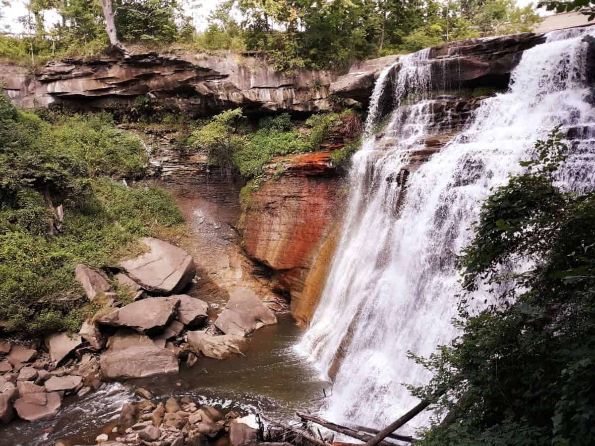
What It is Known For: Cuyahoga Valley National Park is the only National Park in Ohio. It is known as a urban oasis in the northern half of the state, and it is famous for some of the best waterfalls in Ohio, including the stunning showstopper, Brandywine Falls!
Cuyahoga Valley National Park is unique among the U.S. parks system. It is a haven of hiking trails and waterways, in the heart of a very urban setting. In fact, there are four main infrastructure “arteries” that pass through Cuyahoga Valley: the Cuyahoga River, the Canal Towpath, the scenic railroad, and the auto scenic byway.
Cuyahoga Valley National Park is loved for its wealth of serene hiking trails, the unique additional offerings like the scenic railroad, the historic inns, the iconic Towpath, and the simple way that this urban National Park excels at integrating with and including the community. After all, it is the only National Park in Ohio, and it does a superb job of upholding that title!
Map of the Best Cuyahoga Valley National Park Hiking Trails
Use this map below of the best Cuyahoga Valley National Park hiking trails to create your own hiking itinerary for your visit!
Map of the best Cuyahoga Valley National Park hiking trails
The Best Cuyahoga Valley National Park Hiking Trails
Due to its size and convenient location, Cuyahoga Valley National Park can be best enjoyed as either a several days long jaunt, or as a short, road trip stopover destination! Cuyahoga offers a deceptively dynamic depth of variety, with thick forests, wetlands, and rocky cliff sides all waiting to be explored. But its showstoppers are definitely its water features, including some of the best waterfalls in Ohio!
The best Cuyahoga Valley National Park hiking trails include:
- #1:The Brandywine Gorge Trail to Brandywine Falls
- #2: Cuyahoga Valley Ledges Trail
- #3: Stanford House to Brandywine Falls Trail
- #4: Blue Hen Falls Trail
- #5: The Plateau Trail
- #6: Kendall Lake Loop Trail

 Shady Cuyahoga Valley National Park hiking trails
#1: Brandywine Gorge Trail to Brandywine Falls
Quick Facts on the Brandywine Gorge Trail:
Length: 1.4 mile loop roundtrip (3.8 if you include the Stanford House Trail add on – more below on #3)
Rating: Easy
Elevation Gain: 164 feet (534 including the Stanford House Trail add on)


#2: Cuyahoga Valley Ledges Trail
Quick Facts on the Cuyahoga Valley Ledges Trail:
Length: 2.3 miles roundtrip loop
Rating: Moderate
Elevation Gain: 203 feet

The “ledges” part of the name gives away the highlight of this trail – the lofty ledges that create a beautiful plateau overlook over Cuyahoga Valley. There are consistent up and downs along this trail, and some rocky portions, though nothing is overly strenuous or technical.
#3: Stanford House to Brandywine Falls Trail
Quick Facts on the Stanford House to Brandywine Falls Trail:
Length: 3.9 miles roundtrip loop
Rating: Moderate
Elevation Gain: 574 feet

This is really just a longer version of the Brandywine Gorge Trail. This hike starts at the historic Stanford House, and finishes at Brandywine Falls. While this hike is described as a loop hike, it is really more of a “lollipop” hike, as you can see below. It is a great option for those that want a fantastic “destination” hike (in this case, the turnaround point or half way point is Brandywine Falls), but prefer a slightly longer and more moderate trail than the Brandywine Gorge Trail.


#4: Blue Hen Falls Trail (the Buckeye Trail)
Quick Facts on the Blue Hen Falls Trail:
Length: 2.5 miles roundtrip out and back
Rating: Moderate
Elevation Gain: 498 feet

The Blue Hen Falls Trail (which is accessible via the Buckeye Trail), is another example of a great destination hike, as the destination at the turnaround spot, or half way point, is Blue Hen Falls.
Blue Hen Falls is daintier than Brandywine, yet it cascades over a mysteriously concave cliff side, lending to the sense of mystique. The hike to the falls is only a half mile, but it can be continued for another 2 miles to a hidden creek.

#5: The Plateau Trail
Quick Facts on the Plateau Trail:
Length: 4.6 miles roundtrip loop
Rating: Easy
Elevation Gain: 341 feet

This is a very easy, scenic hike, through almost all forest. There is only one moderate climb to watch for, and the rest of the trail contains very minor gains or losses. Along the way you will pass multiple small ponds, including Chestnut Pond, and groves of pine trees.
#6: Kendall Lake Loop Trail
Quick Facts on the Kendall Lake Loop Trail
Length: 1.5 miles roundtrip loop
Rating: Easy
Elevation Gain: 98 feet

A solid half of this trail is shoreline views of Kendall Lake, making it a very popular trek among Cuyahoga Valley National Park’s hiking trails. The other half is through the forest, creating a nice contrast with the lake. Kendall Lake is also a popular gathering spot for local wildlife, like beavers, deer, ducks, geese, and multiple species of birds. Note that there is one section of steep stairs to traverse.
Other Notable Waterfalls Near Cuyahoga Valley National Park
- At a half mile in length and only thirty feet in elevation gain, Bridal Veil Falls (Google Maps location) is the easiest of these day hikes in Cuyahoga Valley. But what it lacks in length or difficulty, it makes up for in its romanticism. This unique waterfall does not just sheerly drop off as the others do, but gracefully cascades over several pillowy levels until it terminates in the river below. Technically, the Bridal Veil Falls Trail is located in the Bedford Reservation, one of northern Ohio’s most scenic parks, just a hair outside the National Park borders by about 15 minutes.
- Just down the road from Bridal Veil Falls, in the town of Bedford Ohio, resides another of the best waterfalls in Ohio, Linda Falls. Linda Falls is another concave featured cliff, that is graced by a waterfall, but only after a significant rain. It is two miles in length, and heralded as one of the least visited, and therefore most secluded, falls in the Cuyahoga Valley. Much like Bridal Veil Falls, Linda Falls is just north of Cuyahoga Valley National Park, so it is not actually within the park borders, but it can very easily be included in any visit to the Cuyahoga Valley area. It is located on the Sagamore Creek Loop Trail (Google Maps location), in the Bedford Reservation. The Sagamore Creek Loop Trail is a 3.6 mile roundtrip hike, with a moderate elevation gain of 232 feet. You can also see the historic Frazee House on this trail.
- Great Falls of Tinkers Creek (Google Maps location) is a third option for viewing some of the best waterfalls in Ohio, right outside the door of Cuyahoga Valley National Park. In the same vicinity as Bridal Veil Falls and Linda Falls, the Great Falls of Tinkers Creek can be found in the city of Bedford, Ohio.
Cuyahoga Valley National Park Camping/Lodging
In addition to the chain hotels, quaint family owned hotels, boutique hotels, small chain hotels, vacation rentals, and B and B’s that populate the areas immediately on the boundaries of the park, there is also Cuyahoga Valley National Park camping options. While there are NO campgrounds actually WITHIN the park borders, there are several located within 10 miles, and dozens located less than an hour’s drive away, so you have plenty of options to camp in the Cuyahoga Valley. Below is a summary of camping options near Cuyahoga Valley National Park.
The 4 closest campgrounds less than 10 miles away include:
Additional Nearby Campgrounds:
- Woodside Lake Park
- Roundup Lake Campground
- Willow Lake Park
- West Branch State Park
- Cherokee Park
- American Wilderness Campground
- Maple Lakes Campground
- Punderson State Park
- Findley State Park
As I mentioned before, ALL of the above campgrounds are less than an hour’s drive from Cuyahoga Valley National Park!
If camping is not quite your thing, there are also two unique and historical places to stay within the park itself. Stanford House is a remodeled nine bedroom home surrounded by beautiful park grounds. The Inn at Brandywine Falls is a 6 bedroom bed and breakfast, built in 1848, that overlooks its namesake waterfall!
Additional Activities In and Near Cuyahoga Valley National Park
While it is clear that Cuyahoga Valley National Park contains some of the best hiking trails and waterfalls in Ohio, plus a plethora of great camping opportunities nearby, there are even more surprises to this park! Here are a few more unique and memorable things you can enjoy during your visit!
- Explore the Towpath Trail
The Towpath Trail is a historic, multi use trail where you can bike, run, or walk through Cuyahoga Valley. The Towpath Trail follows the historic route of the Ohio and Erie Canal, so you can experience a feel of the early history of northern Ohio’s canal systems, all while exploring the trail. The Towpath Trail is a 101 mile long trail, and 20 miles are located within Cuyahoga Valley National Park. There are multiple access points along the Towpath Trail, as well as bike rentals and stops along the Cuyahoga Valley Scenic Railroad.
- Ride the Cuyahoga Valley Scenic Railroad
Experience all the beauty of the Cuyahoga Valley and Cuyahoga River on the historic Cuyahoga Valley Scenic Railroad! You can even catch the train for a one way return after hiking or biking the Towpath Trail, or paddling one way on the Cuyahoga River!
There you have it! The best of Cuyahoga Valley National Park hiking trails, camping, waterfalls, and other attractions in the Cuyahoga Valley! So get ready to escape urban Ohio, while basking in the magic of welcoming trails, stunning waterfalls, and exciting camping, all while chuckling to yourself every time you say the fun-sounding word “Cuyahoga”!
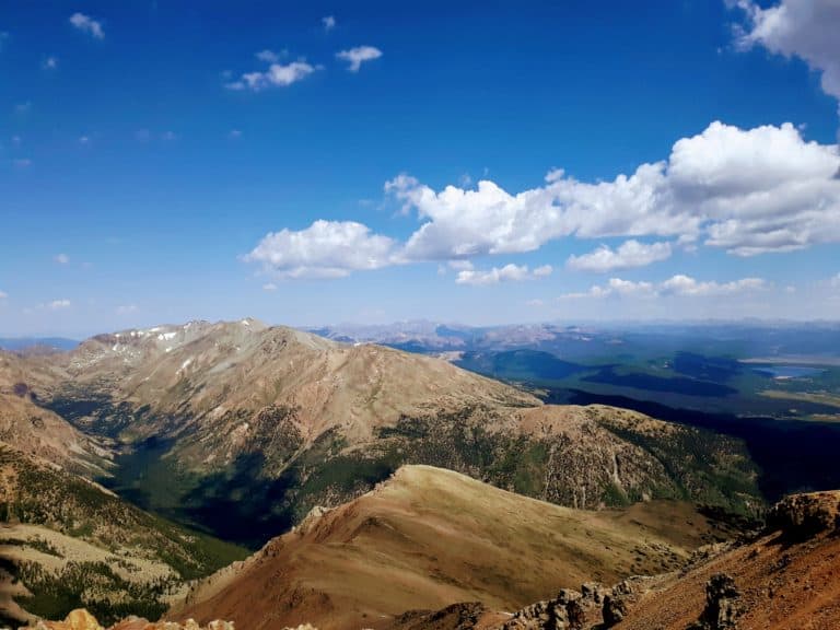
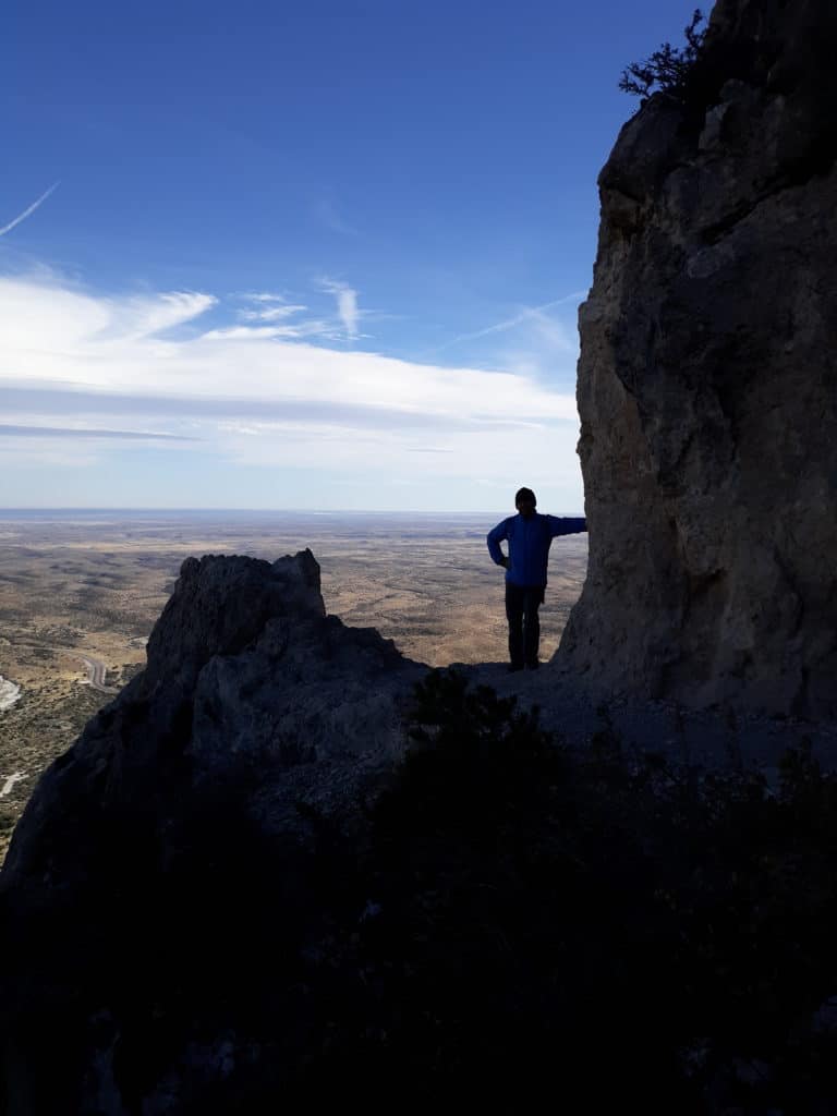
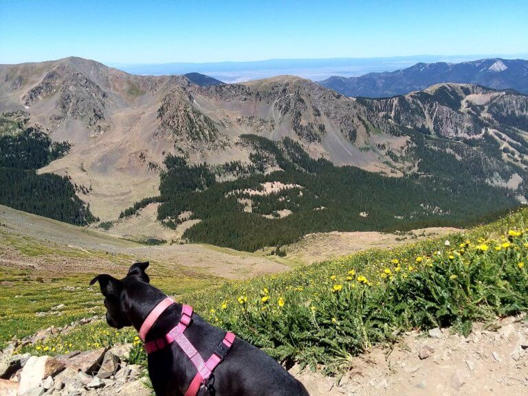
Read More: Cuyahoga Valley National Park was one of those “surprise” National Parks I was not very familiar with. Turns out, there’s many more endearing, “surprise parks” out there in the U.S., like Valley of Fire State Park, Monahans Sandhills State Park, and Guadalupe Mountains National Park, a few of my personal, under-rated, favorites!
So, What’s Next After Cuyahoga?
Check off all of the U.S. National Parks with this
and plan away 🙂
PIN for LATER!


I love in NE Ohio and frequent these falls! They are so beautidul all year round!
Lucky you Kim! This is such a beautiful part of Ohio, and I had no idea how lovely it is, or how many waterfalls reside here.
Wow, the images are really stunning! I am a real sucker when it comes down to National Parks. This park definitely goes on my to see list after reading this post!
Jonas,
It’s a beautiful park, one of those under-rated hidden gems! And if you enjoy waterfall hikes, you won’t be disappointed!